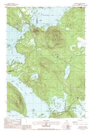
Norcross Topo Map Maine
To zoom in, hover over the map of Norcross
USGS Topo Quad 45068f7 - 1:24,000 scale
| Topo Map Name: | Norcross |
| USGS Topo Quad ID: | 45068f7 |
| Print Size: | ca. 21 1/4" wide x 27" high |
| Southeast Coordinates: | 45.625° N latitude / 68.75° W longitude |
| Map Center Coordinates: | 45.6875° N latitude / 68.8125° W longitude |
| U.S. State: | ME |
| Filename: | o45068f7.jpg |
| Download Map JPG Image: | Norcross topo map 1:24,000 scale |
| Map Type: | Topographic |
| Topo Series: | 7.5´ |
| Map Scale: | 1:24,000 |
| Source of Map Images: | United States Geological Survey (USGS) |
| Alternate Map Versions: |
Norcross ME 1978, updated 1981 Download PDF Buy paper map Norcross ME 1988, updated 1988 Download PDF Buy paper map Norcross ME 2011 Download PDF Buy paper map Norcross ME 2014 Download PDF Buy paper map |
1:24,000 Topo Quads surrounding Norcross
> Back to 45068e1 at 1:100,000 scale
> Back to 45068a1 at 1:250,000 scale
> Back to U.S. Topo Maps home
Norcross topo map: Gazetteer
Norcross: Airports
Millinocket Seaplane Base elevation 150m 492′Norcross: Bays
Deep Cove elevation 150m 492′Spencer Cove elevation 150m 492′
Norcross: Capes
Haynes Point elevation 150m 492′Perrow Point elevation 150m 492′
Powers Point elevation 148m 485′
Russell Point elevation 151m 495′
Snake Point elevation 150m 492′
Norcross: Dams
North Twin Dam elevation 149m 488′Norcross: Islands
Black Island elevation 150m 492′Burnt Island elevation 150m 492′
Indian Point Island elevation 150m 492′
Reed Island elevation 146m 479′
Spring Island elevation 150m 492′
Norcross: Lakes
Ambajejus Lake elevation 150m 492′Bait Pond elevation 152m 498′
Elbow Lake elevation 150m 492′
Marden Pond elevation 172m 564′
North Twin Lake elevation 150m 492′
Smith Pond elevation 160m 524′
Wadleigh Pond elevation 160m 524′
Norcross: Populated Places
Norcross elevation 152m 498′Norcross: Reservoirs
Twin Lakes elevation 140m 459′Norcross: Ridges
Hammatt Ridge elevation 327m 1072′North Twin Ridge elevation 234m 767′
Norcross: Streams
Grant Brook elevation 146m 479′Wadleigh Brook elevation 150m 492′
Norcross: Summits
Black Cat Mountain elevation 258m 846′Norcross digital topo map on disk
Buy this Norcross topo map showing relief, roads, GPS coordinates and other geographical features, as a high-resolution digital map file on DVD:
Maine, New Hampshire, Rhode Island & Eastern Massachusetts
Buy digital topo maps: Maine, New Hampshire, Rhode Island & Eastern Massachusetts


