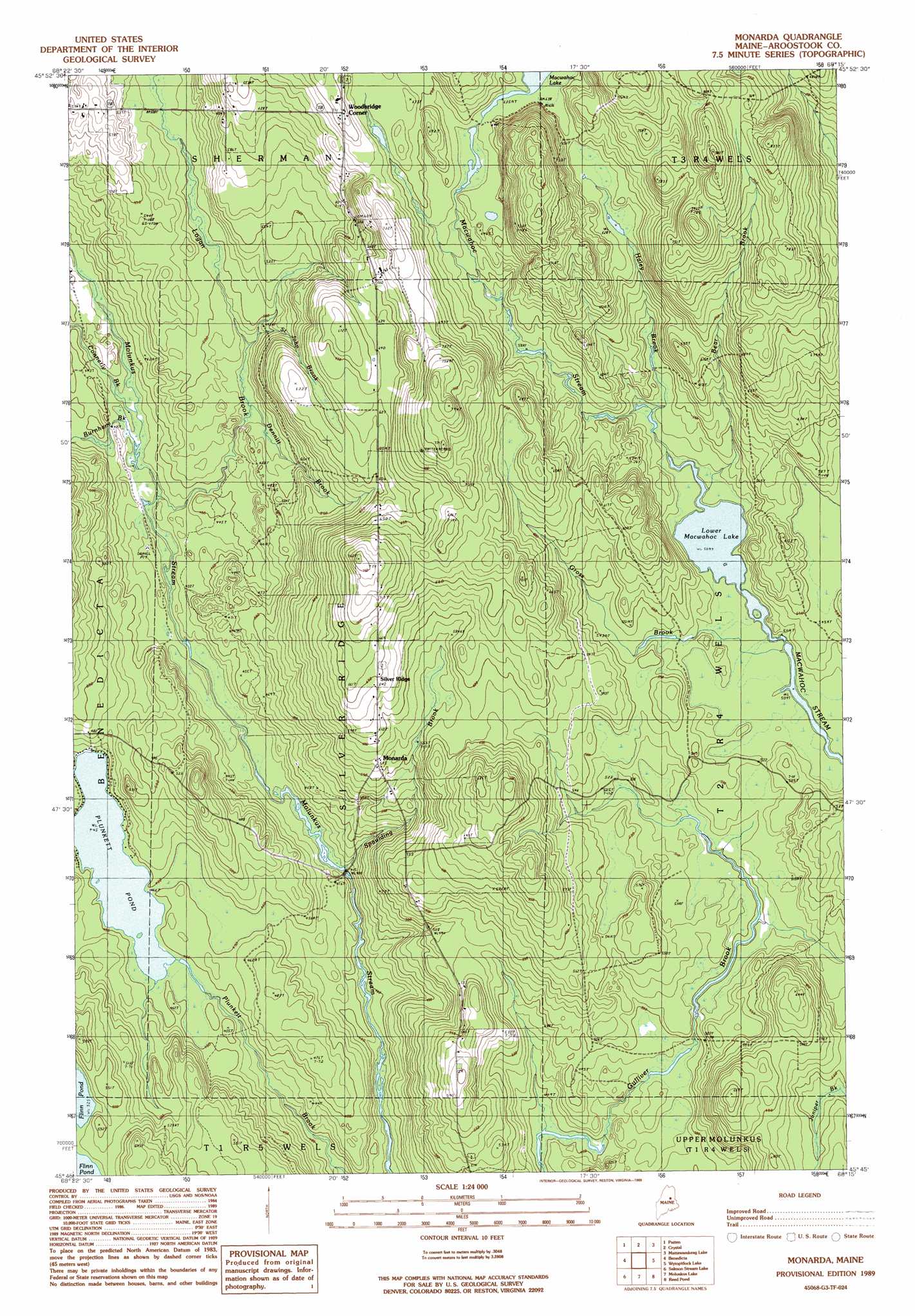
Monarda Topo Map Maine
To zoom in, hover over the map of Monarda
USGS Topo Quad 45068g3 - 1:24,000 scale
| Topo Map Name: | Monarda |
| USGS Topo Quad ID: | 45068g3 |
| Print Size: | ca. 21 1/4" wide x 27" high |
| Southeast Coordinates: | 45.75° N latitude / 68.25° W longitude |
| Map Center Coordinates: | 45.8125° N latitude / 68.3125° W longitude |
| U.S. State: | ME |
| Filename: | o45068g3.jpg |
| Download Map JPG Image: | Monarda topo map 1:24,000 scale |
| Map Type: | Topographic |
| Topo Series: | 7.5´ |
| Map Scale: | 1:24,000 |
| Source of Map Images: | United States Geological Survey (USGS) |
| Alternate Map Versions: |
Sherman SE ME 1975, updated 1980 Download PDF Buy paper map Monarda ME 1989, updated 1989 Download PDF Buy paper map Monarda ME 2011 Download PDF Buy paper map Monarda ME 2014 Download PDF Buy paper map |
1:24,000 Topo Quads surrounding Monarda
Shin Pond |
Mount Chase |
Island Falls |
Oakfield |
Meduxnekeag Lake |
Lookout Mountain |
Patten |
Crystal |
Mattawamkeag Lake |
Monument Brook |
Stacyville |
Benedicta |
Monarda |
Wytopitlock Lake |
Alder Brook |
East Millinocket |
Salmon Stream Lake |
Molunkid Lake |
Reed Pond |
Wytopitlock |
Medunkeunk Lake |
Mattaseunk Lake |
Mattawamkeag |
Kingman |
Potter Hill |
> Back to 45068e1 at 1:100,000 scale
> Back to 45068a1 at 1:250,000 scale
> Back to U.S. Topo Maps home
Monarda topo map: Gazetteer
Monarda: Lakes
Lower Macwahoc Lake elevation 155m 508′Plunkett Pond elevation 135m 442′
Monarda: Populated Places
Monarda elevation 173m 567′Silver Ridge elevation 198m 649′
Woodbridge Corner elevation 218m 715′
Monarda: Streams
Bear Brook elevation 156m 511′Burnham Brook elevation 132m 433′
Connerly Brook elevation 131m 429′
Dennitt Brook elevation 142m 465′
Gross Brook elevation 155m 508′
Haley Brook elevation 155m 508′
Logan Brook elevation 128m 419′
Saint John Brook elevation 146m 479′
Spaulding Brook elevation 124m 406′
Monarda digital topo map on disk
Buy this Monarda topo map showing relief, roads, GPS coordinates and other geographical features, as a high-resolution digital map file on DVD:
Maine, New Hampshire, Rhode Island & Eastern Massachusetts
Buy digital topo maps: Maine, New Hampshire, Rhode Island & Eastern Massachusetts