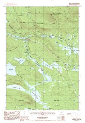
Abol Pond Topo Map Maine
To zoom in, hover over the map of Abol Pond
USGS Topo Quad 45068g8 - 1:24,000 scale
| Topo Map Name: | Abol Pond |
| USGS Topo Quad ID: | 45068g8 |
| Print Size: | ca. 21 1/4" wide x 27" high |
| Southeast Coordinates: | 45.75° N latitude / 68.875° W longitude |
| Map Center Coordinates: | 45.8125° N latitude / 68.9375° W longitude |
| U.S. State: | ME |
| Filename: | o45068g8.jpg |
| Download Map JPG Image: | Abol Pond topo map 1:24,000 scale |
| Map Type: | Topographic |
| Topo Series: | 7.5´ |
| Map Scale: | 1:24,000 |
| Source of Map Images: | United States Geological Survey (USGS) |
| Alternate Map Versions: |
Abol Pond ME 1978, updated 1981 Download PDF Buy paper map Abol Pond ME 1988, updated 1988 Download PDF Buy paper map Abol Pond ME 1988, updated 1988 Download PDF Buy paper map Abol Pond ME 2011 Download PDF Buy paper map Abol Pond ME 2014 Download PDF Buy paper map |
1:24,000 Topo Quads surrounding Abol Pond
> Back to 45068e1 at 1:100,000 scale
> Back to 45068a1 at 1:250,000 scale
> Back to U.S. Topo Maps home
Abol Pond topo map: Gazetteer
Abol Pond: Channels
Abol Deadwater elevation 174m 570′Pockwockamus Deadwater elevation 160m 524′
Abol Pond: Falls
Abol Falls elevation 168m 551′Debsconeag Falls elevation 160m 524′
Pockwockamus Falls elevation 166m 544′
Abol Pond: Lakes
Abol Pond elevation 180m 590′Compass Pond elevation 163m 534′
Cranberry Pond elevation 187m 613′
Debsconeag Deadwater elevation 153m 501′
Duck Pond elevation 192m 629′
First Debsconeag Lake elevation 153m 501′
Hale Pond elevation 180m 590′
Helon Taylor Pond elevation 188m 616′
Hurd Pond elevation 176m 577′
Mink Pond elevation 198m 649′
Mud Pond elevation 169m 554′
Pockwockamus Pond elevation 180m 590′
River Pond elevation 162m 531′
Rocky Pond elevation 188m 616′
Round Pond elevation 192m 629′
Rum Pond elevation 193m 633′
Sunday Pond elevation 169m 554′
Upper Togue Pond elevation 185m 606′
Abol Pond: Streams
Abol Stream elevation 174m 570′Foss and Knowlton Brook elevation 175m 574′
Hurd Pond Stream elevation 154m 505′
Katahdin Stream elevation 174m 570′
Pockwockamus Stream elevation 163m 534′
Rum Brook elevation 183m 600′
Abol Pond: Summits
Abol Mountain elevation 687m 2253′Abol Pond digital topo map on disk
Buy this Abol Pond topo map showing relief, roads, GPS coordinates and other geographical features, as a high-resolution digital map file on DVD:
Maine, New Hampshire, Rhode Island & Eastern Massachusetts
Buy digital topo maps: Maine, New Hampshire, Rhode Island & Eastern Massachusetts


