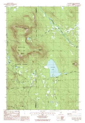
Katahdin Lake Topo Map Maine
To zoom in, hover over the map of Katahdin Lake
USGS Topo Quad 45068h7 - 1:24,000 scale
| Topo Map Name: | Katahdin Lake |
| USGS Topo Quad ID: | 45068h7 |
| Print Size: | ca. 21 1/4" wide x 27" high |
| Southeast Coordinates: | 45.875° N latitude / 68.75° W longitude |
| Map Center Coordinates: | 45.9375° N latitude / 68.8125° W longitude |
| U.S. State: | ME |
| Filename: | o45068h7.jpg |
| Download Map JPG Image: | Katahdin Lake topo map 1:24,000 scale |
| Map Type: | Topographic |
| Topo Series: | 7.5´ |
| Map Scale: | 1:24,000 |
| Source of Map Images: | United States Geological Survey (USGS) |
| Alternate Map Versions: |
Katahdin Lake ME 1978, updated 1981 Download PDF Buy paper map Katahdin Lake ME 1988, updated 1988 Download PDF Buy paper map Katahdin Lake ME 1988, updated 1988 Download PDF Buy paper map Katahdin Lake ME 2011 Download PDF Buy paper map Katahdin Lake ME 2014 Download PDF Buy paper map |
1:24,000 Topo Quads surrounding Katahdin Lake
> Back to 45068e1 at 1:100,000 scale
> Back to 45068a1 at 1:250,000 scale
> Back to U.S. Topo Maps home
Katahdin Lake topo map: Gazetteer
Katahdin Lake: Cliffs
Windey Pitch elevation 370m 1213′Katahdin Lake: Lakes
Katahdin Lake elevation 310m 1017′Martin Ponds elevation 376m 1233′
Rober Pond elevation 236m 774′
Rocky Pond elevation 302m 990′
Sandy Stream Pond elevation 463m 1519′
Twin Ponds elevation 608m 1994′
Whidden Ponds elevation 496m 1627′
Katahdin Lake: Streams
Avalanche Brook elevation 348m 1141′Roaring Brook elevation 365m 1197′
Robar Brook elevation 220m 721′
South Turner Brook elevation 311m 1020′
Twin Pond Brook elevation 226m 741′
Katahdin Lake: Summits
Barnard Mountain elevation 479m 1571′East Turner Mountain elevation 730m 2395′
North Turner Mountain elevation 999m 3277′
South Turner Mountain elevation 873m 2864′
Katahdin Lake: Trails
Sand Bank Trail elevation 364m 1194′Katahdin Lake digital topo map on disk
Buy this Katahdin Lake topo map showing relief, roads, GPS coordinates and other geographical features, as a high-resolution digital map file on DVD:
Maine, New Hampshire, Rhode Island & Eastern Massachusetts
Buy digital topo maps: Maine, New Hampshire, Rhode Island & Eastern Massachusetts


