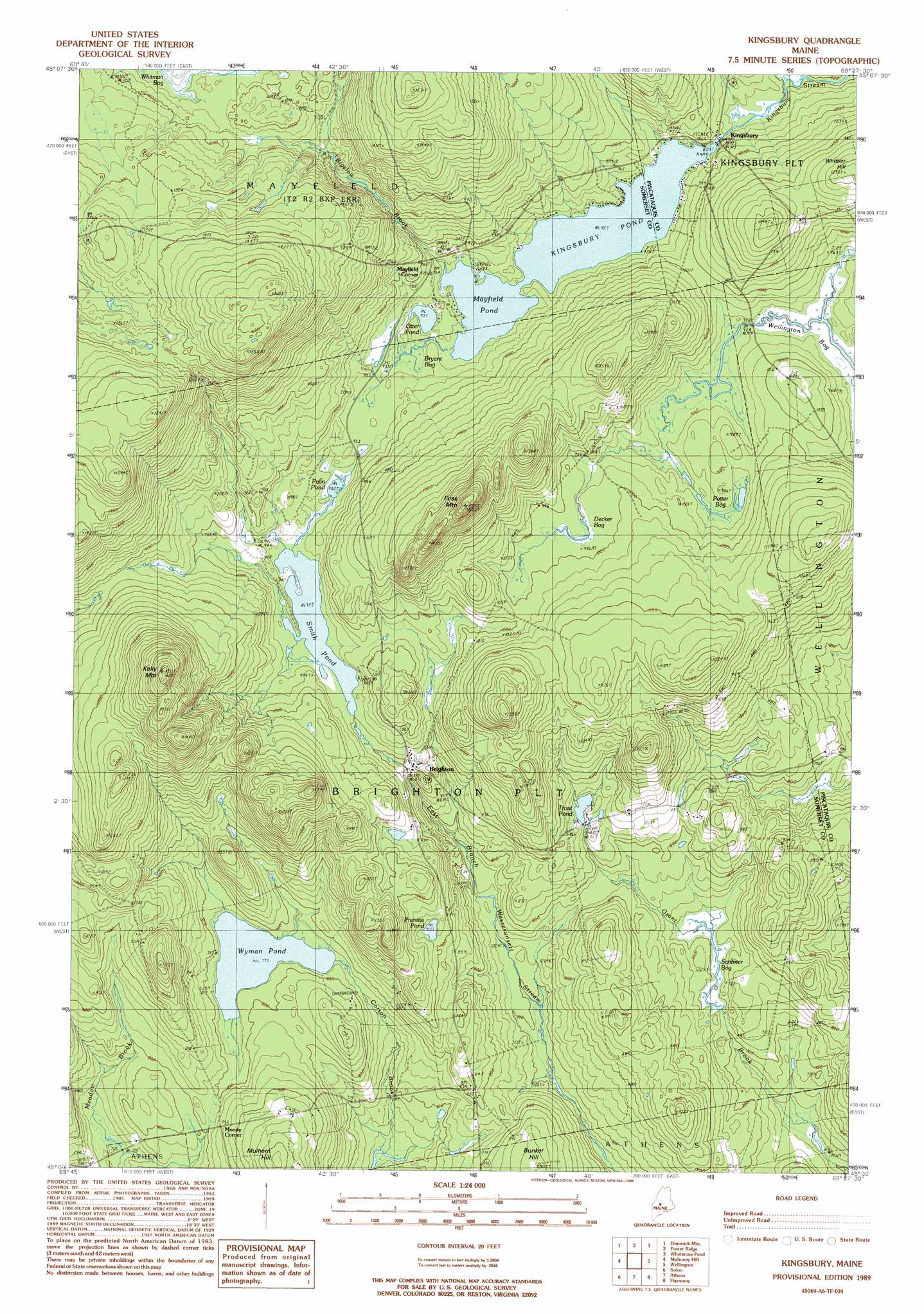
Kingsbury Topo Map Maine
To zoom in, hover over the map of Kingsbury
USGS Topo Quad 45069a6 - 1:24,000 scale
| Topo Map Name: | Kingsbury |
| USGS Topo Quad ID: | 45069a6 |
| Print Size: | ca. 21 1/4" wide x 27" high |
| Southeast Coordinates: | 45° N latitude / 69.625° W longitude |
| Map Center Coordinates: | 45.0625° N latitude / 69.6875° W longitude |
| U.S. State: | ME |
| Filename: | o45069a6.jpg |
| Download Map JPG Image: | Kingsbury topo map 1:24,000 scale |
| Map Type: | Topographic |
| Topo Series: | 7.5´ |
| Map Scale: | 1:24,000 |
| Source of Map Images: | United States Geological Survey (USGS) |
| Alternate Map Versions: |
Kingsbury SW ME 1975, updated 1980 Download PDF Buy paper map Kingsbury ME 1989, updated 1989 Download PDF Buy paper map Kingsbury ME 2011 Download PDF Buy paper map Kingsbury ME 2014 Download PDF Buy paper map |
1:24,000 Topo Quads surrounding Kingsbury
The Forks |
Moxie Pond |
Bald Mountain Pond |
Monson West |
Monson East |
Caratunk |
Dimmick Mountain |
Foster Ridge |
Whetstone Pond |
Guilford |
Bingham |
Mahoney Hill |
Kingsbury |
Wellington |
Cambridge |
Embden Pond |
Solon |
Arbens |
Harmony |
Hartland |
Madison West |
Madison East |
Skowhegan |
Canaan |
Pittsfield |
> Back to 45069a1 at 1:100,000 scale
> Back to 45068a1 at 1:250,000 scale
> Back to U.S. Topo Maps home
Kingsbury topo map: Gazetteer
Kingsbury: Dams
Kingsbury Dam elevation 282m 925′Kingsbury: Lakes
Mayfield Pond elevation 282m 925′Otter Pond elevation 285m 935′
Palin Pond elevation 283m 928′
Prentiss Pond elevation 278m 912′
Smith Pond elevation 281m 921′
Trout Pond elevation 254m 833′
Wyman Pond elevation 236m 774′
Kingsbury: Populated Places
Brighton elevation 280m 918′Kingsbury elevation 297m 974′
Mayfield Corner elevation 297m 974′
Moody Corner elevation 258m 846′
Kingsbury: Reservoirs
Kingsbury Pond elevation 282m 925′Kingsbury: Streams
Bigelow Brook elevation 287m 941′Kingsbury: Summits
Foss Mountain elevation 458m 1502′Kelly Mountain elevation 487m 1597′
Whittier Hill elevation 372m 1220′
Kingsbury: Swamps
Bryant Bog elevation 286m 938′Decker Bog elevation 300m 984′
Potter Bog elevation 292m 958′
Scribner Bog elevation 216m 708′
Wellington Bog elevation 281m 921′
Kingsbury digital topo map on disk
Buy this Kingsbury topo map showing relief, roads, GPS coordinates and other geographical features, as a high-resolution digital map file on DVD:
Maine, New Hampshire, Rhode Island & Eastern Massachusetts
Buy digital topo maps: Maine, New Hampshire, Rhode Island & Eastern Massachusetts