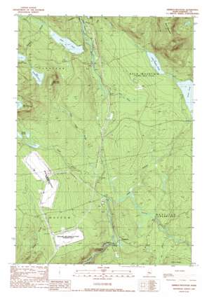
Dimmick Mountain Topo Map Maine
To zoom in, hover over the map of Dimmick Mountain
USGS Topo Quad 45069b7 - 1:24,000 scale
| Topo Map Name: | Dimmick Mountain |
| USGS Topo Quad ID: | 45069b7 |
| Print Size: | ca. 21 1/4" wide x 27" high |
| Southeast Coordinates: | 45.125° N latitude / 69.75° W longitude |
| Map Center Coordinates: | 45.1875° N latitude / 69.8125° W longitude |
| U.S. State: | ME |
| Filename: | o45069b7.jpg |
| Download Map JPG Image: | Dimmick Mountain topo map 1:24,000 scale |
| Map Type: | Topographic |
| Topo Series: | 7.5´ |
| Map Scale: | 1:24,000 |
| Source of Map Images: | United States Geological Survey (USGS) |
| Alternate Map Versions: |
Bingham NE ME 1975, updated 1980 Download PDF Buy paper map Dimmick Mountain ME 1989, updated 1989 Download PDF Buy paper map Dimmick Mountain ME 2011 Download PDF Buy paper map Dimmick Mountain ME 2014 Download PDF Buy paper map |
1:24,000 Topo Quads surrounding Dimmick Mountain
> Back to 45069a1 at 1:100,000 scale
> Back to 45068a1 at 1:250,000 scale
> Back to U.S. Topo Maps home
Dimmick Mountain topo map: Gazetteer
Dimmick Mountain: Falls
Austin Stream Falls elevation 277m 908′Dimmick Mountain: Lakes
Baker Pond elevation 324m 1062′Big Dimmick Pond elevation 446m 1463′
Little Austin Pond elevation 370m 1213′
Little Dimmick Pond elevation 427m 1400′
Mountain Dimmick Pond elevation 619m 2030′
Moxie Bog elevation 301m 987′
Dimmick Mountain: Populated Places
Deadwater elevation 309m 1013′Dimmick Mountain: Streams
Baker Stream elevation 296m 971′Dimmick Stream elevation 327m 1072′
Heald Stream elevation 304m 997′
Little Heald Brook elevation 324m 1062′
Rift Brook elevation 317m 1040′
South Branch Austin Stream elevation 309m 1013′
Wild Brook elevation 304m 997′
Dimmick Mountain: Summits
Dimmick Mountain elevation 549m 1801′Dimmick Mountain digital topo map on disk
Buy this Dimmick Mountain topo map showing relief, roads, GPS coordinates and other geographical features, as a high-resolution digital map file on DVD:
Maine, New Hampshire, Rhode Island & Eastern Massachusetts
Buy digital topo maps: Maine, New Hampshire, Rhode Island & Eastern Massachusetts


