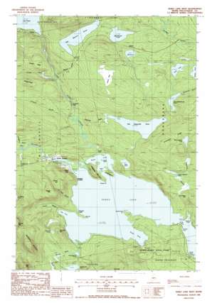
Sebec Lake West Topo Map Maine
To zoom in, hover over the map of Sebec Lake West
USGS Topo Quad 45069c3 - 1:24,000 scale
| Topo Map Name: | Sebec Lake West |
| USGS Topo Quad ID: | 45069c3 |
| Print Size: | ca. 21 1/4" wide x 27" high |
| Southeast Coordinates: | 45.25° N latitude / 69.25° W longitude |
| Map Center Coordinates: | 45.3125° N latitude / 69.3125° W longitude |
| U.S. State: | ME |
| Filename: | o45069c3.jpg |
| Download Map JPG Image: | Sebec Lake West topo map 1:24,000 scale |
| Map Type: | Topographic |
| Topo Series: | 7.5´ |
| Map Scale: | 1:24,000 |
| Source of Map Images: | United States Geological Survey (USGS) |
| Alternate Map Versions: |
Sebec Lake West ME 1978, updated 1981 Download PDF Buy paper map Sebec Lake West ME 1988, updated 1988 Download PDF Buy paper map Sebec Lake West ME 1988, updated 1988 Download PDF Buy paper map Sebec Lake West ME 2011 Download PDF Buy paper map Sebec Lake West ME 2014 Download PDF Buy paper map |
1:24,000 Topo Quads surrounding Sebec Lake West
> Back to 45069a1 at 1:100,000 scale
> Back to 45068a1 at 1:250,000 scale
> Back to U.S. Topo Maps home
Sebec Lake West topo map: Gazetteer
Sebec Lake West: Airports
Two Falls Airport elevation 107m 351′Sebec Lake West: Bays
Bucks Cove elevation 98m 321′Chicken Cove elevation 98m 321′
Norton Cove elevation 98m 321′
Seymour Cove elevation 98m 321′
South Cove elevation 98m 321′
Tims Cove elevation 98m 321′
Sebec Lake West: Benches
Gibralter Ledge elevation 101m 331′Sebec Lake West: Capes
Deer Point elevation 99m 324′Green Point elevation 100m 328′
South Cove Point elevation 101m 331′
Sebec Lake West: Channels
The Narrows elevation 98m 321′Sebec Lake West: Dams
Big Bennett Pond Outlet Dam elevation 109m 357′Sebec Lake West: Falls
Bucks Falls elevation 100m 328′Cowyard Falls elevation 117m 383′
Sebec Lake West: Islands
Jordan Island elevation 117m 383′Stork Island elevation 99m 324′
Stubb Island elevation 103m 337′
Sebec Lake West: Lakes
Bear Pond elevation 110m 360′Big Bennett Pond elevation 110m 360′
Big Benson Pond elevation 218m 715′
Big Grapevine Pond elevation 221m 725′
Duck Pond elevation 196m 643′
First Buttermilk Pond elevation 154m 505′
Garcock Pond elevation 128m 419′
Little Bennett Pond elevation 98m 321′
Little Benson Pond elevation 224m 734′
Little Grapevine Pond elevation 153m 501′
Mud Pond elevation 207m 679′
Sebec Lake elevation 98m 321′
Second Buttermilk Pond elevation 183m 600′
Sebec Lake West: Parks
Peaks-Kenny State Park elevation 120m 393′Sebec Lake West: Populated Places
Benson elevation 218m 715′Earley Landing elevation 109m 357′
Onawa elevation 188m 616′
Packard Landing elevation 102m 334′
Sebec Lake elevation 104m 341′
Sebec Lake West: Reservoirs
Big Bennett Pond Outlet elevation 109m 357′Sebec Lake West: Ridges
Crockett Ridge elevation 215m 705′Grapevine Ridge elevation 251m 823′
Johnson Ridge elevation 242m 793′
Sebec Lake West: Streams
Bennett Brook elevation 98m 321′Benson Brook elevation 138m 452′
Big Wilson Stream elevation 98m 321′
Buttermilk Brook elevation 104m 341′
Crockett Brook elevation 135m 442′
Grapevine Stream elevation 109m 357′
Grindstone Brook elevation 104m 341′
Ice Cave Brook elevation 99m 324′
Johnson Brook elevation 105m 344′
Salmon Stream elevation 102m 334′
Ship Pond Stream elevation 99m 324′
Sebec Lake West: Summits
Deer Hill elevation 339m 1112′Garcock Hill elevation 191m 626′
Granite Mountain elevation 223m 731′
Hampshire Mountain elevation 340m 1115′
Hedgehog Mountain elevation 153m 501′
Ragged Mountain elevation 256m 839′
Sebec Lake West: Swamps
House Bog elevation 231m 757′Sebec Lake West digital topo map on disk
Buy this Sebec Lake West topo map showing relief, roads, GPS coordinates and other geographical features, as a high-resolution digital map file on DVD:
Maine, New Hampshire, Rhode Island & Eastern Massachusetts
Buy digital topo maps: Maine, New Hampshire, Rhode Island & Eastern Massachusetts


