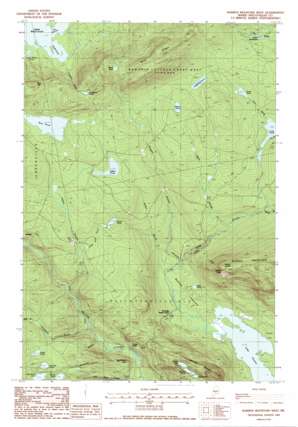
Barren Mountain West Topo Map Maine
To zoom in, hover over the map of Barren Mountain West
USGS Topo Quad 45069d4 - 1:24,000 scale
| Topo Map Name: | Barren Mountain West |
| USGS Topo Quad ID: | 45069d4 |
| Print Size: | ca. 21 1/4" wide x 27" high |
| Southeast Coordinates: | 45.375° N latitude / 69.375° W longitude |
| Map Center Coordinates: | 45.4375° N latitude / 69.4375° W longitude |
| U.S. State: | ME |
| Filename: | o45069d4.jpg |
| Download Map JPG Image: | Barren Mountain West topo map 1:24,000 scale |
| Map Type: | Topographic |
| Topo Series: | 7.5´ |
| Map Scale: | 1:24,000 |
| Source of Map Images: | United States Geological Survey (USGS) |
| Alternate Map Versions: |
Barren Mountain West ME 1977, updated 1981 Download PDF Buy paper map Barren Mountain West ME 1988, updated 1988 Download PDF Buy paper map Barren Mountain West ME 1988, updated 1988 Download PDF Buy paper map Barren Mountain West ME 2011 Download PDF Buy paper map Barren Mountain West ME 2014 Download PDF Buy paper map |
1:24,000 Topo Quads surrounding Barren Mountain West
> Back to 45069a1 at 1:100,000 scale
> Back to 45068a1 at 1:250,000 scale
> Back to U.S. Topo Maps home
Barren Mountain West topo map: Gazetteer
Barren Mountain West: Basins
Bodfish Intervale elevation 171m 561′Barren Mountain West: Bays
South Cove elevation 342m 1122′Barren Mountain West: Benches
Barren Ledges elevation 582m 1909′Barren Mountain West: Channels
The Narrows elevation 342m 1122′Barren Mountain West: Cliffs
Barren Slide elevation 460m 1509′Big Wilson Cliffs elevation 201m 659′
Barren Mountain West: Falls
Slugundy Falls elevation 179m 587′Barren Mountain West: Lakes
Brown Pond elevation 440m 1443′Cranberry Pond elevation 485m 1591′
Hedgehog Pond elevation 419m 1374′
Indian Pond elevation 391m 1282′
Lake Onawa elevation 163m 534′
Little Wilson Pond elevation 282m 925′
Long Pond elevation 358m 1174′
Midday Pond elevation 406m 1332′
Moose Pond elevation 277m 908′
Notch Pond elevation 579m 1899′
Otter Pond elevation 182m 597′
Prescott Pond elevation 303m 994′
Rum Pond elevation 391m 1282′
Secret Pond elevation 334m 1095′
Smith Pond elevation 314m 1030′
Sunrise Pond elevation 406m 1332′
Sunset Pond elevation 414m 1358′
Trout Pond elevation 376m 1233′
Upper Deadwater elevation 381m 1250′
Barren Mountain West: Populated Places
Morkill elevation 305m 1000′Barren Mountain West: Ridges
Blue Ridge elevation 671m 2201′Barren Mountain West: Streams
Cranberry Brook elevation 342m 1122′Indian Stream elevation 200m 656′
Little Wilson Stream elevation 155m 508′
Long Pond Stream elevation 164m 538′
Mink Brook elevation 300m 984′
Secret Brook elevation 297m 974′
Thompson Brook elevation 176m 577′
Trout Brook elevation 349m 1145′
Vaughn Stream elevation 170m 557′
West Branch Thompson Brook elevation 291m 954′
Wilber Brook elevation 169m 554′
Wilder Brook elevation 317m 1040′
Barren Mountain West: Summits
Boarstone Mountain elevation 569m 1866′Barren Mountain West digital topo map on disk
Buy this Barren Mountain West topo map showing relief, roads, GPS coordinates and other geographical features, as a high-resolution digital map file on DVD:
Maine, New Hampshire, Rhode Island & Eastern Massachusetts
Buy digital topo maps: Maine, New Hampshire, Rhode Island & Eastern Massachusetts


