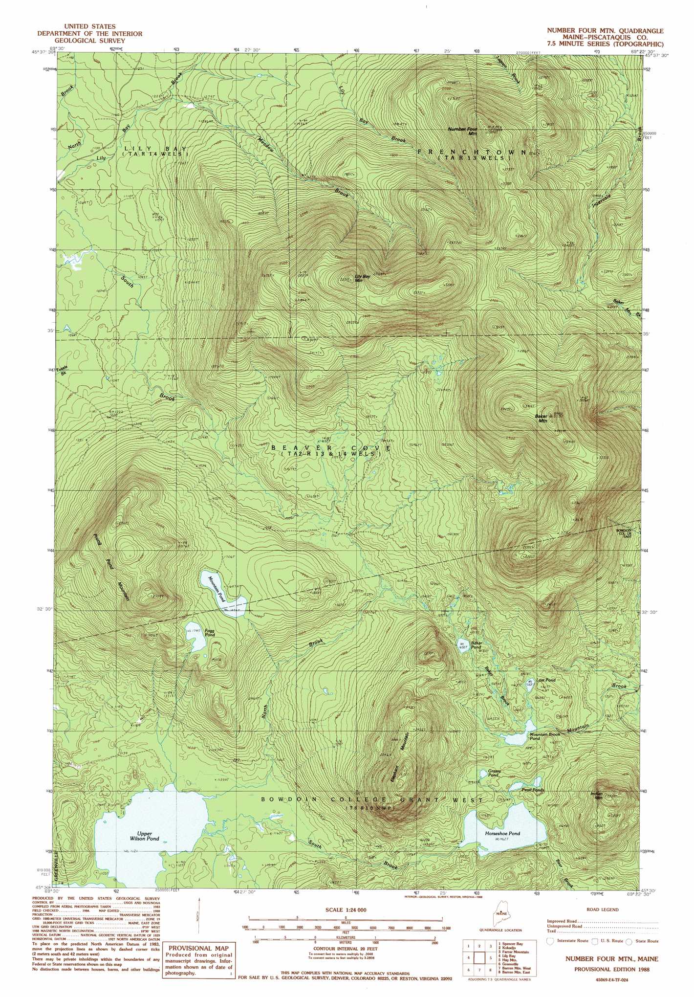
Number Four Mountain Topo Map Maine
To zoom in, hover over the map of Number Four Mountain
USGS Topo Quad 45069e4 - 1:24,000 scale
| Topo Map Name: | Number Four Mountain |
| USGS Topo Quad ID: | 45069e4 |
| Print Size: | ca. 21 1/4" wide x 27" high |
| Southeast Coordinates: | 45.5° N latitude / 69.375° W longitude |
| Map Center Coordinates: | 45.5625° N latitude / 69.4375° W longitude |
| U.S. State: | ME |
| Filename: | o45069e4.jpg |
| Download Map JPG Image: | Number Four Mountain topo map 1:24,000 scale |
| Map Type: | Topographic |
| Topo Series: | 7.5´ |
| Map Scale: | 1:24,000 |
| Source of Map Images: | United States Geological Survey (USGS) |
| Alternate Map Versions: |
Number Four Mountain ME 1977, updated 1981 Download PDF Buy paper map Number Four Mtn. ME 1988, updated 1988 Download PDF Buy paper map Number Four Mtn. ME 1988, updated 1988 Download PDF Buy paper map Number Four Mountain ME 2011 Download PDF Buy paper map Number Four Mountain ME 2014 Download PDF Buy paper map |
1:24,000 Topo Quads surrounding Number Four Mountain
North East Carry |
Lobster Mountain |
Big Spencer Mountain |
Caribou Lake South |
Rainbow Lake West |
Mount Kineo |
Spencer Bay |
Kokadjo |
Farrar Mountain |
Wadleigh Mountain |
Moosehead |
Lily Bay |
Number Four Mountain |
Hay Mountain |
Big Shanty Mountain |
Big Squaw Pond |
Greenville |
Barren Mountain West |
Barren Mountain East |
Silver Lake |
Bald Mountain Pond |
Monson West |
Monson East |
Sebec Lake West |
Sebec Lake East |
> Back to 45069e1 at 1:100,000 scale
> Back to 45068a1 at 1:250,000 scale
> Back to U.S. Topo Maps home
Number Four Mountain topo map: Gazetteer
Number Four Mountain: Lakes
Baker Pond elevation 503m 1650′Fogg Pond elevation 531m 1742′
Grassy Pond elevation 465m 1525′
Horseshoe Pond elevation 445m 1459′
Lost Pond elevation 473m 1551′
Mountain Brook Pond elevation 467m 1532′
Mountain Pond elevation 516m 1692′
Pearl Ponds elevation 448m 1469′
Upper Wilson Pond elevation 342m 1122′
Number Four Mountain: Streams
Baker Brook elevation 468m 1535′Meadow Brook elevation 362m 1187′
North Brook elevation 345m 1131′
South Brook elevation 342m 1122′
Number Four Mountain: Summits
Baker Mountain elevation 1063m 3487′Elephant Mountain elevation 791m 2595′
Indian Mountain elevation 702m 2303′
Lily Bay Mountain elevation 963m 3159′
Number Four Mountain elevation 851m 2791′
Prong Pond Mountain elevation 724m 2375′
Number Four Mountain digital topo map on disk
Buy this Number Four Mountain topo map showing relief, roads, GPS coordinates and other geographical features, as a high-resolution digital map file on DVD:
Maine, New Hampshire, Rhode Island & Eastern Massachusetts
Buy digital topo maps: Maine, New Hampshire, Rhode Island & Eastern Massachusetts