Kokadjo Topo Map Maine
To zoom in, hover over the map of Kokadjo
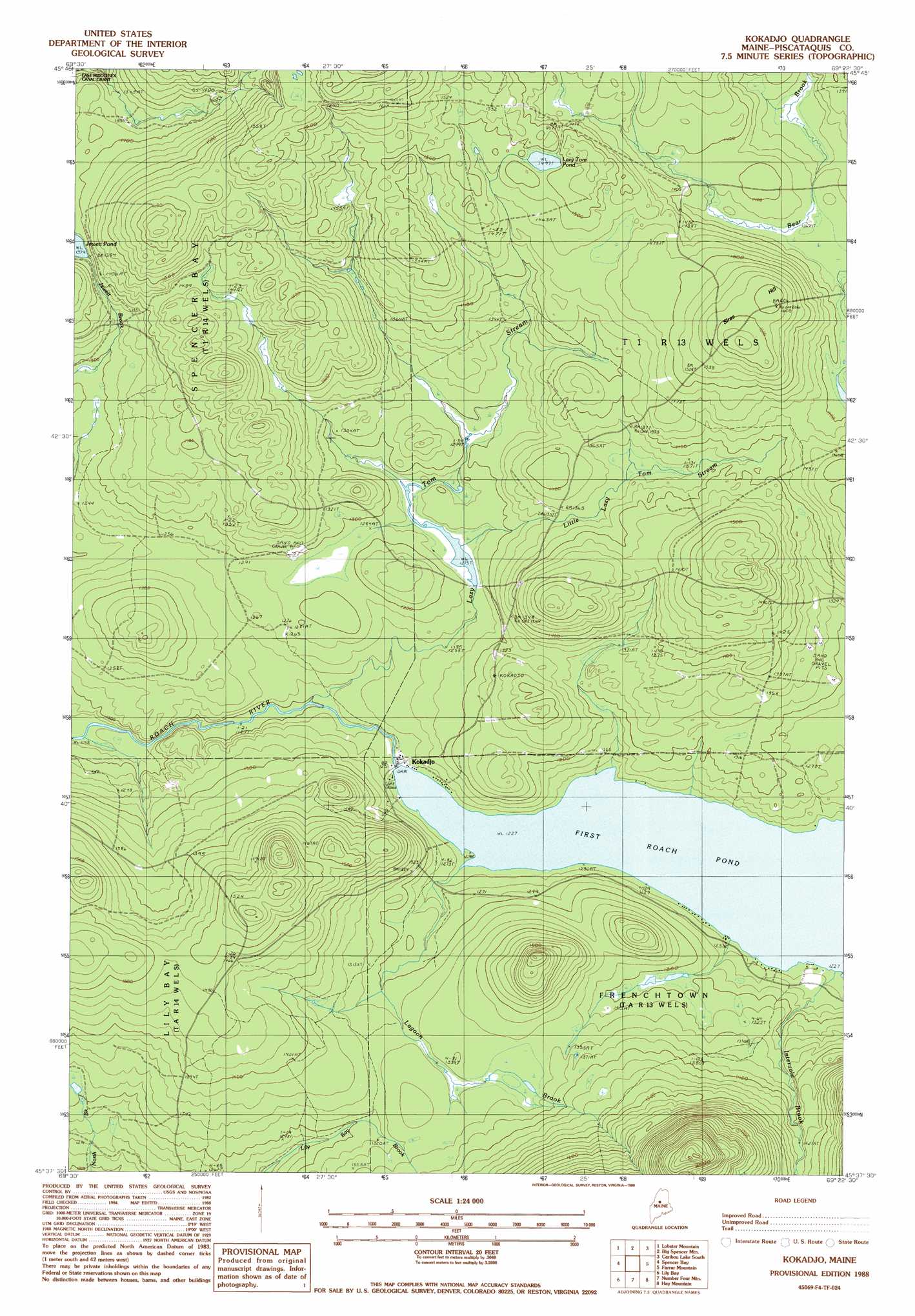
USGS Topo Quad 45069f4 - 1:24,000 scale
| Topo Map Name: | Kokadjo |
| USGS Topo Quad ID: | 45069f4 |
| Print Size: | ca. 21 1/4" wide x 27" high |
| Southeast Coordinates: | 45.625° N latitude / 69.375° W longitude |
| Map Center Coordinates: | 45.6875° N latitude / 69.4375° W longitude |
| U.S. State: | ME |
| Filename: | o45069f4.jpg |
| Download Map JPG Image: | Kokadjo topo map 1:24,000 scale |
| Map Type: | Topographic |
| Topo Series: | 7.5´ |
| Map Scale: | 1:24,000 |
| Source of Map Images: | United States Geological Survey (USGS) |
| Alternate Map Versions: |
Kokadjo ME 1977, updated 1981 Download PDF Buy paper map Kokadjo ME 1988, updated 1988 Download PDF Buy paper map Kokadjo ME 2011 Download PDF Buy paper map Kokadjo ME 2014 Download PDF Buy paper map |
1:24,000 Topo Quads surrounding Kokadjo
Seboomook |
Penobscot Farm |
Pine Stream Flowage |
Caribou Lake North |
Harrington Lake |
North East Carry |
Lobster Mountain |
Big Spencer Mountain |
Caribou Lake South |
Rainbow Lake West |
Mount Kineo |
Spencer Bay |
Kokadjo |
Farrar Mountain |
Wadleigh Mountain |
Moosehead |
Lily Bay |
Number Four Mountain |
Hay Mountain |
Big Shanty Mountain |
Big Squaw Pond |
Greenville |
Barren Mountain West |
Barren Mountain East |
Silver Lake |
> Back to 45069e1 at 1:100,000 scale
> Back to 45068a1 at 1:250,000 scale
> Back to U.S. Topo Maps home
Kokadjo topo map: Gazetteer
Kokadjo: Dams
Lazy Tom Dam elevation 389m 1276′Roach Pond Dam elevation 373m 1223′
Kokadjo: Lakes
Jewett Pond elevation 420m 1377′Lazy Tom Pond elevation 454m 1489′
Kokadjo: Populated Places
Kokadjo elevation 372m 1220′Kokadjo: Reservoirs
First Roach Pond elevation 373m 1223′Lazy Tom Stream Reservoir elevation 389m 1276′
Kokadjo: Streams
Intervale Brook elevation 376m 1233′Lagoon Brook elevation 374m 1227′
Lazy Tom Stream elevation 366m 1200′
Little Lazy Tom Stream elevation 389m 1276′
Kokadjo: Summits
Siras Hill elevation 487m 1597′Kokadjo: Trails
Number Four Mountain Trail elevation 446m 1463′Kokadjo digital topo map on disk
Buy this Kokadjo topo map showing relief, roads, GPS coordinates and other geographical features, as a high-resolution digital map file on DVD:
Maine, New Hampshire, Rhode Island & Eastern Massachusetts
Buy digital topo maps: Maine, New Hampshire, Rhode Island & Eastern Massachusetts