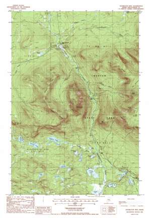
Doubletop Mountain Topo Map Maine
To zoom in, hover over the map of Doubletop Mountain
USGS Topo Quad 45069h1 - 1:24,000 scale
| Topo Map Name: | Doubletop Mountain |
| USGS Topo Quad ID: | 45069h1 |
| Print Size: | ca. 21 1/4" wide x 27" high |
| Southeast Coordinates: | 45.875° N latitude / 69° W longitude |
| Map Center Coordinates: | 45.9375° N latitude / 69.0625° W longitude |
| U.S. State: | ME |
| Filename: | o45069h1.jpg |
| Download Map JPG Image: | Doubletop Mountain topo map 1:24,000 scale |
| Map Type: | Topographic |
| Topo Series: | 7.5´ |
| Map Scale: | 1:24,000 |
| Source of Map Images: | United States Geological Survey (USGS) |
| Alternate Map Versions: |
Doubletop Mountain ME 1978, updated 1981 Download PDF Buy paper map Doubletop Mountain ME 1988, updated 1988 Download PDF Buy paper map Doubletop Mtn ME 1988, updated 1988 Download PDF Buy paper map Doubletop Mountain ME 2011 Download PDF Buy paper map Doubletop Mountain ME 2014 Download PDF Buy paper map |
1:24,000 Topo Quads surrounding Doubletop Mountain
> Back to 45069e1 at 1:100,000 scale
> Back to 45068a1 at 1:250,000 scale
> Back to U.S. Topo Maps home
Doubletop Mountain topo map: Gazetteer
Doubletop Mountain: Dams
Slide Dam elevation 368m 1207′Doubletop Mountain: Falls
Ledge Falls elevation 372m 1220′Doubletop Mountain: Flats
Foster Field elevation 329m 1079′Nesowaonehunk Field elevation 396m 1299′
Doubletop Mountain: Lakes
Beaver Pond elevation 369m 1210′Celia Pond elevation 368m 1207′
Daicey Pond elevation 333m 1092′
Deer Pond elevation 328m 1076′
Draper Pond elevation 326m 1069′
Elbow Pond elevation 319m 1046′
Fowler Pond elevation 379m 1243′
Grassy Pond elevation 317m 1040′
Harrington Pond elevation 328m 1076′
Jackson Pond elevation 373m 1223′
Kidney Pond elevation 321m 1053′
Lily Pad Pond elevation 320m 1049′
Little Beaver Pond elevation 367m 1204′
Little Rocky Pond elevation 332m 1089′
McKenna Pond elevation 350m 1148′
Polly Pond elevation 343m 1125′
Rocky Pond elevation 332m 1089′
Slaughter Pond elevation 345m 1131′
Tracy Pond elevation 322m 1056′
Williams Pond elevation 441m 1446′
Doubletop Mountain: Streams
Little Nesowadnehunk Stream elevation 394m 1292′McManus Brook elevation 396m 1299′
Roaring Brook elevation 372m 1220′
Slaughter Brook elevation 323m 1059′
Doubletop Mountain: Summits
Bean Hole Mountain elevation 513m 1683′Doubletop Mountain elevation 1059m 3474′
Moose Bosom elevation 906m 2972′
Mount Coe elevation 1152m 3779′
Mount O-J-I elevation 1042m 3418′
Mount Veto elevation 821m 2693′
South Brother elevation 1207m 3959′
The Cross Range elevation 806m 2644′
West Peak elevation 734m 2408′
Doubletop Mountain digital topo map on disk
Buy this Doubletop Mountain topo map showing relief, roads, GPS coordinates and other geographical features, as a high-resolution digital map file on DVD:
Maine, New Hampshire, Rhode Island & Eastern Massachusetts
Buy digital topo maps: Maine, New Hampshire, Rhode Island & Eastern Massachusetts


