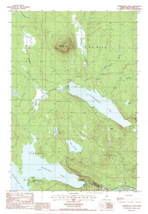
Harrington Lake Topo Map Maine
To zoom in, hover over the map of Harrington Lake
USGS Topo Quad 45069h2 - 1:24,000 scale
| Topo Map Name: | Harrington Lake |
| USGS Topo Quad ID: | 45069h2 |
| Print Size: | ca. 21 1/4" wide x 27" high |
| Southeast Coordinates: | 45.875° N latitude / 69.125° W longitude |
| Map Center Coordinates: | 45.9375° N latitude / 69.1875° W longitude |
| U.S. State: | ME |
| Filename: | o45069h2.jpg |
| Download Map JPG Image: | Harrington Lake topo map 1:24,000 scale |
| Map Type: | Topographic |
| Topo Series: | 7.5´ |
| Map Scale: | 1:24,000 |
| Source of Map Images: | United States Geological Survey (USGS) |
| Alternate Map Versions: |
Harrington Lake ME 1978, updated 1981 Download PDF Buy paper map Harrington Lake ME 1988, updated 1988 Download PDF Buy paper map Harrington Lake ME 2011 Download PDF Buy paper map Harrington Lake ME 2014 Download PDF Buy paper map |
1:24,000 Topo Quads surrounding Harrington Lake
> Back to 45069e1 at 1:100,000 scale
> Back to 45068a1 at 1:250,000 scale
> Back to U.S. Topo Maps home
Harrington Lake topo map: Gazetteer
Harrington Lake: Airports
Chesuncook Forestry District Heliport elevation 287m 941′Harrington Lake: Dams
Harrington Lake Dam elevation 315m 1033′Ripogenus Dam elevation 274m 898′
Harrington Lake: Lakes
Bean Hole Pond elevation 370m 1213′Duck Pond elevation 310m 1017′
Frost Pond elevation 333m 1092′
Jackson Pond elevation 376m 1233′
Little Frost Pond elevation 308m 1010′
Little Mud Pond elevation 313m 1026′
Harrington Lake: Rapids
Big Eddy elevation 208m 682′Harrington Lake: Reservoirs
Chesuncook-Ripogenus Lake elevation 274m 898′Harrington Lake elevation 315m 1033′
Ripogenus Lake elevation 270m 885′
Harrington Lake: Streams
Duck Brook elevation 302m 990′Ripogenus Stream elevation 287m 941′
Sandy Stream elevation 317m 1040′
Smith Brook elevation 315m 1033′
Soper Brook elevation 315m 1033′
Harrington Lake: Summits
Soubunge Mountain elevation 633m 2076′Harrington Lake: Swamps
Brighton Deadwater elevation 298m 977′Harrington Lake: Valleys
Ripogenus Gorge elevation 226m 741′Harrington Lake digital topo map on disk
Buy this Harrington Lake topo map showing relief, roads, GPS coordinates and other geographical features, as a high-resolution digital map file on DVD:
Maine, New Hampshire, Rhode Island & Eastern Massachusetts
Buy digital topo maps: Maine, New Hampshire, Rhode Island & Eastern Massachusetts


