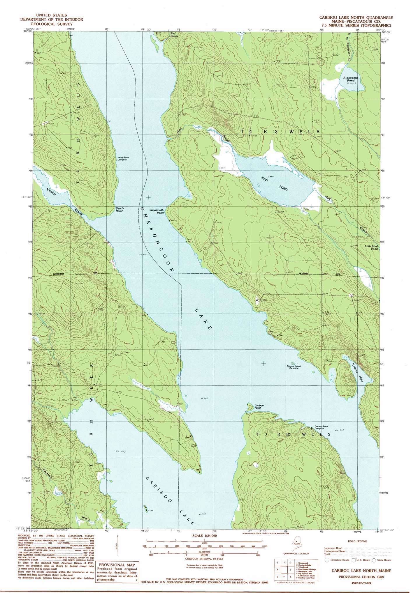
Caribou Lake North Topo Map Maine
To zoom in, hover over the map of Caribou Lake North
USGS Topo Quad 45069h3 - 1:24,000 scale
| Topo Map Name: | Caribou Lake North |
| USGS Topo Quad ID: | 45069h3 |
| Print Size: | ca. 21 1/4" wide x 27" high |
| Southeast Coordinates: | 45.875° N latitude / 69.25° W longitude |
| Map Center Coordinates: | 45.9375° N latitude / 69.3125° W longitude |
| U.S. State: | ME |
| Filename: | o45069h3.jpg |
| Download Map JPG Image: | Caribou Lake North topo map 1:24,000 scale |
| Map Type: | Topographic |
| Topo Series: | 7.5´ |
| Map Scale: | 1:24,000 |
| Source of Map Images: | United States Geological Survey (USGS) |
| Alternate Map Versions: |
Caribou Lake North ME 1978, updated 1981 Download PDF Buy paper map Caribou Lake North ME 1988, updated 1988 Download PDF Buy paper map Caribou Lake North ME 2011 Download PDF Buy paper map Caribou Lake North ME 2014 Download PDF Buy paper map |
1:24,000 Topo Quads surrounding Caribou Lake North
Caucomgomoc Lake East |
Longley Pond |
Mud Pond |
Telos Lake |
Webster Lake |
Ragmuff Stream |
Chesuncook |
Cuxabexis Lake |
Telos Brook |
Nesowad Nehunk Lake |
Penobscot Farm |
Pine Stream Flowage |
Caribou Lake North |
Harrington Lake |
Doubletop Mountain |
Lobster Mountain |
Big Spencer Mountain |
Caribou Lake South |
Rainbow Lake West |
Rainbow Lake East |
Spencer Bay |
Kokadjo |
Farrar Mountain |
Wadleigh Mountain |
Nahmakanta Stream |
> Back to 45069e1 at 1:100,000 scale
> Back to 45068a1 at 1:250,000 scale
> Back to U.S. Topo Maps home
Caribou Lake North topo map: Gazetteer
Caribou Lake North: Capes
Caribou Point elevation 288m 944′Sandy Point elevation 287m 941′
Weymouth Point elevation 290m 951′
Caribou Lake North: Lakes
Chesuncook Lake elevation 287m 941′Holmes Hole elevation 287m 941′
Mud Pond elevation 301m 987′
Ripogenus Pond elevation 327m 1072′
Caribou Lake North: Streams
Fourmile Brook elevation 287m 941′Mud Brook elevation 287m 941′
Otter Brook elevation 298m 977′
Quaker Brook elevation 287m 941′
Red Brook elevation 287m 941′
Caribou Lake North digital topo map on disk
Buy this Caribou Lake North topo map showing relief, roads, GPS coordinates and other geographical features, as a high-resolution digital map file on DVD:
Maine, New Hampshire, Rhode Island & Eastern Massachusetts
Buy digital topo maps: Maine, New Hampshire, Rhode Island & Eastern Massachusetts