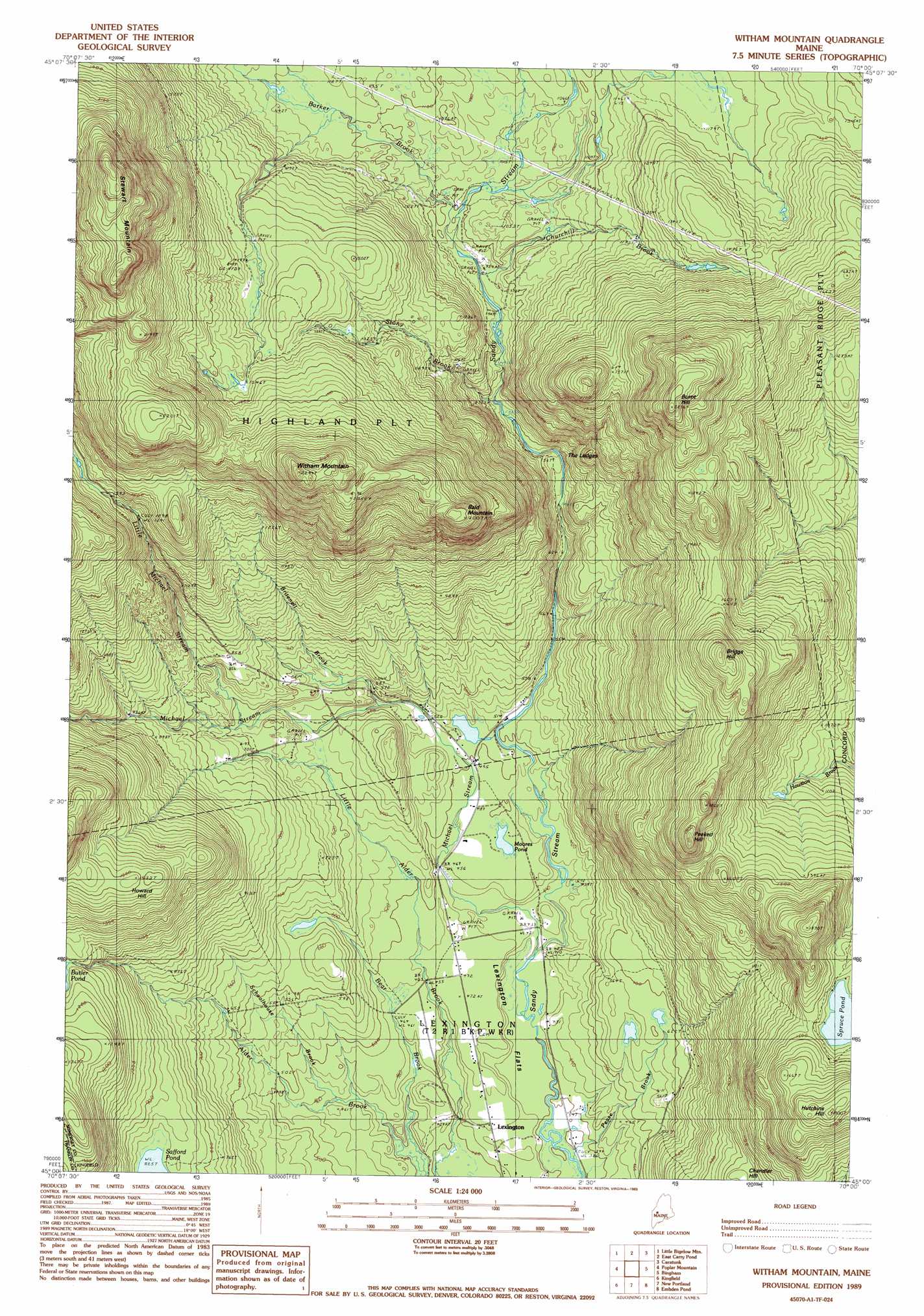
Witham Mountain Topo Map Maine
To zoom in, hover over the map of Witham Mountain
USGS Topo Quad 45070a1 - 1:24,000 scale
| Topo Map Name: | Witham Mountain |
| USGS Topo Quad ID: | 45070a1 |
| Print Size: | ca. 21 1/4" wide x 27" high |
| Southeast Coordinates: | 45° N latitude / 70° W longitude |
| Map Center Coordinates: | 45.0625° N latitude / 70.0625° W longitude |
| U.S. State: | ME |
| Filename: | o45070a1.jpg |
| Download Map JPG Image: | Witham Mountain topo map 1:24,000 scale |
| Map Type: | Topographic |
| Topo Series: | 7.5´ |
| Map Scale: | 1:24,000 |
| Source of Map Images: | United States Geological Survey (USGS) |
| Alternate Map Versions: |
Witham Mountain ME 1979, updated 1983 Download PDF Buy paper map Witham Mtn ME 1989, updated 1989 Download PDF Buy paper map Witham Mountain ME 2011 Download PDF Buy paper map Witham Mountain ME 2014 Download PDF Buy paper map |
1:24,000 Topo Quads surrounding Witham Mountain
King And Bartlett Lake |
Basin Mountain |
Pierce Pond |
The Forks |
Moxie Pond |
The Horns |
Little Bigelow Mountain |
East Carry Pond |
Caratunk |
Dimmick Mountain |
Sugarloaf Mountain |
Poplar Mountain |
Witham Mountain |
Bingham |
Mahoney Hill |
Mount Abraham |
Kingfield |
New Portland |
Embden Pond |
Solon |
Phillips |
Strong |
New Vineyard |
Madison West |
Madison East |
> Back to 45070a1 at 1:100,000 scale
> Back to 45070a1 at 1:250,000 scale
> Back to U.S. Topo Maps home
Witham Mountain topo map: Gazetteer
Witham Mountain: Benches
The Ledges elevation 313m 1026′Witham Mountain: Lakes
Moores Pond elevation 149m 488′Spruce Pond elevation 436m 1430′
Witham Mountain: Streams
Barker Brook elevation 305m 1000′Bear Brook elevation 121m 396′
Britenell Brook elevation 174m 570′
Churchill Brook elevation 288m 944′
Little Michael Stream elevation 205m 672′
Michael Stream elevation 128m 419′
Pease Brook elevation 121m 396′
Schoolhouse Brook elevation 140m 459′
Stony Brook elevation 267m 875′
Witham Mountain: Summits
Bald Mountain elevation 617m 2024′Briggs Hill elevation 595m 1952′
Burnt Hill elevation 680m 2230′
Howard Hill elevation 465m 1525′
Hutchins Hill elevation 549m 1801′
Peaked Hill elevation 560m 1837′
Stewart Mountain elevation 773m 2536′
Witham Mountain elevation 665m 2181′
Witham Mountain digital topo map on disk
Buy this Witham Mountain topo map showing relief, roads, GPS coordinates and other geographical features, as a high-resolution digital map file on DVD:
Maine, New Hampshire, Rhode Island & Eastern Massachusetts
Buy digital topo maps: Maine, New Hampshire, Rhode Island & Eastern Massachusetts