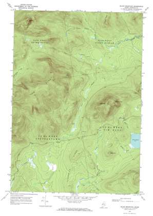
Black Mountain Topo Map Maine
To zoom in, hover over the map of Black Mountain
USGS Topo Quad 45070b6 - 1:24,000 scale
| Topo Map Name: | Black Mountain |
| USGS Topo Quad ID: | 45070b6 |
| Print Size: | ca. 21 1/4" wide x 27" high |
| Southeast Coordinates: | 45.125° N latitude / 70.625° W longitude |
| Map Center Coordinates: | 45.1875° N latitude / 70.6875° W longitude |
| U.S. State: | ME |
| Filename: | o45070b6.jpg |
| Download Map JPG Image: | Black Mountain topo map 1:24,000 scale |
| Map Type: | Topographic |
| Topo Series: | 7.5´ |
| Map Scale: | 1:24,000 |
| Source of Map Images: | United States Geological Survey (USGS) |
| Alternate Map Versions: |
Black Mountain ME 1969, updated 1973 Download PDF Buy paper map Black Mountain ME 1969, updated 1973 Download PDF Buy paper map Black Mountain ME 1977, updated 1983 Download PDF Buy paper map Black Mountain ME 2011 Download PDF Buy paper map Black Mountain ME 2014 Download PDF Buy paper map |
1:24,000 Topo Quads surrounding Black Mountain
> Back to 45070a1 at 1:100,000 scale
> Back to 45070a1 at 1:250,000 scale
> Back to U.S. Topo Maps home
Black Mountain topo map: Gazetteer
Black Mountain: Ridges
Cow Ridge elevation 1095m 3592′Threemile Ridge elevation 640m 2099′
Toenail Ridge elevation 676m 2217′
Black Mountain: Streams
Alder Inlet elevation 612m 2007′Beaver Bog Brook elevation 596m 1955′
Hack Inlet elevation 613m 2011′
Middle Branch Alder Stream elevation 510m 1673′
North Branch Alder Stream elevation 505m 1656′
South Branch Alder Stream elevation 503m 1650′
West Branch Alder Stream elevation 509m 1669′
Black Mountain: Summits
Black Mountain elevation 967m 3172′Boil Mountain elevation 1084m 3556′
Elephants Head elevation 906m 2972′
Maple Hill elevation 714m 2342′
Black Mountain: Swamps
Beaver Bog elevation 613m 2011′Norton Brook Pond elevation 578m 1896′
Black Mountain digital topo map on disk
Buy this Black Mountain topo map showing relief, roads, GPS coordinates and other geographical features, as a high-resolution digital map file on DVD:
Maine, New Hampshire, Rhode Island & Eastern Massachusetts
Buy digital topo maps: Maine, New Hampshire, Rhode Island & Eastern Massachusetts


