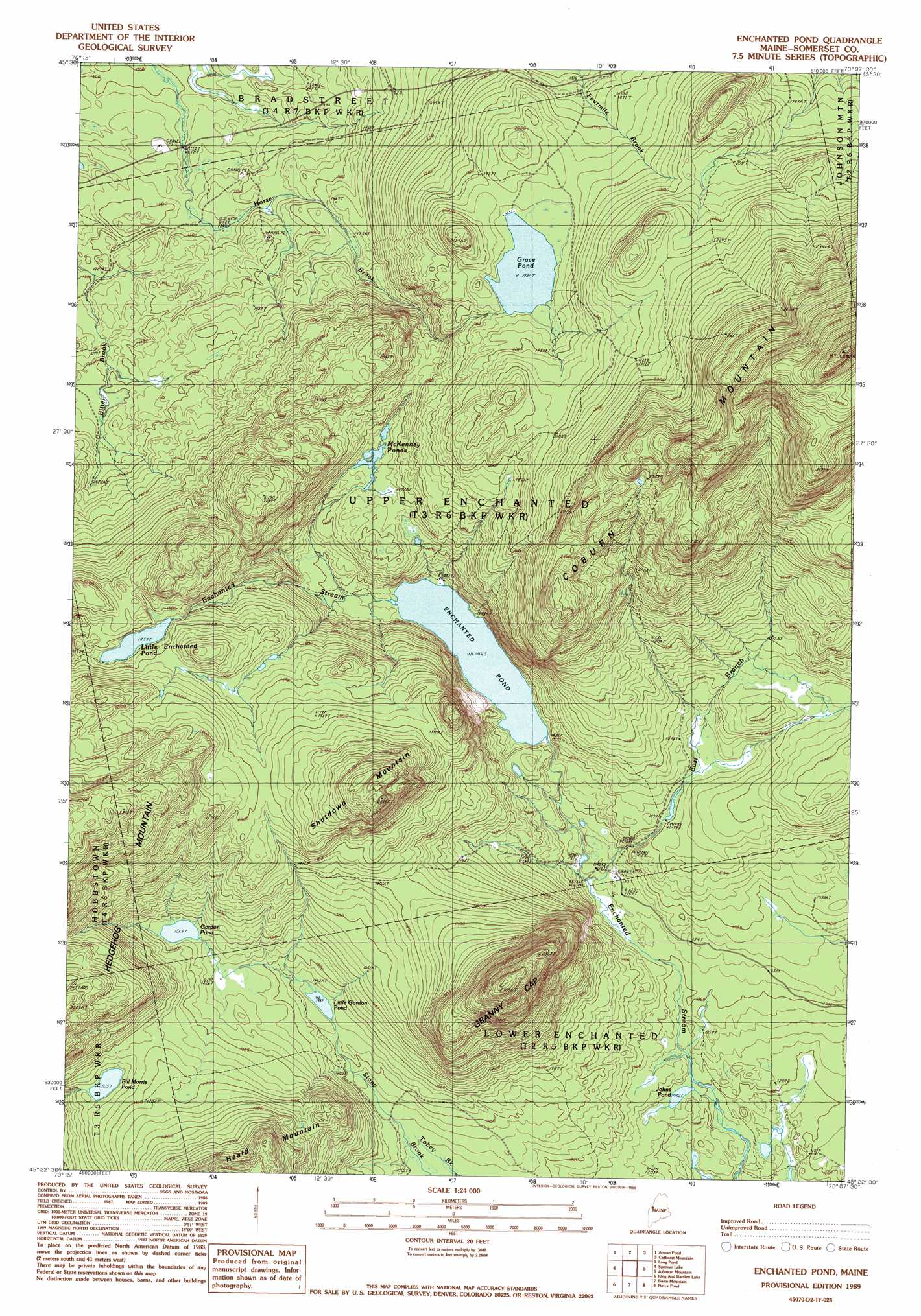
Enchanted Pond Topo Map Maine
To zoom in, hover over the map of Enchanted Pond
USGS Topo Quad 45070d2 - 1:24,000 scale
| Topo Map Name: | Enchanted Pond |
| USGS Topo Quad ID: | 45070d2 |
| Print Size: | ca. 21 1/4" wide x 27" high |
| Southeast Coordinates: | 45.375° N latitude / 70.125° W longitude |
| Map Center Coordinates: | 45.4375° N latitude / 70.1875° W longitude |
| U.S. State: | ME |
| Filename: | o45070d2.jpg |
| Download Map JPG Image: | Enchanted Pond topo map 1:24,000 scale |
| Map Type: | Topographic |
| Topo Series: | 7.5´ |
| Map Scale: | 1:24,000 |
| Source of Map Images: | United States Geological Survey (USGS) |
| Alternate Map Versions: |
Enchanted Pond ME 1977, updated 1983 Download PDF Buy paper map Enchanted Pond ME 1989, updated 1989 Download PDF Buy paper map Enchanted Pond ME 2011 Download PDF Buy paper map Enchanted Pond ME 2014 Download PDF Buy paper map |
1:24,000 Topo Quads surrounding Enchanted Pond
Stony Brook |
Jackman |
Heald Pond |
Churchill Stream |
Brassua Lake West |
Holeb |
Attean Pond |
Catheart Mountain |
Long Pond |
Misery Knob |
Tumbledown Mountain |
Spencer Lake |
Enchanted Pond |
Johnson Mountain |
Black Brook Pond |
King And Bartlett Mountain |
King And Bartlett Lake |
Basin Mountain |
Pierce Pond |
The Forks |
Stratton |
The Horns |
Little Bigelow Mountain |
East Carry Pond |
Caratunk |
> Back to 45070a1 at 1:100,000 scale
> Back to 45070a1 at 1:250,000 scale
> Back to U.S. Topo Maps home
Enchanted Pond topo map: Gazetteer
Enchanted Pond: Lakes
Bill Morris Pond elevation 492m 1614′Enchanted Pond elevation 439m 1440′
Gordon Pond elevation 478m 1568′
Grace Pond elevation 586m 1922′
Johns Pond elevation 373m 1223′
Little Enchanted Pond elevation 564m 1850′
Little Gordon Pond elevation 438m 1437′
McKenney Ponds elevation 500m 1640′
Enchanted Pond: Streams
East Branch Enchanted Stream elevation 403m 1322′Enchanted Pond: Summits
Coburn Mountain elevation 1054m 3458′Granny Cap elevation 807m 2647′
Hedgehog Mountain elevation 771m 2529′
Shutdown Mountain elevation 756m 2480′
Enchanted Pond digital topo map on disk
Buy this Enchanted Pond topo map showing relief, roads, GPS coordinates and other geographical features, as a high-resolution digital map file on DVD:
Maine, New Hampshire, Rhode Island & Eastern Massachusetts
Buy digital topo maps: Maine, New Hampshire, Rhode Island & Eastern Massachusetts