Merrill Mountain Topo Map Maine
To zoom in, hover over the map of Merrill Mountain
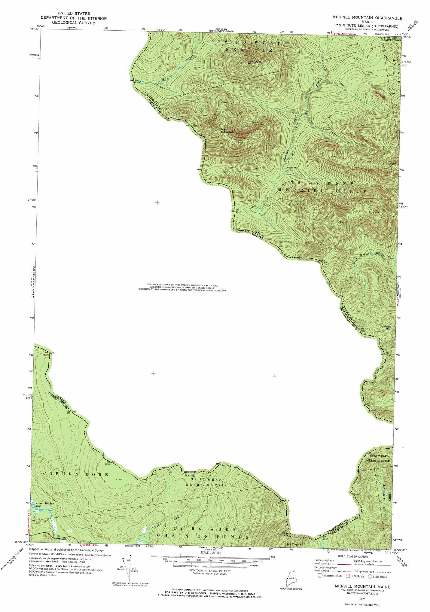
USGS Topo Quad 45070d6 - 1:24,000 scale
| Topo Map Name: | Merrill Mountain |
| USGS Topo Quad ID: | 45070d6 |
| Print Size: | ca. 21 1/4" wide x 27" high |
| Southeast Coordinates: | 45.375° N latitude / 70.625° W longitude |
| Map Center Coordinates: | 45.4375° N latitude / 70.6875° W longitude |
| U.S. State: | ME |
| Filename: | o45070d6.jpg |
| Download Map JPG Image: | Merrill Mountain topo map 1:24,000 scale |
| Map Type: | Topographic |
| Topo Series: | 7.5´ |
| Map Scale: | 1:24,000 |
| Source of Map Images: | United States Geological Survey (USGS) |
| Alternate Map Versions: |
Merrill Mountain ME 1970, updated 1973 Download PDF Buy paper map Merrill Mountain ME 1977, updated 1983 Download PDF Buy paper map Merrill Mountain ME 2011 Download PDF Buy paper map Merrill Mountain ME 2014 Download PDF Buy paper map |
1:24,000 Topo Quads surrounding Merrill Mountain
Skinner Ne |
Stony Brook |
|||
Boundary Pond |
Skinner |
Holeb |
||
Louise Mountain |
Merrill Mountain |
Kibby Mountain |
Tumbledown Mountain |
|
Twin Peaks |
Northwest Pond |
Chain Of Ponds |
Jim Pond |
King And Bartlett Mountain |
Parmachenee Lake |
Little Kennebago Lake |
Black Mountain |
Tim Mountain |
Stratton |
> Back to 45070a1 at 1:100,000 scale
> Back to 45070a1 at 1:250,000 scale
> Back to U.S. Topo Maps home
Merrill Mountain topo map: Gazetteer
Merrill Mountain: Summits
Merrill Mountain elevation 997m 3270′Van Dyke Mountain elevation 934m 3064′
Merrill Mountain digital topo map on disk
Buy this Merrill Mountain topo map showing relief, roads, GPS coordinates and other geographical features, as a high-resolution digital map file on DVD:
Maine, New Hampshire, Rhode Island & Eastern Massachusetts
Buy digital topo maps: Maine, New Hampshire, Rhode Island & Eastern Massachusetts