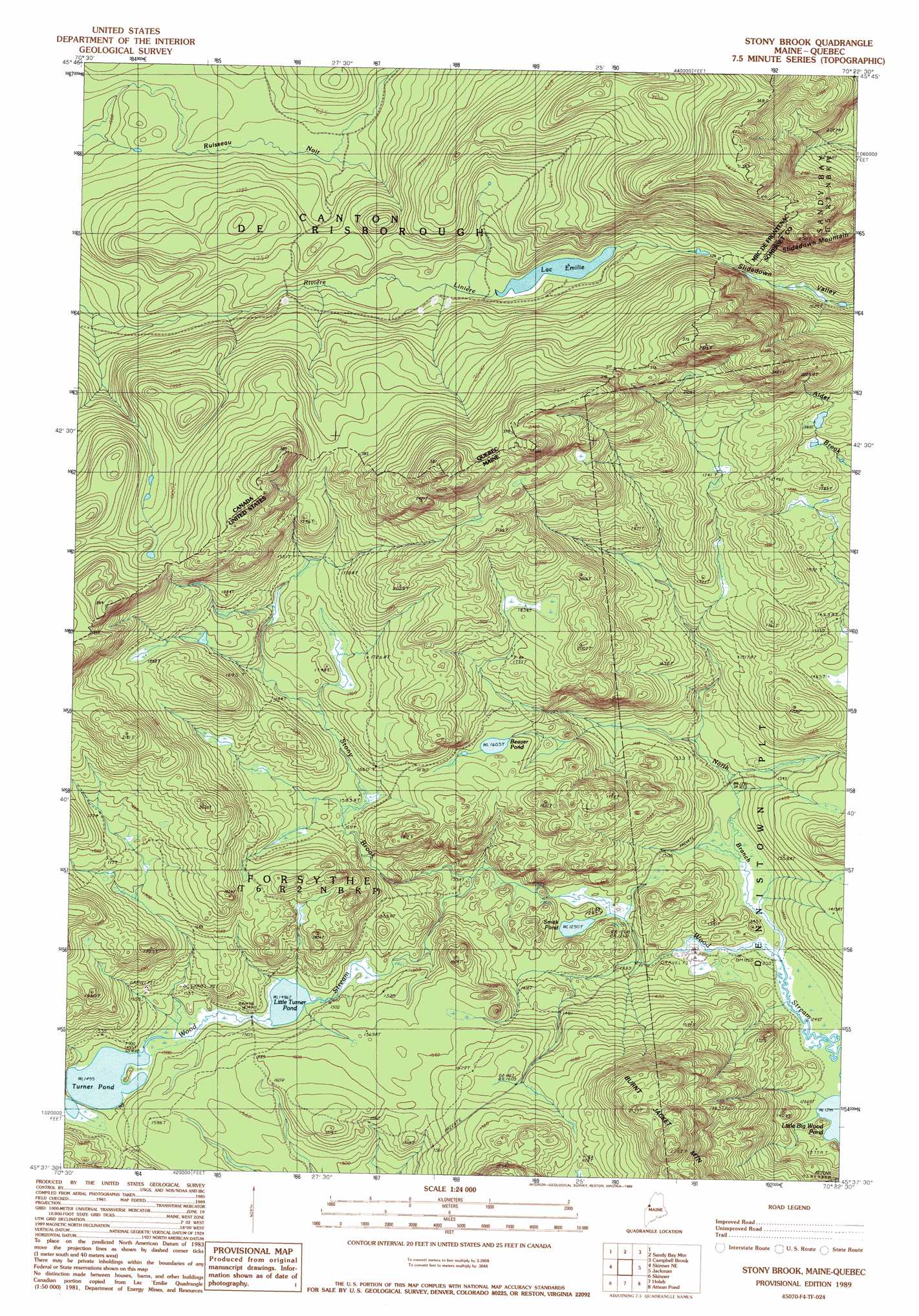
Stony Brook Topo Map Maine
To zoom in, hover over the map of Stony Brook
USGS Topo Quad 45070f4 - 1:24,000 scale
| Topo Map Name: | Stony Brook |
| USGS Topo Quad ID: | 45070f4 |
| Print Size: | ca. 21 1/4" wide x 27" high |
| Southeast Coordinates: | 45.625° N latitude / 70.375° W longitude |
| Map Center Coordinates: | 45.6875° N latitude / 70.4375° W longitude |
| U.S. State: | ME |
| Filename: | o45070f4.jpg |
| Download Map JPG Image: | Stony Brook topo map 1:24,000 scale |
| Map Type: | Topographic |
| Topo Series: | 7.5´ |
| Map Scale: | 1:24,000 |
| Source of Map Images: | United States Geological Survey (USGS) |
| Alternate Map Versions: |
Stony Brook ME 1977, updated 1983 Download PDF Buy paper map Stony Brook ME 1989, updated 1989 Download PDF Buy paper map Stony Brook ME 2011 Download PDF Buy paper map Stony Brook ME 2014 Download PDF Buy paper map |
1:24,000 Topo Quads surrounding Stony Brook
Lac Portage |
Penobscot Lake |
|||
Sandy Bay Mountain |
Campbell Brook |
Boundary Bald Mountain |
||
Skinner Ne |
Stony Brook |
Jackman |
Heald Pond |
|
Boundary Pond |
Skinner |
Holeb |
Attean Pond |
Catheart Mountain |
Merrill Mountain |
Kibby Mountain |
Tumbledown Mountain |
Spencer Lake |
Enchanted Pond |
> Back to 45070e1 at 1:100,000 scale
> Back to 45070a1 at 1:250,000 scale
> Back to U.S. Topo Maps home
Stony Brook topo map: Gazetteer
Stony Brook: Lakes
Beaver Pond elevation 494m 1620′Little Turner Pond elevation 453m 1486′
Smith Pond elevation 394m 1292′
Turner Pond elevation 456m 1496′
Stony Brook: Streams
North Branch Wood Stream elevation 384m 1259′Stony Brook elevation 408m 1338′
Stony Brook: Summits
Burnt Jacket Mountain elevation 672m 2204′Slidedown Mountain elevation 763m 2503′
Stony Brook digital topo map on disk
Buy this Stony Brook topo map showing relief, roads, GPS coordinates and other geographical features, as a high-resolution digital map file on DVD:
Maine, New Hampshire, Rhode Island & Eastern Massachusetts
Buy digital topo maps: Maine, New Hampshire, Rhode Island & Eastern Massachusetts