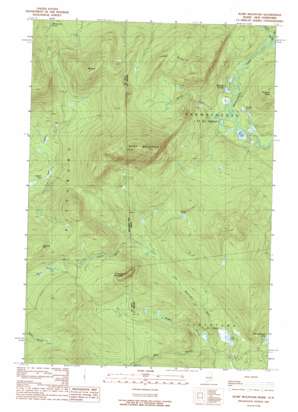
Rump Mountain Topo Map Maine
To zoom in, hover over the map of Rump Mountain
USGS Topo Quad 45071b1 - 1:24,000 scale
| Topo Map Name: | Rump Mountain |
| USGS Topo Quad ID: | 45071b1 |
| Print Size: | ca. 21 1/4" wide x 27" high |
| Southeast Coordinates: | 45.125° N latitude / 71° W longitude |
| Map Center Coordinates: | 45.1875° N latitude / 71.0625° W longitude |
| U.S. States: | ME, NH |
| Filename: | o45071b1.jpg |
| Download Map JPG Image: | Rump Mountain topo map 1:24,000 scale |
| Map Type: | Topographic |
| Topo Series: | 7.5´ |
| Map Scale: | 1:24,000 |
| Source of Map Images: | United States Geological Survey (USGS) |
| Alternate Map Versions: |
Rump Mountain ME 1976, updated 1983 Download PDF Buy paper map Rump Mountain ME 1989, updated 1989 Download PDF Buy paper map Rump Mountain ME 2011 Download PDF Buy paper map Rump Mountain ME 2014 Download PDF Buy paper map |
1:24,000 Topo Quads surrounding Rump Mountain
> Back to 45071a1 at 1:100,000 scale
> Back to 45070a1 at 1:250,000 scale
> Back to U.S. Topo Maps home
Rump Mountain topo map: Gazetteer
Rump Mountain: Lakes
Beaver Pond elevation 673m 2208′Billings Ponds elevation 526m 1725′
Caribou Pond elevation 517m 1696′
Long Pond elevation 472m 1548′
Norton Pool elevation 597m 1958′
Rump Pond elevation 513m 1683′
Rump Mountain: Ridges
Ledge Ridge elevation 809m 2654′Rump Mountain: Streams
Bereau Brook elevation 514m 1686′Middle Branch Little Magalloway River elevation 469m 1538′
Second East Branch Magalloway River elevation 520m 1706′
Trestle Brook elevation 549m 1801′
Trestle Brook elevation 550m 1804′
West Branch Little Magalloway River elevation 500m 1640′
West Branch Little Magalloway River elevation 496m 1627′
Rump Mountain: Summits
Beaman Hill elevation 776m 2545′Mount Kent elevation 891m 2923′
Prospect Mountain elevation 784m 2572′
Rump Mountain elevation 1089m 3572′
Rump Mountain digital topo map on disk
Buy this Rump Mountain topo map showing relief, roads, GPS coordinates and other geographical features, as a high-resolution digital map file on DVD:
Maine, New Hampshire, Rhode Island & Eastern Massachusetts
Buy digital topo maps: Maine, New Hampshire, Rhode Island & Eastern Massachusetts


