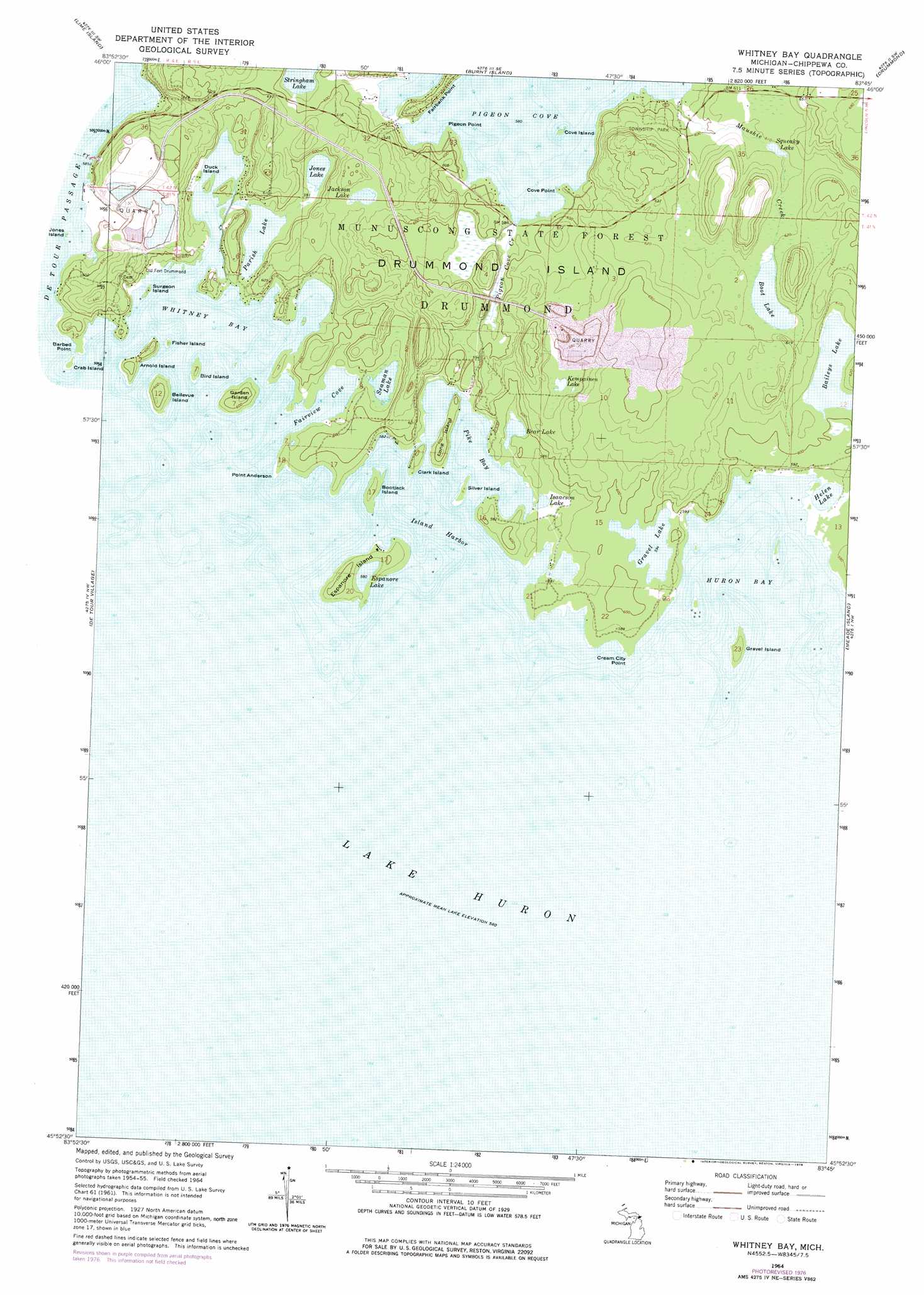
Whitney Bay Topo Map Michigan
To zoom in, hover over the map of Whitney Bay
USGS Topo Quad 45083h7 - 1:24,000 scale
| Topo Map Name: | Whitney Bay |
| USGS Topo Quad ID: | 45083h7 |
| Print Size: | ca. 21 1/4" wide x 27" high |
| Southeast Coordinates: | 45.875° N latitude / 83.75° W longitude |
| Map Center Coordinates: | 45.9375° N latitude / 83.8125° W longitude |
| U.S. State: | MI |
| Filename: | o45083h7.jpg |
| Download Map JPG Image: | Whitney Bay topo map 1:24,000 scale |
| Map Type: | Topographic |
| Topo Series: | 7.5´ |
| Map Scale: | 1:24,000 |
| Source of Map Images: | United States Geological Survey (USGS) |
| Alternate Map Versions: |
Whitney Bay MI 1964, updated 1965 Download PDF Buy paper map Whitney Bay MI 1964, updated 1978 Download PDF Buy paper map Whitney Bay MI 1964, updated 1978 Download PDF Buy paper map Whitney Bay MI 2011 Download PDF Buy paper map Whitney Bay MI 2014 Download PDF Buy paper map Whitney Bay MI 2016 Download PDF Buy paper map |
1:24,000 Topo Quads surrounding Whitney Bay
Munuscong Ne |
||||
Goetzville |
Lime Island |
Burnt Island |
Drummond |
Drummond Se |
Albany Island |
De Tour Village |
Whitney Bay |
Meade Island |
Marble Head |
> Back to 45083e1 at 1:100,000 scale
> Back to 45082a1 at 1:250,000 scale
> Back to U.S. Topo Maps home
Whitney Bay topo map: Gazetteer
Whitney Bay: Bays
Arnold Island elevation 182m 597′Fairview Cove elevation 177m 580′
Fisher Island elevation 180m 590′
Huron Bay elevation 177m 580′
Island Harbor elevation 177m 580′
Pigeon Cove elevation 177m 580′
Pike Bay elevation 177m 580′
Whitney Bay elevation 177m 580′
Whitney Bay: Capes
Cove Point elevation 178m 583′Cream City Point elevation 179m 587′
Fairbank Point elevation 178m 583′
Pigeon Point elevation 177m 580′
Point Anderson elevation 177m 580′
Whitney Bay: Islands
Bellevue Island elevation 184m 603′Bird Island elevation 180m 590′
Bootjack Island elevation 180m 590′
Clark Island elevation 181m 593′
Cove Island elevation 177m 580′
Duck Island elevation 180m 590′
Espanore Island elevation 181m 593′
Garden Island elevation 183m 600′
Gravel Island elevation 180m 590′
Long Island elevation 181m 593′
Silver Island elevation 180m 590′
Surgeon Island elevation 177m 580′
Whitney Bay: Lakes
Baileys Lake elevation 183m 600′Bear Lake elevation 179m 587′
Boot Lake elevation 186m 610′
Espanore Lake elevation 177m 580′
Gravel Lake elevation 180m 590′
Helen Lake elevation 177m 580′
Isaacson Lake elevation 179m 587′
Jackson Lake elevation 189m 620′
Jones Lake elevation 177m 580′
Kempaien Lake elevation 188m 616′
Parish Lake elevation 177m 580′
Seaman Lake elevation 177m 580′
Squeaky Lake elevation 186m 610′
Whitney Bay: Parks
Drummond Township Park elevation 183m 600′Whitney Bay: Streams
Maushie Creek elevation 177m 580′Pigeon Cove Creek elevation 178m 583′
Whitney Bay digital topo map on disk
Buy this Whitney Bay topo map showing relief, roads, GPS coordinates and other geographical features, as a high-resolution digital map file on DVD:
 map DVD")