Atlanta Se Topo Map Michigan
To zoom in, hover over the map of Atlanta Se
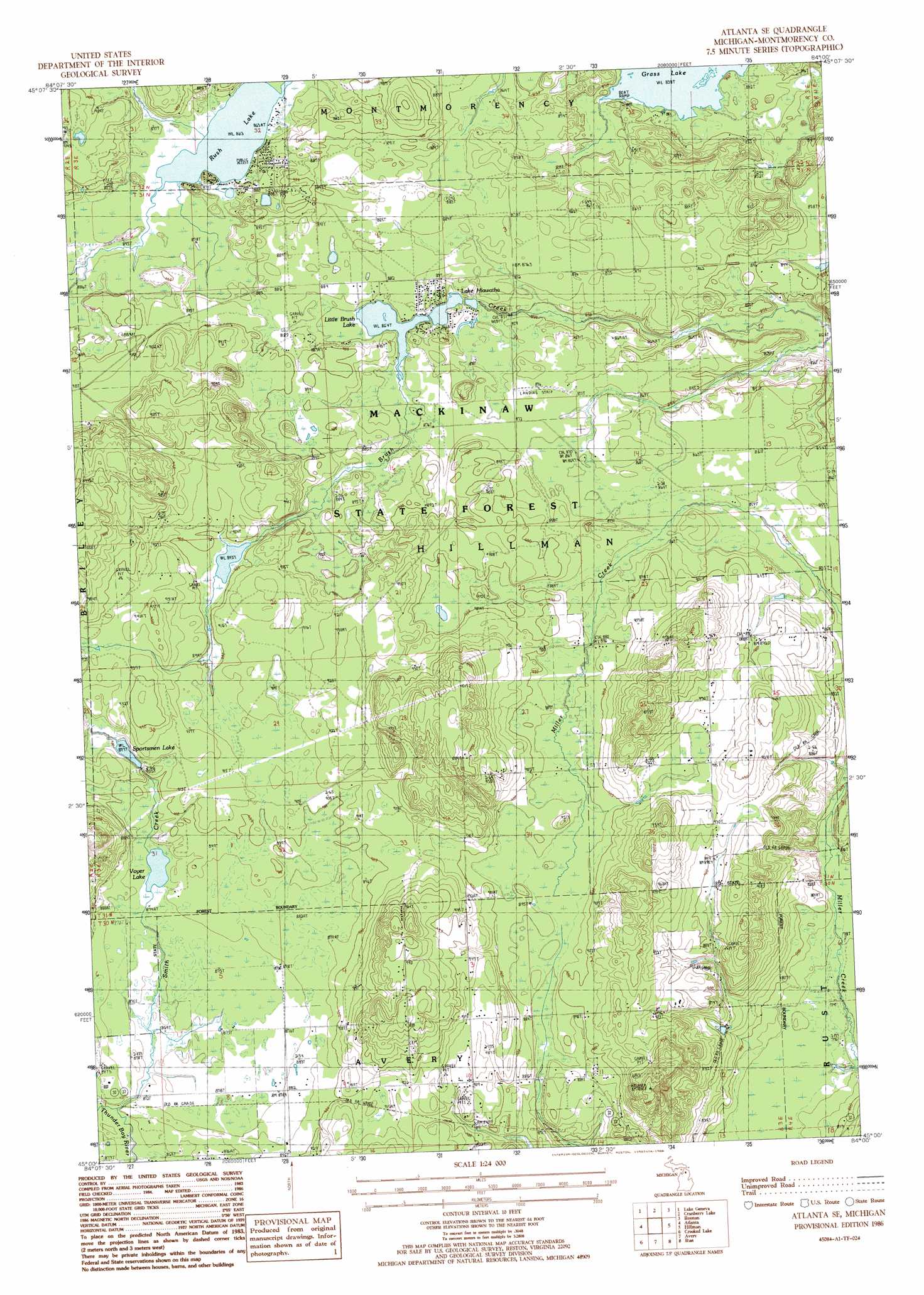
USGS Topo Quad 45084a1 - 1:24,000 scale
| Topo Map Name: | Atlanta Se |
| USGS Topo Quad ID: | 45084a1 |
| Print Size: | ca. 21 1/4" wide x 27" high |
| Southeast Coordinates: | 45° N latitude / 84° W longitude |
| Map Center Coordinates: | 45.0625° N latitude / 84.0625° W longitude |
| U.S. State: | MI |
| Filename: | o45084a1.jpg |
| Download Map JPG Image: | Atlanta Se topo map 1:24,000 scale |
| Map Type: | Topographic |
| Topo Series: | 7.5´ |
| Map Scale: | 1:24,000 |
| Source of Map Images: | United States Geological Survey (USGS) |
| Alternate Map Versions: |
Atlanta SE MI 1986, updated 1986 Download PDF Buy paper map Atlanta SE MI 2011 Download PDF Buy paper map Atlanta SE MI 2014 Download PDF Buy paper map Atlanta SE MI 2017 Download PDF Buy paper map |
1:24,000 Topo Quads surrounding Atlanta Se
Tower |
Onaway |
Millersburg |
Hawks |
Metz |
Silver Lake |
Lake Geneva |
Cranberry Lake |
Royston |
Hillman Ne |
Hetherton |
Atlanta |
Atlanta Se |
Hillman |
Jewett Creek |
Lewiston |
Crooked Lake |
Avery |
Rust |
Beaver Lake |
Comstock Hills |
Oak Lake |
Comins |
Mccollum Lake |
Mcginn Creek |
> Back to 45084a1 at 1:100,000 scale
> Back to 45084a1 at 1:250,000 scale
> Back to U.S. Topo Maps home
Atlanta Se topo map: Gazetteer
Atlanta Se: Lakes
Lake Hiawatha elevation 263m 862′Little Brush Lake elevation 263m 862′
Rush Lake elevation 263m 862′
Sportsmen Lake elevation 274m 898′
Voyer Lake elevation 266m 872′
Atlanta Se: Streams
Smith Creek elevation 264m 866′Atlanta Se digital topo map on disk
Buy this Atlanta Se topo map showing relief, roads, GPS coordinates and other geographical features, as a high-resolution digital map file on DVD: