Sparr Topo Map Michigan
To zoom in, hover over the map of Sparr
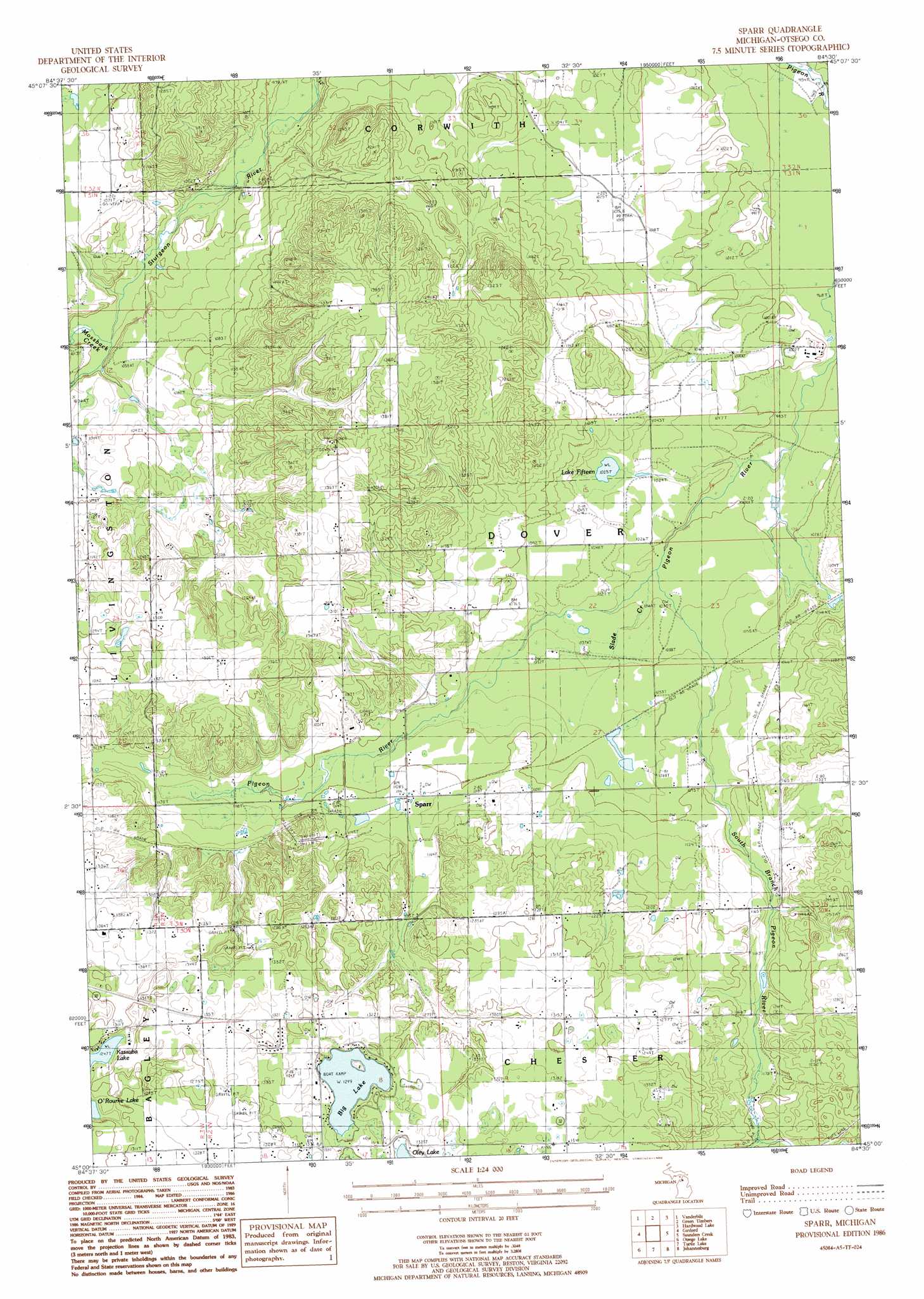
USGS Topo Quad 45084a5 - 1:24,000 scale
| Topo Map Name: | Sparr |
| USGS Topo Quad ID: | 45084a5 |
| Print Size: | ca. 21 1/4" wide x 27" high |
| Southeast Coordinates: | 45° N latitude / 84.5° W longitude |
| Map Center Coordinates: | 45.0625° N latitude / 84.5625° W longitude |
| U.S. State: | MI |
| Filename: | o45084a5.jpg |
| Download Map JPG Image: | Sparr topo map 1:24,000 scale |
| Map Type: | Topographic |
| Topo Series: | 7.5´ |
| Map Scale: | 1:24,000 |
| Source of Map Images: | United States Geological Survey (USGS) |
| Alternate Map Versions: |
Sparr MI 1986, updated 1986 Download PDF Buy paper map Sparr MI 2011 Download PDF Buy paper map Sparr MI 2014 Download PDF Buy paper map Sparr MI 2017 Download PDF Buy paper map |
1:24,000 Topo Quads surrounding Sparr
Epsilon |
Wildwood |
Wolverine |
Afton |
Tower |
Thumb Lake |
Vanderbilt |
Green Timbers |
Hardwood Lake |
Silver Lake |
Elmira |
Gaylord |
Sparr |
Saunders Creek |
Hetherton |
Lake Arrowhead |
Otsego Lake |
Turtle Lake |
Johannesburg |
Lewiston |
Frederic |
Big Bradford Lake |
K P Lake |
Lovells |
Comstock Hills |
> Back to 45084a1 at 1:100,000 scale
> Back to 45084a1 at 1:250,000 scale
> Back to U.S. Topo Maps home
Sparr topo map: Gazetteer
Sparr: Lakes
Big Lake elevation 396m 1299′Kassuba Lake elevation 380m 1246′
Lake Fifteen elevation 312m 1023′
Treetops Masterpiece Golf Course elevation 408m 1338′
Sparr: Populated Places
Sparr elevation 341m 1118′Sparr: Post Offices
Brown's Dale Post Office (historical) elevation 334m 1095′Sparr Post Office (historical) elevation 340m 1115′
Sparr: Streams
Mossback Creek elevation 299m 980′South Branch Pigeon River elevation 309m 1013′
Sparr digital topo map on disk
Buy this Sparr topo map showing relief, roads, GPS coordinates and other geographical features, as a high-resolution digital map file on DVD: