Silver Lake Topo Map Michigan
To zoom in, hover over the map of Silver Lake
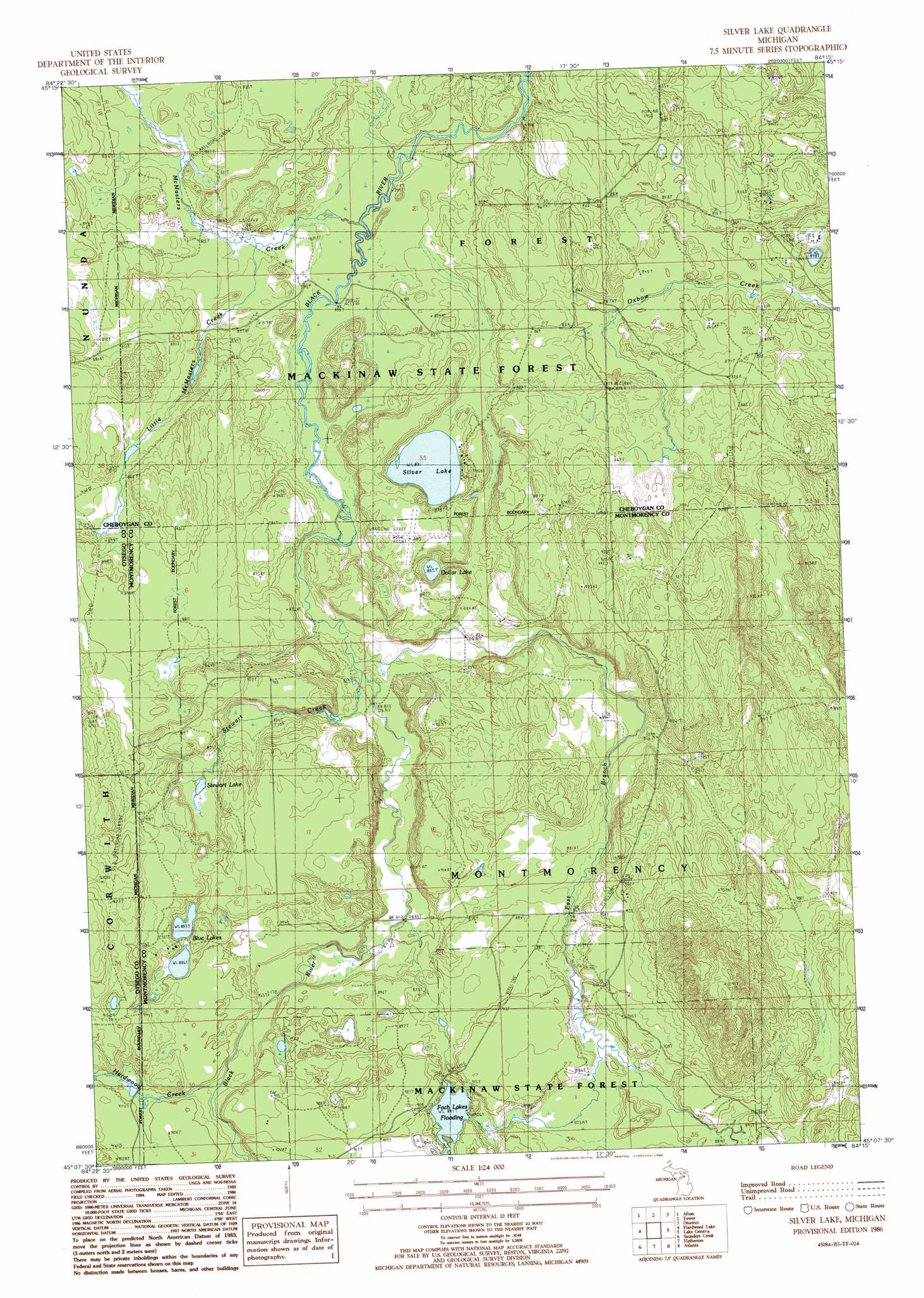
USGS Topo Quad 45084b3 - 1:24,000 scale
| Topo Map Name: | Silver Lake |
| USGS Topo Quad ID: | 45084b3 |
| Print Size: | ca. 21 1/4" wide x 27" high |
| Southeast Coordinates: | 45.125° N latitude / 84.25° W longitude |
| Map Center Coordinates: | 45.1875° N latitude / 84.3125° W longitude |
| U.S. State: | MI |
| Filename: | o45084b3.jpg |
| Download Map JPG Image: | Silver Lake topo map 1:24,000 scale |
| Map Type: | Topographic |
| Topo Series: | 7.5´ |
| Map Scale: | 1:24,000 |
| Source of Map Images: | United States Geological Survey (USGS) |
| Alternate Map Versions: |
Silver Lake MI 1986, updated 1986 Download PDF Buy paper map Silver Lake MI 1986, updated 1986 Download PDF Buy paper map Silver Lake MI 2011 Download PDF Buy paper map Silver Lake MI 2014 Download PDF Buy paper map Silver Lake MI 2017 Download PDF Buy paper map |
1:24,000 Topo Quads surrounding Silver Lake
Indian River |
Legrand |
Hangore Heights |
Black Lake Bluffs |
Ocqueoc |
Wolverine |
Afton |
Tower |
Onaway |
Millersburg |
Green Timbers |
Hardwood Lake |
Silver Lake |
Lake Geneva |
Cranberry Lake |
Sparr |
Saunders Creek |
Hetherton |
Atlanta |
Atlanta Se |
Turtle Lake |
Johannesburg |
Lewiston |
Crooked Lake |
Avery |
> Back to 45084a1 at 1:100,000 scale
> Back to 45084a1 at 1:250,000 scale
> Back to U.S. Topo Maps home
Silver Lake topo map: Gazetteer
Silver Lake: Airports
Black River Ranch Airport elevation 268m 879′Silver Lake: Bridges
Barber Bridge elevation 264m 866′Silver Lake: Lakes
Blue Lakes elevation 270m 885′Dollar Lake elevation 251m 823′
Foch Lakes elevation 271m 889′
Silver Lake elevation 253m 830′
Stewart Lake elevation 265m 869′
Silver Lake: Streams
East Branch Black River elevation 249m 816′Hardwood Creek elevation 272m 892′
Little McMasters Creek elevation 246m 807′
McMasters Creek elevation 244m 800′
Stewart Creek elevation 250m 820′
Silver Lake digital topo map on disk
Buy this Silver Lake topo map showing relief, roads, GPS coordinates and other geographical features, as a high-resolution digital map file on DVD: