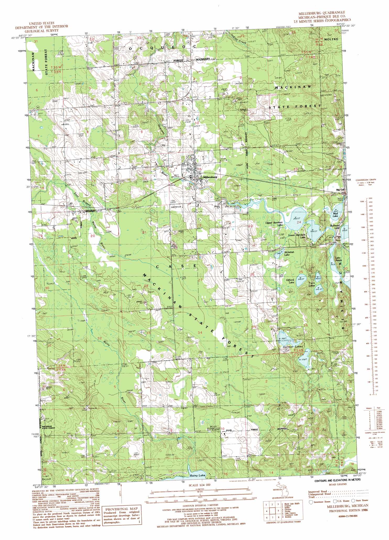
Millersburg Topo Map Michigan
To zoom in, hover over the map of Millersburg
USGS Topo Quad 45084c1 - 1:24,000 scale
| Topo Map Name: | Millersburg |
| USGS Topo Quad ID: | 45084c1 |
| Print Size: | ca. 21 1/4" wide x 27" high |
| Southeast Coordinates: | 45.25° N latitude / 84° W longitude |
| Map Center Coordinates: | 45.3125° N latitude / 84.0625° W longitude |
| U.S. State: | MI |
| Filename: | o45084c1.jpg |
| Download Map JPG Image: | Millersburg topo map 1:24,000 scale |
| Map Type: | Topographic |
| Topo Series: | 7.5´ |
| Map Scale: | 1:24,000 |
| Source of Map Images: | United States Geological Survey (USGS) |
| Alternate Map Versions: |
Millersburg MI 1986, updated 1986 Download PDF Buy paper map Millersburg MI 2011 Download PDF Buy paper map Millersburg MI 2014 Download PDF Buy paper map Millersburg MI 2017 Download PDF Buy paper map |
1:24,000 Topo Quads surrounding Millersburg
Manning |
Grace |
|||
Hangore Heights |
Black Lake Bluffs |
Ocqueoc |
Moltke |
Rogers City |
Tower |
Onaway |
Millersburg |
Hawks |
Metz |
Silver Lake |
Lake Geneva |
Cranberry Lake |
Royston |
Hillman Ne |
Hetherton |
Atlanta |
Atlanta Se |
Hillman |
Jewett Creek |
> Back to 45084a1 at 1:100,000 scale
> Back to 45084a1 at 1:250,000 scale
> Back to U.S. Topo Maps home
Millersburg topo map: Gazetteer
Millersburg: Lakes
Bullhead Lake elevation 242m 793′Gifford Lake elevation 241m 790′
Gorman Lakes elevation 249m 816′
Lower Barnhart Lake elevation 241m 790′
McIntosh Lake elevation 243m 797′
Mud Lake elevation 241m 790′
Twin Lakes elevation 240m 787′
Upper Barnhart Lake elevation 241m 790′
Millersburg: Populated Places
Millersburg elevation 243m 797′Millersburg: Post Offices
Millersburg Post Office elevation 242m 793′Providence Post Office (historical) elevation 239m 784′
Millersburg digital topo map on disk
Buy this Millersburg topo map showing relief, roads, GPS coordinates and other geographical features, as a high-resolution digital map file on DVD: