Tower Topo Map Michigan
To zoom in, hover over the map of Tower
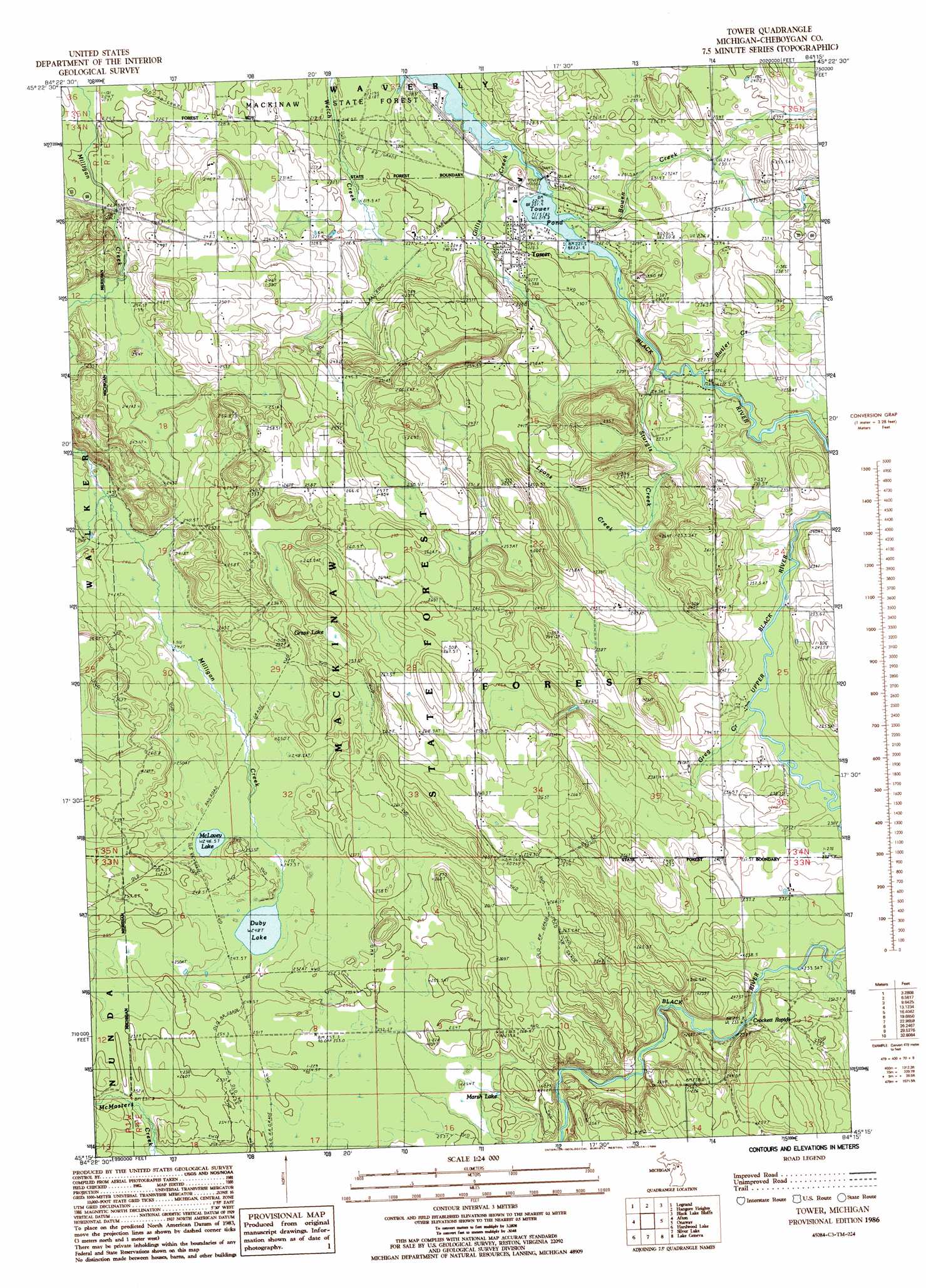
USGS Topo Quad 45084c3 - 1:24,000 scale
| Topo Map Name: | Tower |
| USGS Topo Quad ID: | 45084c3 |
| Print Size: | ca. 21 1/4" wide x 27" high |
| Southeast Coordinates: | 45.25° N latitude / 84.25° W longitude |
| Map Center Coordinates: | 45.3125° N latitude / 84.3125° W longitude |
| U.S. State: | MI |
| Filename: | o45084c3.jpg |
| Download Map JPG Image: | Tower topo map 1:24,000 scale |
| Map Type: | Topographic |
| Topo Series: | 7.5´ |
| Map Scale: | 1:24,000 |
| Source of Map Images: | United States Geological Survey (USGS) |
| Alternate Map Versions: |
Tower MI 1986, updated 1986 Download PDF Buy paper map Tower MI 2011 Download PDF Buy paper map Tower MI 2014 Download PDF Buy paper map Tower MI 2017 Download PDF Buy paper map |
1:24,000 Topo Quads surrounding Tower
Mullett Lake |
Aloha |
Manning |
Grace |
|
Indian River |
Legrand |
Hangore Heights |
Black Lake Bluffs |
Ocqueoc |
Wolverine |
Afton |
Tower |
Onaway |
Millersburg |
Green Timbers |
Hardwood Lake |
Silver Lake |
Lake Geneva |
Cranberry Lake |
Sparr |
Saunders Creek |
Hetherton |
Atlanta |
Atlanta Se |
> Back to 45084a1 at 1:100,000 scale
> Back to 45084a1 at 1:250,000 scale
> Back to U.S. Topo Maps home
Tower topo map: Gazetteer
Tower: Lakes
Dorsy Lake elevation 248m 813′Marsh Lake elevation 252m 826′
McLavey Lake elevation 246m 807′
Tower: Populated Places
Tower elevation 222m 728′Tower: Post Offices
Midway Post Office (historical) elevation 235m 770′Tower Post Office elevation 221m 725′
Tower: Rapids
Crockett Rapids elevation 233m 764′Tower: Reservoirs
Tower Pond elevation 222m 728′Tower: Streams
Bowen Creek elevation 220m 721′Canada Creek elevation 231m 757′
Gillis Creek elevation 222m 728′
Gregg Creek elevation 230m 754′
Lewis Branch Adair Creek elevation 238m 780′
Lyons Creek elevation 230m 754′
Sturgis Creek elevation 222m 728′
Tower: Swamps
Grass Lake elevation 257m 843′Tower digital topo map on disk
Buy this Tower topo map showing relief, roads, GPS coordinates and other geographical features, as a high-resolution digital map file on DVD: