Afton Topo Map Michigan
To zoom in, hover over the map of Afton
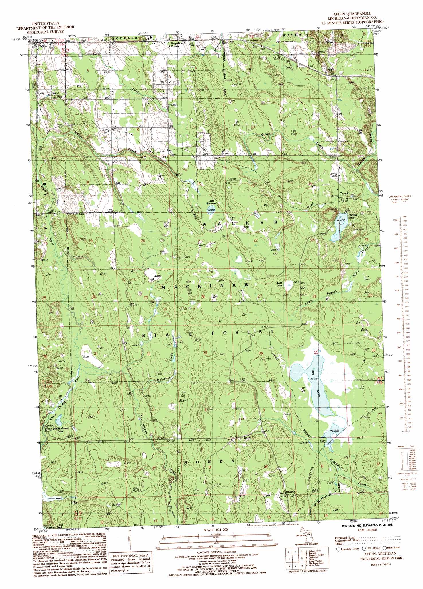
USGS Topo Quad 45084c4 - 1:24,000 scale
| Topo Map Name: | Afton |
| USGS Topo Quad ID: | 45084c4 |
| Print Size: | ca. 21 1/4" wide x 27" high |
| Southeast Coordinates: | 45.25° N latitude / 84.375° W longitude |
| Map Center Coordinates: | 45.3125° N latitude / 84.4375° W longitude |
| U.S. State: | MI |
| Filename: | o45084c4.jpg |
| Download Map JPG Image: | Afton topo map 1:24,000 scale |
| Map Type: | Topographic |
| Topo Series: | 7.5´ |
| Map Scale: | 1:24,000 |
| Source of Map Images: | United States Geological Survey (USGS) |
| Alternate Map Versions: |
Afton MI 1986, updated 1986 Download PDF Buy paper map Afton MI 1986, updated 1986 Download PDF Buy paper map Afton MI 2011 Download PDF Buy paper map Afton MI 2014 Download PDF Buy paper map Afton MI 2017 Download PDF Buy paper map |
1:24,000 Topo Quads surrounding Afton
Indian Village |
Mullett Lake |
Aloha |
Manning |
Grace |
Burt Lake |
Indian River |
Legrand |
Hangore Heights |
Black Lake Bluffs |
Wildwood |
Wolverine |
Afton |
Tower |
Onaway |
Vanderbilt |
Green Timbers |
Hardwood Lake |
Silver Lake |
Lake Geneva |
Gaylord |
Sparr |
Saunders Creek |
Hetherton |
Atlanta |
> Back to 45084a1 at 1:100,000 scale
> Back to 45084a1 at 1:250,000 scale
> Back to U.S. Topo Maps home
Afton topo map: Gazetteer
Afton: Lakes
Dog Lake elevation 258m 846′Lake Sixteen elevation 268m 879′
Lost Lake elevation 259m 849′
MacAndrews Lake elevation 229m 751′
Osmun Lake elevation 246m 807′
Afton: Populated Places
Afton elevation 240m 787′Fingerboard Corner elevation 274m 898′
Afton: Post Offices
Afton Post Office (historical) elevation 240m 787′Afton: Streams
Gokee Creek elevation 234m 767′Little Pigeon River elevation 229m 751′
McIntosh Creek elevation 244m 800′
Weed Creek elevation 235m 770′
West McMasters Creek elevation 254m 833′
Wilkes Creek elevation 224m 734′
Afton digital topo map on disk
Buy this Afton topo map showing relief, roads, GPS coordinates and other geographical features, as a high-resolution digital map file on DVD: