Epsilon Topo Map Michigan
To zoom in, hover over the map of Epsilon
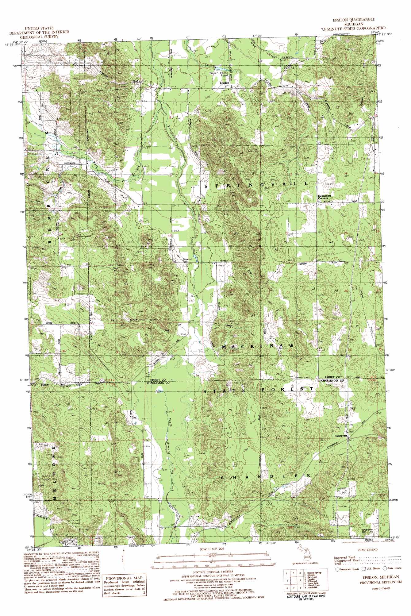
USGS Topo Quad 45084c7 - 1:25,000 scale
| Topo Map Name: | Epsilon |
| USGS Topo Quad ID: | 45084c7 |
| Print Size: | ca. 21 1/4" wide x 27" high |
| Southeast Coordinates: | 45.25° N latitude / 84.75° W longitude |
| Map Center Coordinates: | 45.3125° N latitude / 84.8125° W longitude |
| U.S. State: | MI |
| Filename: | l45084c7.jpg |
| Download Map JPG Image: | Epsilon topo map 1:25,000 scale |
| Map Type: | Topographic |
| Topo Series: | 7.5´ |
| Map Scale: | 1:25,000 |
| Source of Map Images: | United States Geological Survey (USGS) |
| Alternate Map Versions: |
Epsilon MI 1983, updated 1984 Download PDF Buy paper map |
1:24,000 Topo Quads surrounding Epsilon
Goodhart |
Larks Lake |
Pellston |
Indian Village |
Mullett Lake |
Forest Beach |
Harbor Springs |
Alanson |
Burt Lake |
Indian River |
Bayshore |
Petoskey |
Epsilon |
Wildwood |
Wolverine |
Boyne City |
Boyne Falls |
Thumb Lake |
Vanderbilt |
Green Timbers |
Chestonia |
Deadmans Hill |
Elmira |
Gaylord |
Sparr |
> Back to 45084a1 at 1:100,000 scale
> Back to 45084a1 at 1:250,000 scale
> Back to U.S. Topo Maps home
Epsilon topo map: Gazetteer
Epsilon: Populated Places
Epsilon elevation 214m 702′Epsilon: Post Offices
Dot Post Office (historical) elevation 289m 948′Epsilon Post Office (historical) elevation 214m 702′
Littlefield Post Office (historical) elevation 304m 997′
Epsilon: Reservoirs
Silver Creek Pond elevation 202m 662′Epsilon: Springs
Shotto Spring elevation 216m 708′Epsilon: Streams
West Branch Minnehaha Creek elevation 195m 639′Epsilon: Summits
Chandler Hill elevation 372m 1220′Gray Hill elevation 336m 1102′
Epsilon digital topo map on disk
Buy this Epsilon topo map showing relief, roads, GPS coordinates and other geographical features, as a high-resolution digital map file on DVD: