Black Lake Bluffs Topo Map Michigan
To zoom in, hover over the map of Black Lake Bluffs
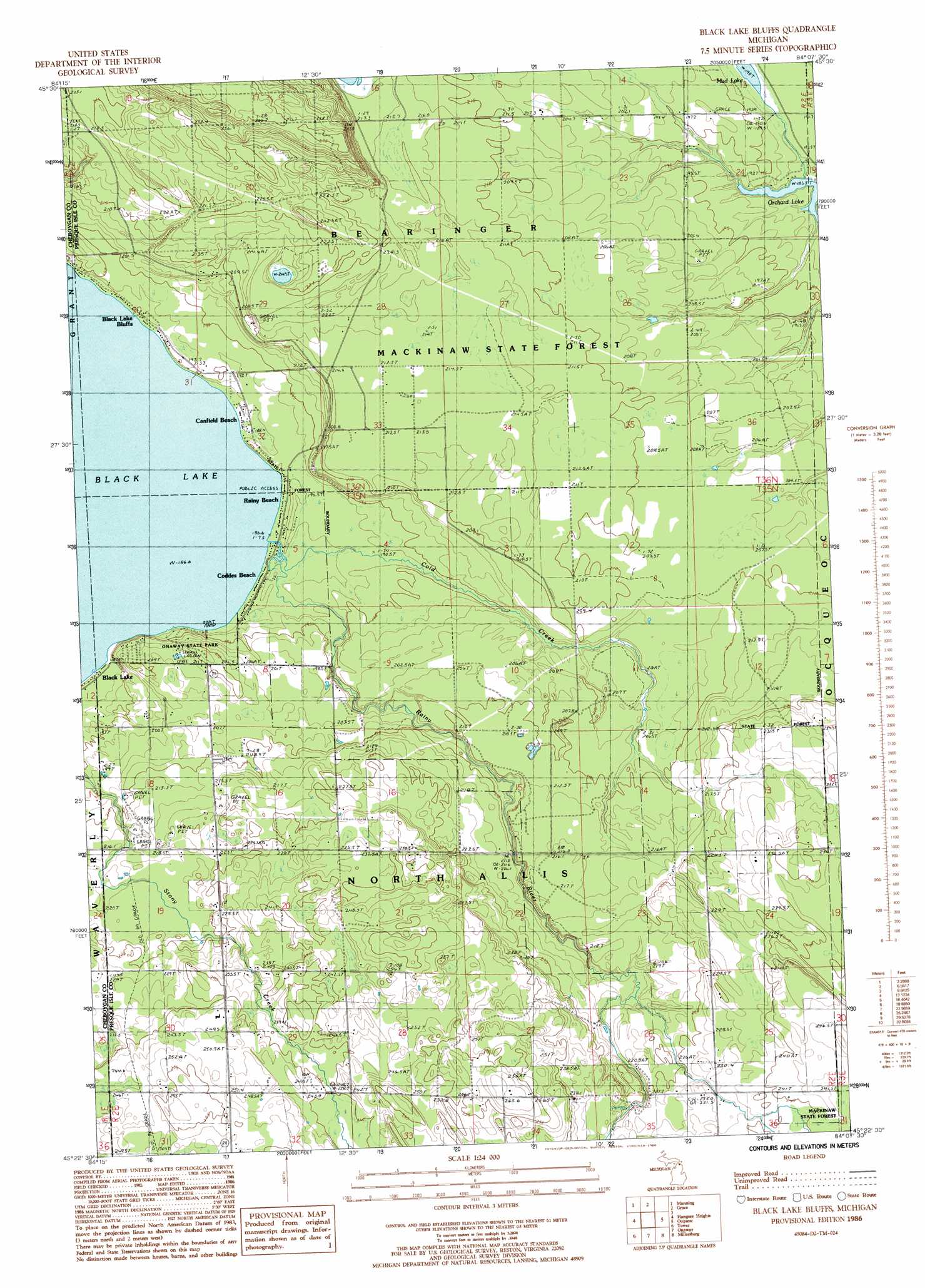
USGS Topo Quad 45084d2 - 1:24,000 scale
| Topo Map Name: | Black Lake Bluffs |
| USGS Topo Quad ID: | 45084d2 |
| Print Size: | ca. 21 1/4" wide x 27" high |
| Southeast Coordinates: | 45.375° N latitude / 84.125° W longitude |
| Map Center Coordinates: | 45.4375° N latitude / 84.1875° W longitude |
| U.S. State: | MI |
| Filename: | o45084d2.jpg |
| Download Map JPG Image: | Black Lake Bluffs topo map 1:24,000 scale |
| Map Type: | Topographic |
| Topo Series: | 7.5´ |
| Map Scale: | 1:24,000 |
| Source of Map Images: | United States Geological Survey (USGS) |
| Alternate Map Versions: |
Black Lake Bluffs MI 1986, updated 1986 Download PDF Buy paper map Black Lake Bluffs MI 2011 Download PDF Buy paper map Black Lake Bluffs MI 2014 Download PDF Buy paper map Black Lake Bluffs MI 2017 Download PDF Buy paper map |
1:24,000 Topo Quads surrounding Black Lake Bluffs
Cheboygan |
Cordwood Point |
Ninemile Point |
||
Aloha |
Manning |
Grace |
||
Legrand |
Hangore Heights |
Black Lake Bluffs |
Ocqueoc |
Moltke |
Afton |
Tower |
Onaway |
Millersburg |
Hawks |
Hardwood Lake |
Silver Lake |
Lake Geneva |
Cranberry Lake |
Royston |
> Back to 45084a1 at 1:100,000 scale
> Back to 45084a1 at 1:250,000 scale
> Back to U.S. Topo Maps home
Black Lake Bluffs topo map: Gazetteer
Black Lake Bluffs: Lakes
Mud Lake elevation 189m 620′Orchard Lake elevation 185m 606′
Black Lake Bluffs: Parks
Bearinger Union School Historical Marker elevation 195m 639′Onaway State Park elevation 206m 675′
Black Lake Bluffs: Populated Places
Black Lake elevation 187m 613′Black Lake Bluffs elevation 188m 616′
Canfield Beach elevation 187m 613′
Coddes Beach elevation 187m 613′
Rainy Beach elevation 187m 613′
Black Lake Bluffs: Post Offices
Allis Post Office (historical) elevation 216m 708′Black Lake Bluffs: Streams
Cold Creek elevation 187m 613′Rainy River elevation 188m 616′
Black Lake Bluffs digital topo map on disk
Buy this Black Lake Bluffs topo map showing relief, roads, GPS coordinates and other geographical features, as a high-resolution digital map file on DVD: