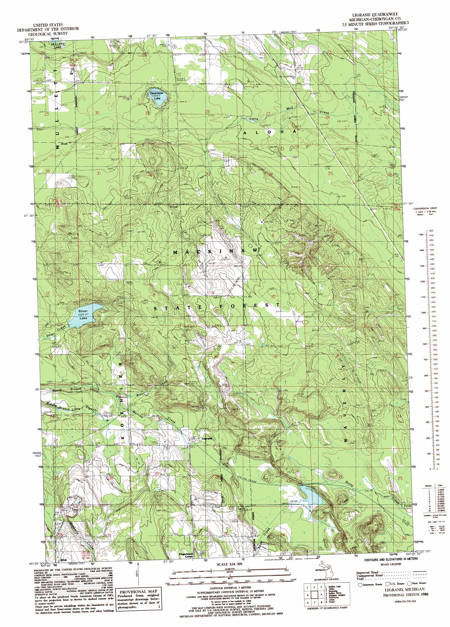
Legrand Topo Map Michigan
To zoom in, hover over the map of Legrand
USGS Topo Quad 45084d4 - 1:24,000 scale
| Topo Map Name: | Legrand |
| USGS Topo Quad ID: | 45084d4 |
| Print Size: | ca. 21 1/4" wide x 27" high |
| Southeast Coordinates: | 45.375° N latitude / 84.375° W longitude |
| Map Center Coordinates: | 45.4375° N latitude / 84.4375° W longitude |
| U.S. State: | MI |
| Filename: | o45084d4.jpg |
| Download Map JPG Image: | Legrand topo map 1:24,000 scale |
| Map Type: | Topographic |
| Topo Series: | 7.5´ |
| Map Scale: | 1:24,000 |
| Source of Map Images: | United States Geological Survey (USGS) |
| Alternate Map Versions: |
Legrand MI 1986, updated 1986 Download PDF Buy paper map Legrand MI 2011 Download PDF Buy paper map Legrand MI 2014 Download PDF Buy paper map Legrand MI 2017 Download PDF Buy paper map |
1:24,000 Topo Quads surrounding Legrand
Freedom |
Point Nipigon |
Cheboygan |
Cordwood Point |
Ninemile Point |
Indian Village |
Mullett Lake |
Aloha |
Manning |
Grace |
Burt Lake |
Indian River |
Legrand |
Hangore Heights |
Black Lake Bluffs |
Wildwood |
Wolverine |
Afton |
Tower |
Onaway |
Vanderbilt |
Green Timbers |
Hardwood Lake |
Silver Lake |
Lake Geneva |
> Back to 45084a1 at 1:100,000 scale
> Back to 45084a1 at 1:250,000 scale
> Back to U.S. Topo Maps home
Legrand topo map: Gazetteer
Legrand: Lakes
Devereaux Lake elevation 206m 675′Silver Lake elevation 209m 685′
Legrand: Populated Places
Legrand elevation 227m 744′Legrand: Post Offices
Legrand Post Office (historical) elevation 227m 744′Legrand: Streams
Adair Creek elevation 236m 774′Kimberly Creek elevation 219m 718′
Morrow Creek elevation 212m 695′
Legrand digital topo map on disk
Buy this Legrand topo map showing relief, roads, GPS coordinates and other geographical features, as a high-resolution digital map file on DVD: