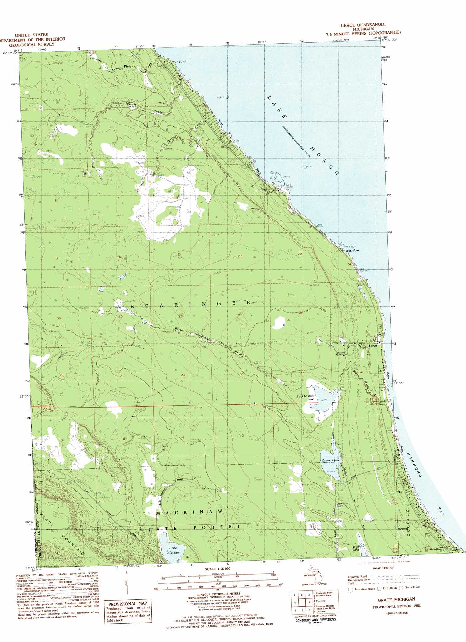
Grace Topo Map Michigan
To zoom in, hover over the map of Grace
USGS Topo Quad 45084e2 - 1:25,000 scale
| Topo Map Name: | Grace |
| USGS Topo Quad ID: | 45084e2 |
| Print Size: | ca. 21 1/4" wide x 27" high |
| Southeast Coordinates: | 45.5° N latitude / 84.125° W longitude |
| Map Center Coordinates: | 45.5625° N latitude / 84.1875° W longitude |
| U.S. State: | MI |
| Filename: | l45084e2.jpg |
| Download Map JPG Image: | Grace topo map 1:25,000 scale |
| Map Type: | Topographic |
| Topo Series: | 7.5´ |
| Map Scale: | 1:25,000 |
| Source of Map Images: | United States Geological Survey (USGS) |
| Alternate Map Versions: |
1:24,000 Topo Quads surrounding Grace
Mcrae Bay |
||||
Cheboygan |
Cordwood Point |
Ninemile Point |
||
Aloha |
Manning |
Grace |
||
Legrand |
Hangore Heights |
Black Lake Bluffs |
Ocqueoc |
Moltke |
Afton |
Tower |
Onaway |
Millersburg |
Hawks |
> Back to 45084e1 at 1:100,000 scale
> Back to 45084a1 at 1:250,000 scale
> Back to U.S. Topo Maps home
Grace topo map: Gazetteer
Grace: Bays
Hammond Bay Harbor elevation 177m 580′Grace: Beaches
Huron Beach elevation 176m 577′Grace: Capes
Highway Point elevation 176m 577′Mast Point elevation 178m 583′
Grace: Lakes
Black Mallard Lake elevation 187m 613′Clear Lake elevation 189m 620′
Lake Sixteen elevation 215m 705′
Grace: Parks
Lake Huron Historical Marker elevation 179m 587′Grace: Populated Places
Grace elevation 181m 593′Grace: Post Offices
Grace Post Office (historical) elevation 181m 593′Grace: Streams
Black Mallard River elevation 177m 580′Grace Creek elevation 176m 577′
Lone Pine Creek elevation 178m 583′
Mulligan Creek elevation 179m 587′
Three Creek elevation 176m 577′
Grace digital topo map on disk
Buy this Grace topo map showing relief, roads, GPS coordinates and other geographical features, as a high-resolution digital map file on DVD: