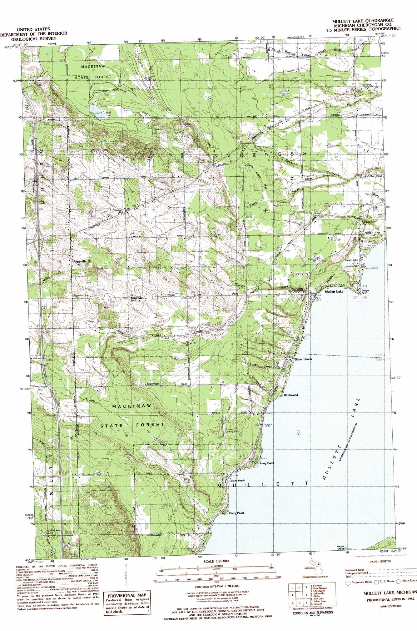
Mullett Lake Topo Map Michigan
To zoom in, hover over the map of Mullett Lake
USGS Topo Quad 45084e5 - 1:25,000 scale
| Topo Map Name: | Mullett Lake |
| USGS Topo Quad ID: | 45084e5 |
| Print Size: | ca. 21 1/4" wide x 27" high |
| Southeast Coordinates: | 45.5° N latitude / 84.5° W longitude |
| Map Center Coordinates: | 45.5625° N latitude / 84.5625° W longitude |
| U.S. State: | MI |
| Filename: | l45084e5.jpg |
| Download Map JPG Image: | Mullett Lake topo map 1:25,000 scale |
| Map Type: | Topographic |
| Topo Series: | 7.5´ |
| Map Scale: | 1:25,000 |
| Source of Map Images: | United States Geological Survey (USGS) |
| Alternate Map Versions: |
Mullett Lake MI 1982, updated 1983 Download PDF Buy paper map |
1:24,000 Topo Quads surrounding Mullett Lake
Mcgulpin Point |
Saint Ignace |
Round Island |
Mcrae Bay |
|
Levaring |
Freedom |
Point Nipigon |
Cheboygan |
Cordwood Point |
Pellston |
Indian Village |
Mullett Lake |
Aloha |
Manning |
Alanson |
Burt Lake |
Indian River |
Legrand |
Hangore Heights |
Epsilon |
Wildwood |
Wolverine |
Afton |
Tower |
> Back to 45084e1 at 1:100,000 scale
> Back to 45084a1 at 1:250,000 scale
> Back to U.S. Topo Maps home
Mullett Lake topo map: Gazetteer
Mullett Lake: Airports
Pbeaaye Airport elevation 205m 672′Mullett Lake: Beaches
Miami Beach elevation 181m 593′Mullett Lake: Capes
Dodge Point elevation 183m 600′Round Point elevation 190m 623′
Mullett Lake: Crossings
Interchange 322 elevation 246m 807′Mullett Lake: Lakes
Mud Lake elevation 225m 738′Mullett Lake elevation 181m 593′
Mullett Lake: Populated Places
Birchwood elevation 182m 597′Long Point elevation 182m 597′
Mullett Lake elevation 183m 600′
Riggsville elevation 227m 744′
Silver Beach elevation 181m 593′
Veery Point elevation 182m 597′
Mullett Lake: Post Offices
Longpoint Post Office (historical) elevation 182m 597′Mullett Lake Post Office elevation 184m 603′
Riggsville Post Office (historical) elevation 227m 744′
Mullett Lake: Streams
Birchwood Creek elevation 183m 600′Mullett Creek elevation 181m 593′
Mullett Lake Creek elevation 182m 597′
Silver Creek elevation 182m 597′
Sipper Creek elevation 201m 659′
Terry Creek elevation 198m 649′
Mullett Lake digital topo map on disk
Buy this Mullett Lake topo map showing relief, roads, GPS coordinates and other geographical features, as a high-resolution digital map file on DVD: