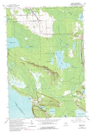
Moran Topo Map Michigan
To zoom in, hover over the map of Moran
USGS Topo Quad 45084h7 - 1:24,000 scale
| Topo Map Name: | Moran |
| USGS Topo Quad ID: | 45084h7 |
| Print Size: | ca. 21 1/4" wide x 27" high |
| Southeast Coordinates: | 45.875° N latitude / 84.75° W longitude |
| Map Center Coordinates: | 45.9375° N latitude / 84.8125° W longitude |
| U.S. State: | MI |
| Filename: | o45084h7.jpg |
| Download Map JPG Image: | Moran topo map 1:24,000 scale |
| Map Type: | Topographic |
| Topo Series: | 7.5´ |
| Map Scale: | 1:24,000 |
| Source of Map Images: | United States Geological Survey (USGS) |
| Alternate Map Versions: |
Moran MI 1964, updated 1966 Download PDF Buy paper map Moran MI 1964, updated 1989 Download PDF Buy paper map Moran MI 2011 Download PDF Buy paper map Moran MI 2014 Download PDF Buy paper map Moran MI 2017 Download PDF Buy paper map |
| FStopo: | US Forest Service topo Moran is available: Download FStopo PDF Download FStopo TIF |
1:24,000 Topo Quads surrounding Moran
> Back to 45084e1 at 1:100,000 scale
> Back to 45084a1 at 1:250,000 scale
> Back to U.S. Topo Maps home
Moran topo map: Gazetteer
Moran: Bays
Poupard Bay elevation 177m 580′Moran: Crossings
Interchange 359 elevation 194m 636′Moran: Lakes
Chain Lake elevation 183m 600′Cranberry Lake elevation 190m 623′
Freschette Lake elevation 182m 597′
Gamble Lake elevation 188m 616′
Hay Lake elevation 189m 620′
Lant Lake elevation 180m 590′
Martin Lake elevation 186m 610′
Massey Lake elevation 184m 603′
Mud Lake elevation 187m 613′
Round Lake elevation 188m 616′
Satago Lake elevation 190m 623′
Silver Lake elevation 187m 613′
Sprinkler Lake elevation 191m 626′
Moran: Parks
Brevort Township Community Recreation Area elevation 214m 702′Gros Cap Roadside Park elevation 224m 734′
Moran: Populated Places
Allenville elevation 213m 698′Moran elevation 215m 705′
Moran: Post Offices
Allenville Post Office (historical) elevation 213m 698′Moran Post Office elevation 215m 705′
Moran: Streams
Kitchens Creek elevation 177m 580′Summerby Creek elevation 189m 620′
Moran: Swamps
Summerby Swamp elevation 192m 629′Moran digital topo map on disk
Buy this Moran topo map showing relief, roads, GPS coordinates and other geographical features, as a high-resolution digital map file on DVD:


