Gills Pier Topo Map Michigan
To zoom in, hover over the map of Gills Pier
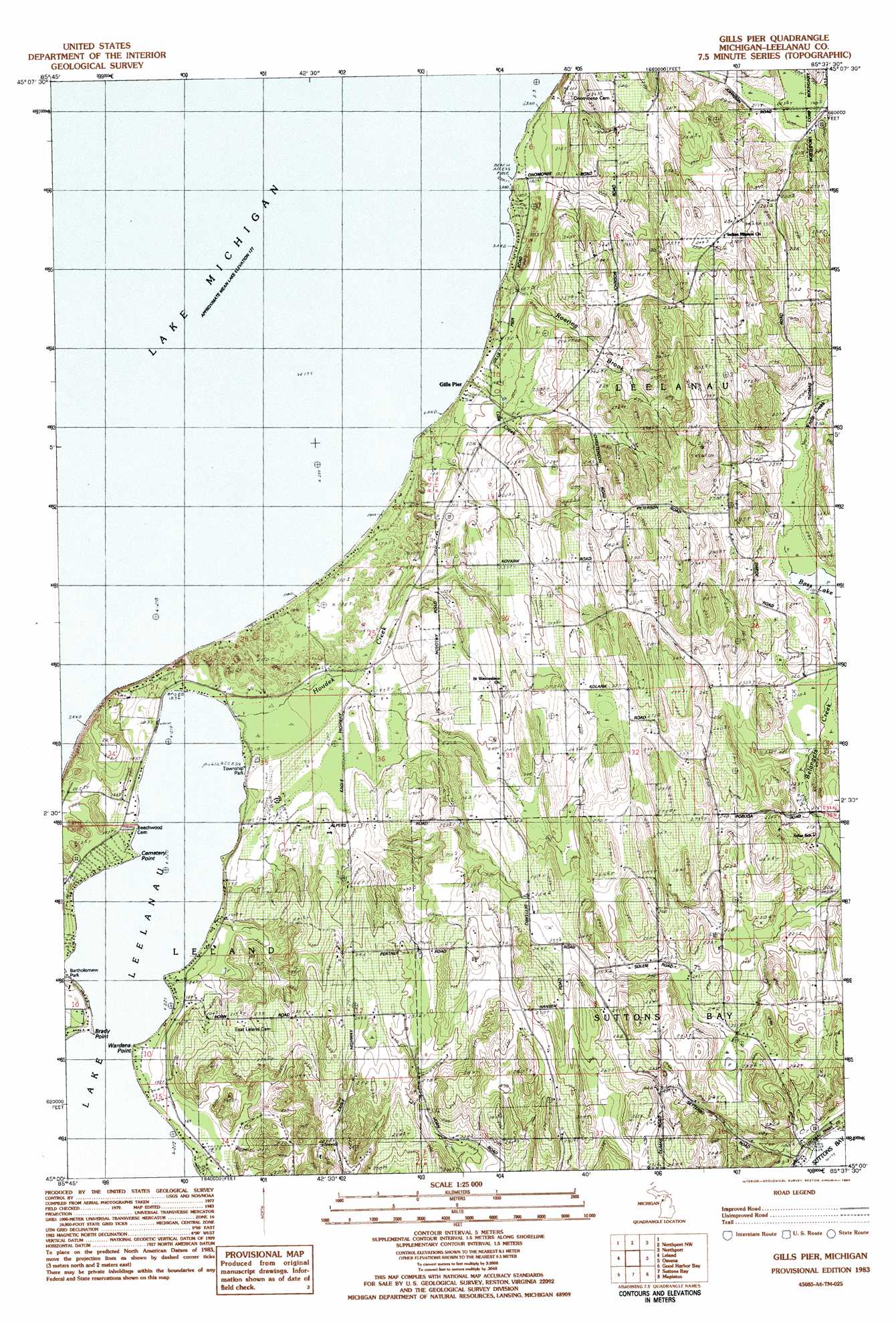
USGS Topo Quad 45085a6 - 1:25,000 scale
| Topo Map Name: | Gills Pier |
| USGS Topo Quad ID: | 45085a6 |
| Print Size: | ca. 21 1/4" wide x 27" high |
| Southeast Coordinates: | 45° N latitude / 85.625° W longitude |
| Map Center Coordinates: | 45.0625° N latitude / 85.6875° W longitude |
| U.S. State: | MI |
| Filename: | l45085a6.jpg |
| Download Map JPG Image: | Gills Pier topo map 1:25,000 scale |
| Map Type: | Topographic |
| Topo Series: | 7.5´ |
| Map Scale: | 1:25,000 |
| Source of Map Images: | United States Geological Survey (USGS) |
| Alternate Map Versions: |
Gills Pier MI 1983, updated 1984 Download PDF Buy paper map |
1:24,000 Topo Quads surrounding Gills Pier
Northport Nw |
Northport |
|||
North Manitou Island |
Leland |
Gills Pier |
Omena |
|
Glen Arbor |
Good Harbor Bay |
Suttons Bay |
Mapleton |
Elk Rapids |
Burdickville |
Maple City |
Traverse City Sw |
Traverse City Se |
Williamsburg |
> Back to 45085a1 at 1:100,000 scale
> Back to 45084a1 at 1:250,000 scale
> Back to U.S. Topo Maps home
Gills Pier topo map: Gazetteer
Gills Pier: Capes
Brady Point elevation 180m 590′Cemetery Point elevation 179m 587′
Wardens Point elevation 180m 590′
Gills Pier: Parks
Bartholomew Park elevation 182m 597′Leland Township Park elevation 183m 600′
Saint Wenceslaus Church and Cemetery Historical Marker elevation 246m 807′
Gills Pier: Post Offices
Gills Pier Post Office (historical) elevation 191m 626′Gills Pier: Streams
Gills Creek elevation 230m 754′Houdek Creek elevation 180m 590′
Roaring Brook elevation 187m 613′
Gills Pier digital topo map on disk
Buy this Gills Pier topo map showing relief, roads, GPS coordinates and other geographical features, as a high-resolution digital map file on DVD: