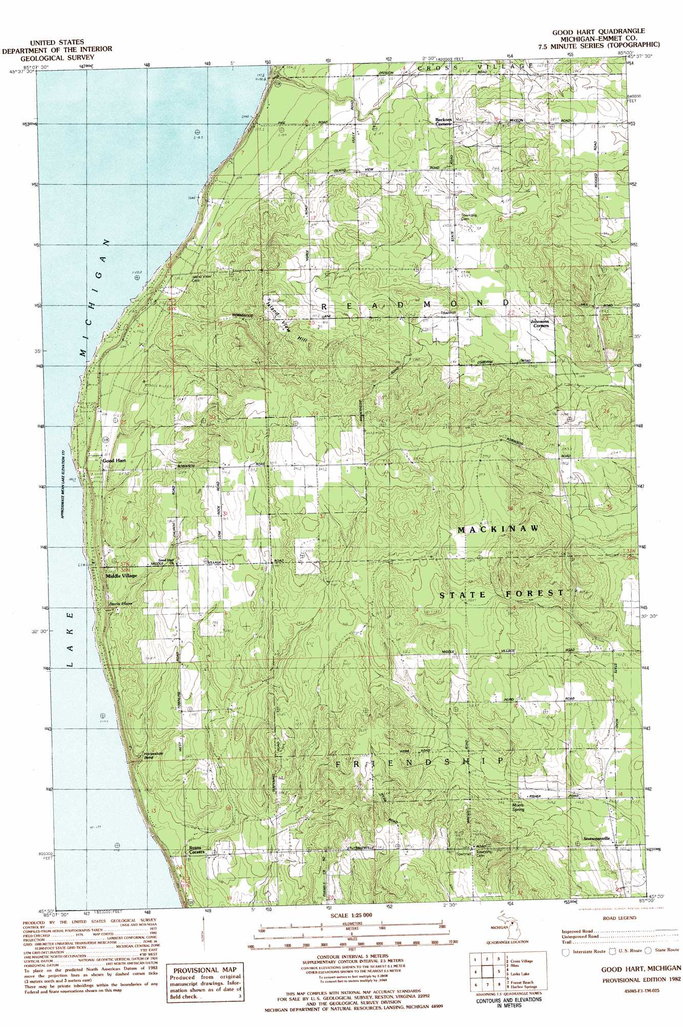
Goodhart Topo Map Michigan
To zoom in, hover over the map of Goodhart
USGS Topo Quad 45085e1 - 1:25,000 scale
| Topo Map Name: | Goodhart |
| USGS Topo Quad ID: | 45085e1 |
| Print Size: | ca. 21 1/4" wide x 27" high |
| Southeast Coordinates: | 45.5° N latitude / 85° W longitude |
| Map Center Coordinates: | 45.5625° N latitude / 85.0625° W longitude |
| U.S. State: | MI |
| Filename: | l45085e1.jpg |
| Download Map JPG Image: | Goodhart topo map 1:25,000 scale |
| Map Type: | Topographic |
| Topo Series: | 7.5´ |
| Map Scale: | 1:25,000 |
| Source of Map Images: | United States Geological Survey (USGS) |
| Alternate Map Versions: |
Good Hart MI 1982, updated 1983 Download PDF Buy paper map |
1:24,000 Topo Quads surrounding Goodhart
Hog Island East |
Waugoshance Island |
Big Stone Bay |
Mcgulpin Point |
|
Cross Village |
Bliss |
Levaring |
||
Goodhart |
Larks Lake |
Pellston |
||
Forest Beach |
Harbor Springs |
Alanson |
||
Charlevoix |
Ironton |
Bayshore |
Petoskey |
Epsilon |
> Back to 45085e1 at 1:100,000 scale
> Back to 45084a1 at 1:250,000 scale
> Back to U.S. Topo Maps home
Goodhart topo map: Gazetteer
Goodhart: Bends
Devils Elbow elevation 244m 800′Horseshoe Bend elevation 220m 721′
Goodhart: Populated Places
Good Hart elevation 213m 698′Middle Village elevation 214m 702′
Stutsmanville elevation 261m 856′
Goodhart: Post Offices
Good Hart Post Office (historical) elevation 213m 698′Readmond Post Office (historical) elevation 282m 925′
Goodhart: Springs
Morris Spring elevation 281m 921′Goodhart: Summits
Island View Hill elevation 330m 1082′Goodhart digital topo map on disk
Buy this Goodhart topo map showing relief, roads, GPS coordinates and other geographical features, as a high-resolution digital map file on DVD: