Gull Island Topo Map Michigan
To zoom in, hover over the map of Gull Island
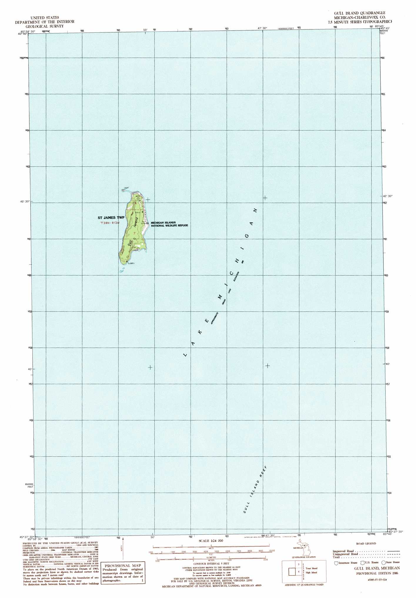
USGS Topo Quad 45085f7 - 1:24,000 scale
| Topo Map Name: | Gull Island |
| USGS Topo Quad ID: | 45085f7 |
| Print Size: | ca. 21 1/4" wide x 27" high |
| Southeast Coordinates: | 45.625° N latitude / 85.75° W longitude |
| Map Center Coordinates: | 45.6875° N latitude / 85.8125° W longitude |
| U.S. State: | MI |
| Filename: | o45085f7.jpg |
| Download Map JPG Image: | Gull Island topo map 1:24,000 scale |
| Map Type: | Topographic |
| Topo Series: | 7.5´ |
| Map Scale: | 1:24,000 |
| Source of Map Images: | United States Geological Survey (USGS) |
| Alternate Map Versions: |
Gull Island MI 1986, updated 1986 Download PDF Buy paper map Gull Island MI 2011 Download PDF Buy paper map Gull Island MI 2014 Download PDF Buy paper map Gull Island MI 2016 Download PDF Buy paper map |
1:24,000 Topo Quads surrounding Gull Island
Gulliver |
Seul Choix Point |
Hughes Point |
Point Patterson |
|
Garden Island West |
||||
Gull Island |
High Island |
Beaver Island North |
||
Beaver Island South |
||||
South Fox Island |
> Back to 45085e1 at 1:100,000 scale
> Back to 45084a1 at 1:250,000 scale
> Back to U.S. Topo Maps home
Gull Island topo map: Gazetteer
Gull Island: Bars
Gull Island Reef elevation 176m 577′Gull Island: Islands
Gull Island elevation 184m 603′Gull Island: Parks
Michigan Islands National Wildlife Refuge elevation 181m 593′Gull Island digital topo map on disk
Buy this Gull Island topo map showing relief, roads, GPS coordinates and other geographical features, as a high-resolution digital map file on DVD: