Waugoshance Island Topo Map Michigan
To zoom in, hover over the map of Waugoshance Island
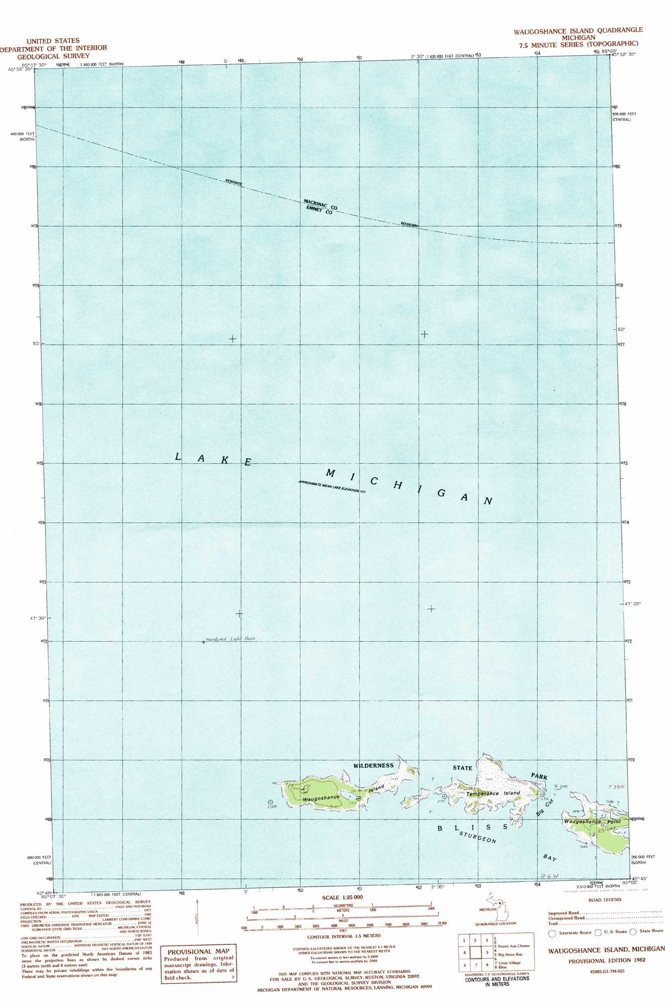
USGS Topo Quad 45085g1 - 1:25,000 scale
| Topo Map Name: | Waugoshance Island |
| USGS Topo Quad ID: | 45085g1 |
| Print Size: | ca. 21 1/4" wide x 27" high |
| Southeast Coordinates: | 45.75° N latitude / 85° W longitude |
| Map Center Coordinates: | 45.8125° N latitude / 85.0625° W longitude |
| U.S. State: | MI |
| Filename: | l45085g1.jpg |
| Download Map JPG Image: | Waugoshance Island topo map 1:25,000 scale |
| Map Type: | Topographic |
| Topo Series: | 7.5´ |
| Map Scale: | 1:25,000 |
| Source of Map Images: | United States Geological Survey (USGS) |
| Alternate Map Versions: |
Waugoshance Island MI 1982, updated 1983 Download PDF Buy paper map |
1:24,000 Topo Quads surrounding Waugoshance Island
Hog Island Point |
Epoufette |
Brevort |
Kenneth |
Ozark Se |
Pnte Aux Chenes |
Moran |
|||
Hog Island East |
Waugoshance Island |
Big Stone Bay |
Mcgulpin Point |
|
Cross Village |
Bliss |
Levaring |
||
Goodhart |
Larks Lake |
Pellston |
> Back to 45085e1 at 1:100,000 scale
> Back to 45084a1 at 1:250,000 scale
> Back to U.S. Topo Maps home
Waugoshance Island topo map: Gazetteer
Waugoshance Island: Bars
East Shoal elevation 177m 580′New Shoal Number One elevation 177m 580′
New Shoal Number Three elevation 177m 580′
New Shoal Number Two elevation 177m 580′
Rose Shoal elevation 177m 580′
Vienna Shoal elevation 177m 580′
White Shoal elevation 177m 580′
Waugoshance Island: Canals
Big Cut elevation 177m 580′Waugoshance Island: Capes
Waugoshance Point elevation 178m 583′Waugoshance Island: Islands
Temperance Island elevation 178m 583′Waugoshance Island elevation 179m 587′
Waugoshance Island digital topo map on disk
Buy this Waugoshance Island topo map showing relief, roads, GPS coordinates and other geographical features, as a high-resolution digital map file on DVD: