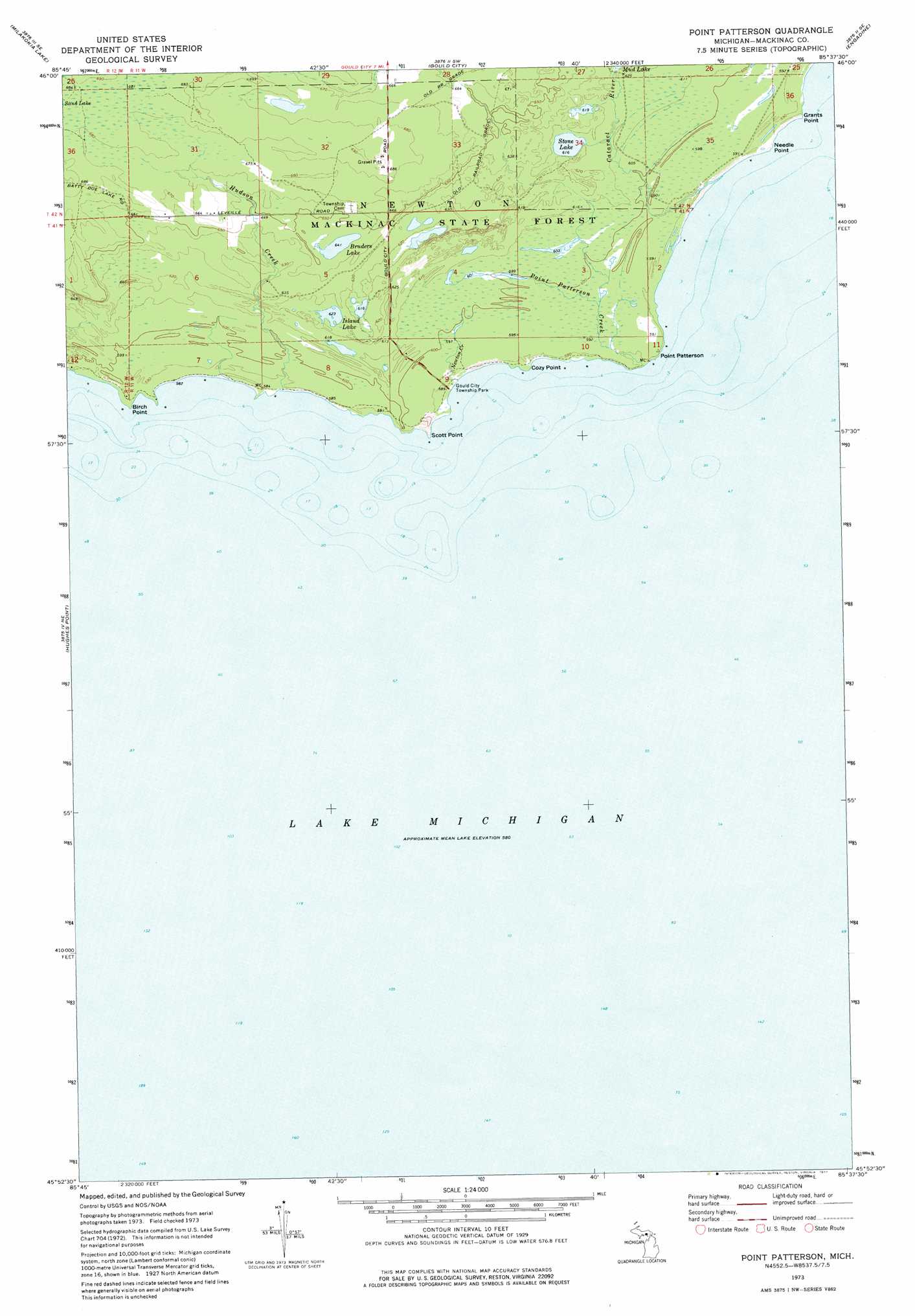
Point Patterson Topo Map Michigan
To zoom in, hover over the map of Point Patterson
USGS Topo Quad 45085h6 - 1:24,000 scale
| Topo Map Name: | Point Patterson |
| USGS Topo Quad ID: | 45085h6 |
| Print Size: | ca. 21 1/4" wide x 27" high |
| Southeast Coordinates: | 45.875° N latitude / 85.625° W longitude |
| Map Center Coordinates: | 45.9375° N latitude / 85.6875° W longitude |
| U.S. State: | MI |
| Filename: | o45085h6.jpg |
| Download Map JPG Image: | Point Patterson topo map 1:24,000 scale |
| Map Type: | Topographic |
| Topo Series: | 7.5´ |
| Map Scale: | 1:24,000 |
| Source of Map Images: | United States Geological Survey (USGS) |
| Alternate Map Versions: |
Point Patterson MI 1973, updated 1977 Download PDF Buy paper map Point Patterson MI 2011 Download PDF Buy paper map Point Patterson MI 2014 Download PDF Buy paper map Point Patterson MI 2016 Download PDF Buy paper map |
1:24,000 Topo Quads surrounding Point Patterson
Germfask |
Curtis West |
Curtis East |
Millecoquins |
Gilchrist |
Blaney Park |
Milakokia Lake |
Gould City |
Engadine |
Naubinway |
Seul Choix Point |
Hughes Point |
Point Patterson |
||
Garden Island West |
Hog Island West |
|||
Gull Island |
High Island |
Beaver Island North |
> Back to 45085e1 at 1:100,000 scale
> Back to 45084a1 at 1:250,000 scale
> Back to U.S. Topo Maps home
Point Patterson topo map: Gazetteer
Point Patterson: Capes
Birch Point elevation 180m 590′Cozy Point elevation 180m 590′
Grants Point elevation 180m 590′
Needle Point elevation 179m 587′
Point Patterson elevation 180m 590′
Scott Point elevation 179m 587′
Point Patterson: Lakes
Bruders Lake elevation 195m 639′Island Lake elevation 191m 626′
Stone Lake elevation 186m 610′
Point Patterson: Parks
Gould City Township Park elevation 179m 587′Point Patterson: Post Offices
Orville Post Office (historical) elevation 187m 613′Point Patterson: Streams
Cataract River elevation 178m 583′Hudson Creek elevation 177m 580′
Newton Creek elevation 179m 587′
Point Patterson Creek elevation 178m 583′
Point Patterson digital topo map on disk
Buy this Point Patterson topo map showing relief, roads, GPS coordinates and other geographical features, as a high-resolution digital map file on DVD: