Washington Island Se Topo Map Wisconsin
To zoom in, hover over the map of Washington Island Se
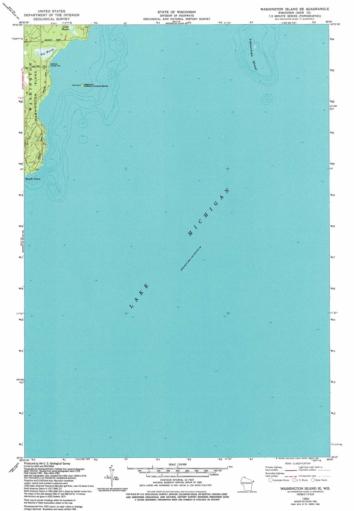
USGS Topo Quad 45086c7 - 1:24,000 scale
| Topo Map Name: | Washington Island Se |
| USGS Topo Quad ID: | 45086c7 |
| Print Size: | ca. 21 1/4" wide x 27" high |
| Southeast Coordinates: | 45.25° N latitude / 86.75° W longitude |
| Map Center Coordinates: | 45.3125° N latitude / 86.8125° W longitude |
| U.S. State: | WI |
| Filename: | o45086c7.jpg |
| Download Map JPG Image: | Washington Island Se topo map 1:24,000 scale |
| Map Type: | Topographic |
| Topo Series: | 7.5´ |
| Map Scale: | 1:24,000 |
| Source of Map Images: | United States Geological Survey (USGS) |
| Alternate Map Versions: |
Washington Island SE WI 1982, updated 1982 Download PDF Buy paper map Washington Island SE WI 1982, updated 1994 Download PDF Buy paper map Washington Island SE WI 2010 Download PDF Buy paper map Washington Island SE WI 2013 Download PDF Buy paper map Washington Island SE WI 2016 Download PDF Buy paper map |
1:24,000 Topo Quads surrounding Washington Island Se
Fairport |
Point Detour |
|||
Washington Island Nw |
Washington Island Nw |
|||
Ellison Bay |
Washington Island Sw |
Washington Island Se |
||
Sister Bay |
Spider Island |
|||
Baileys Harbor East |
> Back to 45086a1 at 1:100,000 scale
> Back to 45086a1 at 1:250,000 scale
> Back to U.S. Topo Maps home
Washington Island Se topo map: Gazetteer
Washington Island Se: Bars
Fisherman Shoal elevation 177m 580′Washington Island Se: Capes
South Point elevation 177m 580′Washington Island Se: Channels
Whitefish Channel elevation 176m 577′Washington Island Se: Islands
Hog Island elevation 179m 587′Washington Island Se: Parks
Big And Little Marsh State Natural Area elevation 180m 590′Eastside County Park elevation 177m 580′
Green Bay National Wildlife Refuge elevation 177m 580′
Washington Island Se: Swamps
Big Marsh elevation 178m 583′Little Marsh elevation 179m 587′
Washington Island Se digital topo map on disk
Buy this Washington Island Se topo map showing relief, roads, GPS coordinates and other geographical features, as a high-resolution digital map file on DVD: