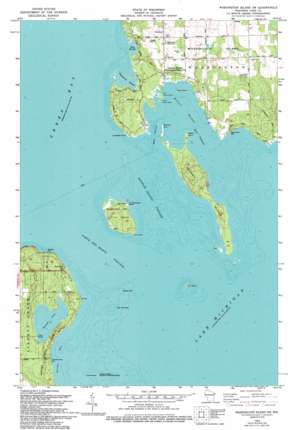
Washington Island Sw Topo Map Wisconsin
To zoom in, hover over the map of Washington Island Sw
USGS Topo Quad 45086c8 - 1:24,000 scale
| Topo Map Name: | Washington Island Sw |
| USGS Topo Quad ID: | 45086c8 |
| Print Size: | ca. 21 1/4" wide x 27" high |
| Southeast Coordinates: | 45.25° N latitude / 86.875° W longitude |
| Map Center Coordinates: | 45.3125° N latitude / 86.9375° W longitude |
| U.S. State: | WI |
| Filename: | o45086c8.jpg |
| Download Map JPG Image: | Washington Island Sw topo map 1:24,000 scale |
| Map Type: | Topographic |
| Topo Series: | 7.5´ |
| Map Scale: | 1:24,000 |
| Source of Map Images: | United States Geological Survey (USGS) |
| Alternate Map Versions: |
Washington Island SW WI 1982, updated 1983 Download PDF Buy paper map Washington Island SW WI 1982, updated 1994 Download PDF Buy paper map Washington Island SW WI 2010 Download PDF Buy paper map Washington Island SW WI 2013 Download PDF Buy paper map Washington Island SW WI 2016 Download PDF Buy paper map |
1:24,000 Topo Quads surrounding Washington Island Sw
Henderson Lakes |
Fairport |
|||
Washington Island Nw |
Washington Island Nw |
|||
Ellison Bay |
Washington Island Sw |
Washington Island Se |
||
Ephraim |
Sister Bay |
Spider Island |
||
Baileys Harbor West |
Baileys Harbor East |
> Back to 45086a1 at 1:100,000 scale
> Back to 45086a1 at 1:250,000 scale
> Back to U.S. Topo Maps home
Washington Island Sw topo map: Gazetteer
Washington Island Sw: Bars
Middle Shoal elevation 177m 580′Nine Foot Shoal elevation 177m 580′
Waverly Shoal elevation 177m 580′
Washington Island Sw: Bays
Detroit Harbor elevation 177m 580′Europe Bay elevation 177m 580′
Figenscaus Harbor elevation 177m 580′
Pedersens Bay elevation 176m 577′
West Harbor elevation 177m 580′
Washington Island Sw: Beaches
Gislason Beach elevation 176m 577′Washington Island Sw: Canals
East Channel elevation 177m 580′West Channel elevation 177m 580′
Washington Island Sw: Capes
Lobdells Point elevation 179m 587′Rabbit Point elevation 177m 580′
Richters Point elevation 177m 580′
Washington Island Sw: Channels
Detroit Island Passage elevation 177m 580′Porte des Morts elevation 177m 580′
Washington Island Sw: Islands
Big Susie Island elevation 177m 580′Detroit Island elevation 181m 593′
Gravel Island elevation 177m 580′
Little Susie Island elevation 177m 580′
Pilot Island elevation 177m 580′
Plum Island elevation 186m 610′
Snake Island elevation 177m 580′
Washington Island Sw: Lakes
Europe Lake elevation 183m 600′Washington Island Sw: Parks
Detroit Harbor State Natural Area elevation 177m 580′Europe Bay Woods State Natural Area elevation 184m 603′
Ferdinand Hotz Park elevation 182m 597′
Kenosha Park elevation 187m 613′
Sand Dunes Park elevation 179m 587′
Washington Island Sw: Populated Places
Detroit Harbor elevation 184m 603′Northport elevation 181m 593′
Washington Island Sw digital topo map on disk
Buy this Washington Island Sw topo map showing relief, roads, GPS coordinates and other geographical features, as a high-resolution digital map file on DVD:


