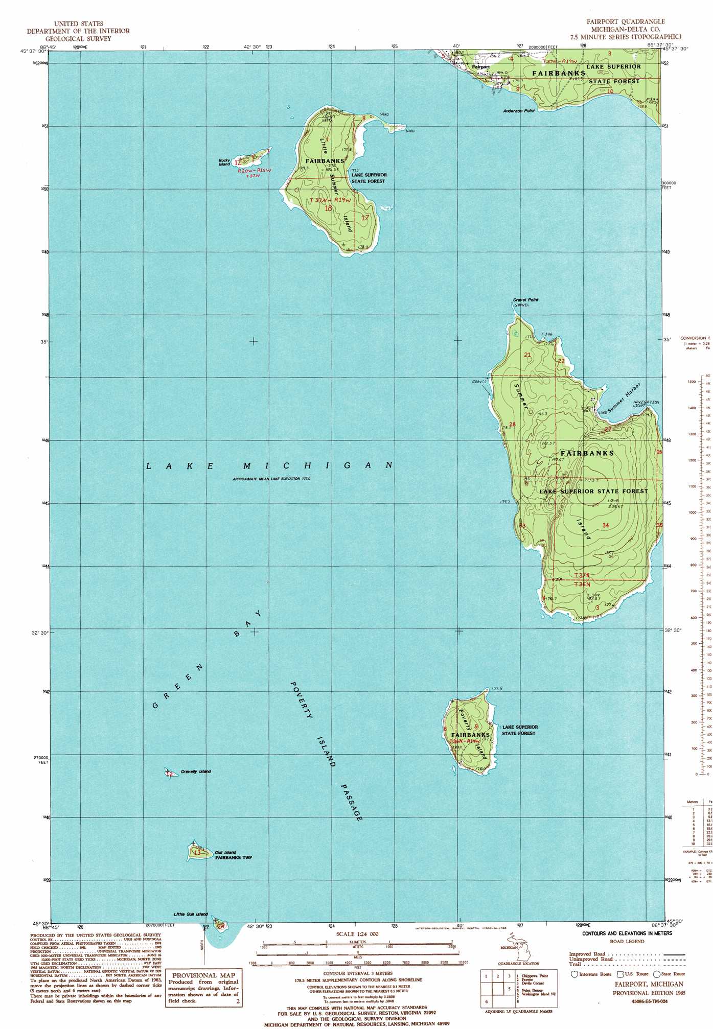
Fairport Topo Map Michigan
To zoom in, hover over the map of Fairport
USGS Topo Quad 45086e6 - 1:24,000 scale
| Topo Map Name: | Fairport |
| USGS Topo Quad ID: | 45086e6 |
| Print Size: | ca. 21 1/4" wide x 27" high |
| Southeast Coordinates: | 45.5° N latitude / 86.625° W longitude |
| Map Center Coordinates: | 45.5625° N latitude / 86.6875° W longitude |
| U.S. State: | MI |
| Filename: | o45086e6.jpg |
| Download Map JPG Image: | Fairport topo map 1:24,000 scale |
| Map Type: | Topographic |
| Topo Series: | 7.5´ |
| Map Scale: | 1:24,000 |
| Source of Map Images: | United States Geological Survey (USGS) |
| Alternate Map Versions: |
Fairport MI 1985, updated 1985 Download PDF Buy paper map Fairport MI 2011 Download PDF Buy paper map Fairport MI 2014 Download PDF Buy paper map Fairport MI 2016 Download PDF Buy paper map |
1:24,000 Topo Quads surrounding Fairport
Maywood |
Ogontz |
Nahma |
Gardner |
Hiram Point |
Peninsula Point |
Chippewa Point |
Fayette |
Devils Corner |
|
Fairport |
Point Detour |
|||
Washington Island Nw |
Washington Island Nw |
|||
Washington Island Sw |
Washington Island Se |
> Back to 45086e1 at 1:100,000 scale
> Back to 45086a1 at 1:250,000 scale
> Back to U.S. Topo Maps home
Fairport topo map: Gazetteer
Fairport: Bars
Gravelly Island Shoals elevation 177m 580′Little Summer Island Shoal elevation 177m 580′
Poverty Island Shoal elevation 177m 580′
Fairport: Bays
Summer Harbor elevation 177m 580′Fairport: Capes
Anderson Point elevation 181m 593′Gravel Point elevation 180m 590′
Fairport: Channels
Poverty Island Passage elevation 177m 580′Fairport: Islands
Gravelly Island elevation 178m 583′Gull Island elevation 180m 590′
Little Summer Island elevation 185m 606′
Poverty Island elevation 184m 603′
Rocky Island elevation 180m 590′
Summer Island elevation 210m 688′
Fairport: Populated Places
Fairport elevation 182m 597′Fairport digital topo map on disk
Buy this Fairport topo map showing relief, roads, GPS coordinates and other geographical features, as a high-resolution digital map file on DVD: