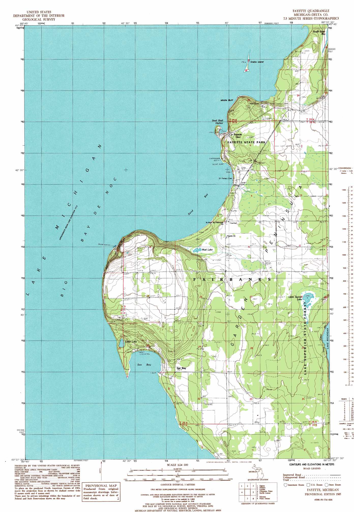
Fayette Topo Map Michigan
To zoom in, hover over the map of Fayette
USGS Topo Quad 45086f6 - 1:24,000 scale
| Topo Map Name: | Fayette |
| USGS Topo Quad ID: | 45086f6 |
| Print Size: | ca. 21 1/4" wide x 27" high |
| Southeast Coordinates: | 45.625° N latitude / 86.625° W longitude |
| Map Center Coordinates: | 45.6875° N latitude / 86.6875° W longitude |
| U.S. State: | MI |
| Filename: | o45086f6.jpg |
| Download Map JPG Image: | Fayette topo map 1:24,000 scale |
| Map Type: | Topographic |
| Topo Series: | 7.5´ |
| Map Scale: | 1:24,000 |
| Source of Map Images: | United States Geological Survey (USGS) |
| Alternate Map Versions: |
Fayette MI 1985, updated 1985 Download PDF Buy paper map Fayette MI 2011 Download PDF Buy paper map Fayette MI 2014 Download PDF Buy paper map Fayette MI 2016 Download PDF Buy paper map |
1:24,000 Topo Quads surrounding Fayette
Rapid River |
Ensign |
Saint Jacques |
Garden Corners |
Cooks |
Maywood |
Ogontz |
Nahma |
Gardner |
Hiram Point |
Peninsula Point |
Chippewa Point |
Fayette |
Devils Corner |
|
Fairport |
Point Detour |
|||
Washington Island Nw |
Washington Island Nw |
> Back to 45086e1 at 1:100,000 scale
> Back to 45086a1 at 1:250,000 scale
> Back to U.S. Topo Maps home
Fayette topo map: Gazetteer
Fayette: Bays
Sac Bay elevation 177m 580′Sand Bay elevation 177m 580′
Snail Shell Harbor elevation 177m 580′
Fayette: Capes
Garden Peninsula elevation 193m 633′Fayette: Cliffs
Burnt Bluff elevation 246m 807′Middle Bluff elevation 205m 672′
Fayette: Islands
Snake Island elevation 177m 580′Fayette: Lakes
Little Lake elevation 177m 580′Little Sucker Lake elevation 185m 606′
Mud Lake elevation 185m 606′
Fayette: Parks
Fayette Historic State Park elevation 205m 672′Fayette: Populated Places
Fayette elevation 199m 652′Sac Bay elevation 187m 613′
Fayette: Post Offices
Fayette Post Office elevation 188m 616′Fayette digital topo map on disk
Buy this Fayette topo map showing relief, roads, GPS coordinates and other geographical features, as a high-resolution digital map file on DVD: