Peninsula Point Topo Map Michigan
To zoom in, hover over the map of Peninsula Point
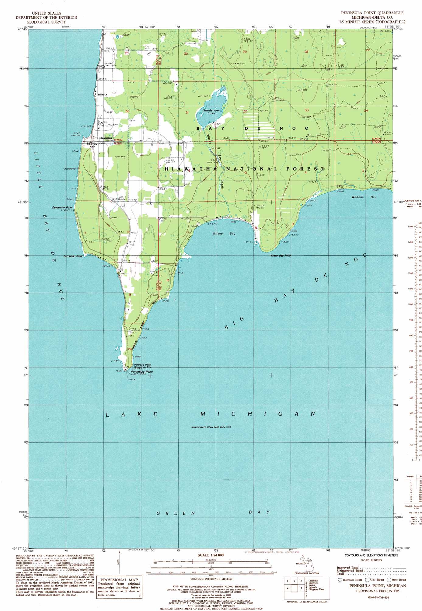
USGS Topo Quad 45086f8 - 1:24,000 scale
| Topo Map Name: | Peninsula Point |
| USGS Topo Quad ID: | 45086f8 |
| Print Size: | ca. 21 1/4" wide x 27" high |
| Southeast Coordinates: | 45.625° N latitude / 86.875° W longitude |
| Map Center Coordinates: | 45.6875° N latitude / 86.9375° W longitude |
| U.S. State: | MI |
| Filename: | o45086f8.jpg |
| Download Map JPG Image: | Peninsula Point topo map 1:24,000 scale |
| Map Type: | Topographic |
| Topo Series: | 7.5´ |
| Map Scale: | 1:24,000 |
| Source of Map Images: | United States Geological Survey (USGS) |
| Alternate Map Versions: |
Peninsula Point MI 1985, updated 1985 Download PDF Buy paper map Peninsula Point MI 2011 Download PDF Buy paper map Peninsula Point MI 2014 Download PDF Buy paper map Peninsula Point MI 2016 Download PDF Buy paper map |
| FStopo: | US Forest Service topo Peninsula Point is available: Download FStopo PDF Download FStopo TIF |
1:24,000 Topo Quads surrounding Peninsula Point
Cornell |
Perkins |
Rapid River |
Ensign |
Saint Jacques |
Chandler |
Gladstone |
Maywood |
Ogontz |
Nahma |
Ford River |
Escanaba |
Peninsula Point |
Chippewa Point |
Fayette |
Henderson Lakes |
Fairport |
|||
Washington Island Nw |
Washington Island Nw |
> Back to 45086e1 at 1:100,000 scale
> Back to 45086a1 at 1:250,000 scale
> Back to U.S. Topo Maps home
Peninsula Point topo map: Gazetteer
Peninsula Point: Bars
Eleven Foot Shoal elevation 177m 580′Peninsula Point Shoal elevation 177m 580′
Peninsula Point: Bays
Wedens Bay elevation 177m 580′Wilsey Bay elevation 177m 580′
Peninsula Point: Capes
Deepwater Point elevation 179m 587′Dutchman Point elevation 179m 587′
Peninsula Point elevation 179m 587′
Wilsey Bay Point elevation 179m 587′
Peninsula Point: Lakes
Sandstrom Lake elevation 181m 593′Peninsula Point: Populated Places
Stonington elevation 189m 620′Peninsula Point: Post Offices
Stonington Post Office (historical) elevation 189m 620′Peninsula Point: Streams
Wilsey Bay Creek elevation 177m 580′Peninsula Point digital topo map on disk
Buy this Peninsula Point topo map showing relief, roads, GPS coordinates and other geographical features, as a high-resolution digital map file on DVD: