Gardner Topo Map Michigan
To zoom in, hover over the map of Gardner
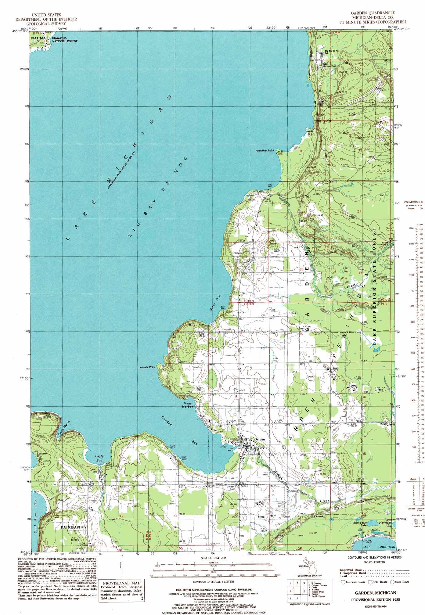
USGS Topo Quad 45086g5 - 1:24,000 scale
| Topo Map Name: | Gardner |
| USGS Topo Quad ID: | 45086g5 |
| Print Size: | ca. 21 1/4" wide x 27" high |
| Southeast Coordinates: | 45.75° N latitude / 86.5° W longitude |
| Map Center Coordinates: | 45.8125° N latitude / 86.5625° W longitude |
| U.S. State: | MI |
| Filename: | o45086g5.jpg |
| Download Map JPG Image: | Gardner topo map 1:24,000 scale |
| Map Type: | Topographic |
| Topo Series: | 7.5´ |
| Map Scale: | 1:24,000 |
| Source of Map Images: | United States Geological Survey (USGS) |
| Alternate Map Versions: |
Garden MI 1985, updated 1985 Download PDF Buy paper map Garden MI 2011 Download PDF Buy paper map Garden MI 2014 Download PDF Buy paper map Garden MI 2016 Download PDF Buy paper map |
| FStopo: | US Forest Service topo Garden is available: Download FStopo PDF Download FStopo TIF |
1:24,000 Topo Quads surrounding Gardner
Poplar Lake |
Waco Lake |
Gooseneck Lake |
Thunder Lake |
Hiawath |
Ensign |
Saint Jacques |
Garden Corners |
Cooks |
Manistique West |
Ogontz |
Nahma |
Gardner |
Hiram Point |
Point Aux Barques |
Chippewa Point |
Fayette |
Devils Corner |
||
Fairport |
Point Detour |
> Back to 45086e1 at 1:100,000 scale
> Back to 45086a1 at 1:250,000 scale
> Back to U.S. Topo Maps home
Gardner topo map: Gazetteer
Gardner: Bays
Garden Bay elevation 177m 580′Goully Harbor elevation 177m 580′
Kates Bay elevation 177m 580′
Puffy Bay elevation 177m 580′
Vans Harbor elevation 177m 580′
Gardner: Capes
Ansels Point elevation 179m 587′Valentine Point elevation 177m 580′
Gardner: Cliffs
Jacks Bluff elevation 214m 702′Gardner: Lakes
Buck Fever Lake elevation 182m 597′Gardner: Parks
Biddle House Historical Marker elevation 177m 580′Gardner: Populated Places
Garden elevation 180m 590′Gardner: Post Offices
Garden Post Office elevation 185m 606′Vans Harbor Post Office (historical) elevation 183m 600′
Gardner: Streams
Garden Creek elevation 177m 580′Puffy Creek elevation 179m 587′
Valentine Creek elevation 177m 580′
Gardner digital topo map on disk
Buy this Gardner topo map showing relief, roads, GPS coordinates and other geographical features, as a high-resolution digital map file on DVD: