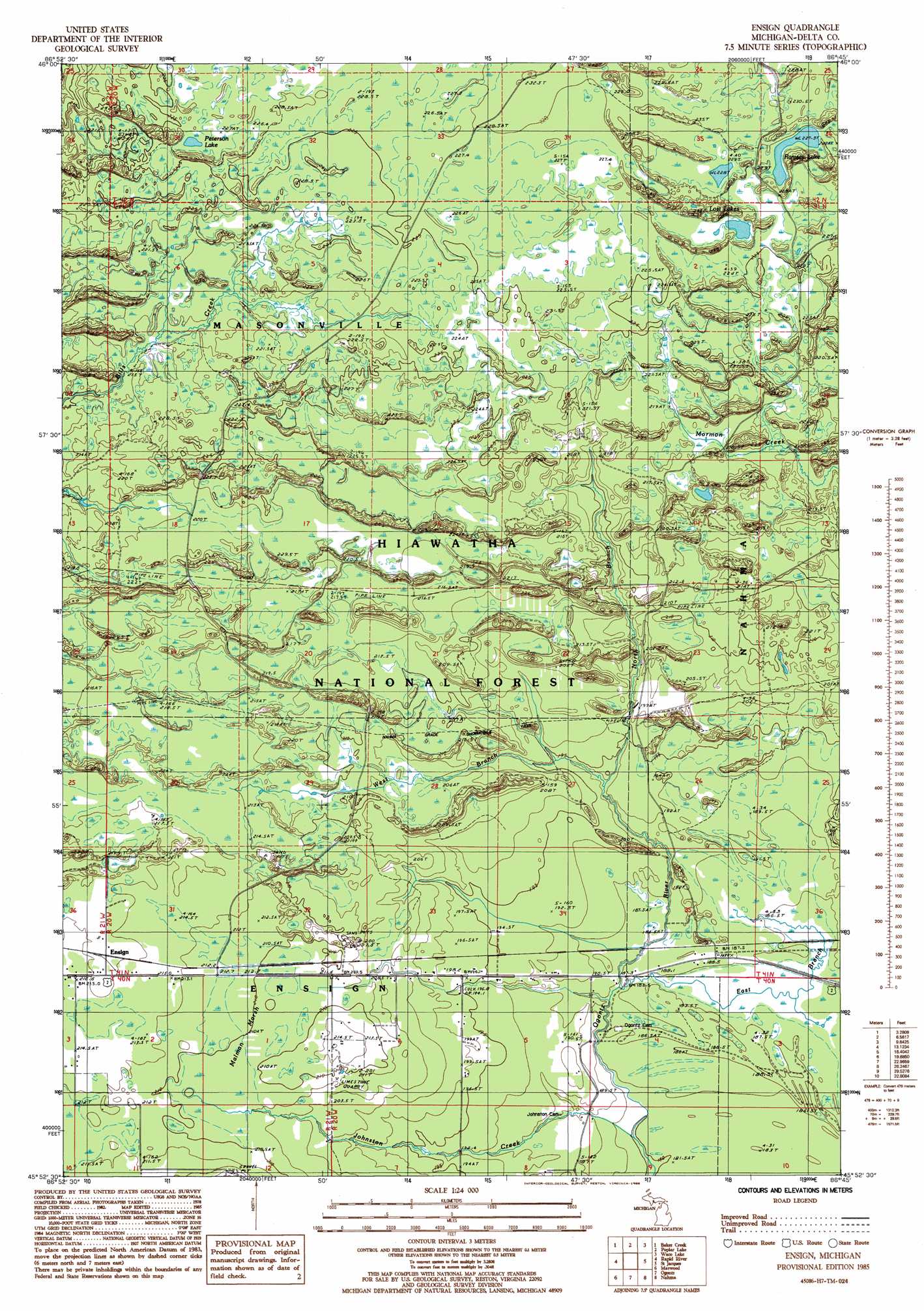
Ensign Topo Map Michigan
To zoom in, hover over the map of Ensign
USGS Topo Quad 45086h7 - 1:24,000 scale
| Topo Map Name: | Ensign |
| USGS Topo Quad ID: | 45086h7 |
| Print Size: | ca. 21 1/4" wide x 27" high |
| Southeast Coordinates: | 45.875° N latitude / 86.75° W longitude |
| Map Center Coordinates: | 45.9375° N latitude / 86.8125° W longitude |
| U.S. State: | MI |
| Filename: | o45086h7.jpg |
| Download Map JPG Image: | Ensign topo map 1:24,000 scale |
| Map Type: | Topographic |
| Topo Series: | 7.5´ |
| Map Scale: | 1:24,000 |
| Source of Map Images: | United States Geological Survey (USGS) |
| Alternate Map Versions: |
Ensign MI 1985, updated 1985 Download PDF Buy paper map Ensign MI 2011 Download PDF Buy paper map Ensign MI 2014 Download PDF Buy paper map Ensign MI 2016 Download PDF Buy paper map |
| FStopo: | US Forest Service topo Ensign is available: Download FStopo PDF Download FStopo TIF |
1:24,000 Topo Quads surrounding Ensign
Diffin |
Trenary |
Lake Stella |
The Lake |
Corner Lake |
Rock Se |
Baker Creek |
Poplar Lake |
Waco Lake |
Gooseneck Lake |
Perkins |
Rapid River |
Ensign |
Saint Jacques |
Garden Corners |
Gladstone |
Maywood |
Ogontz |
Nahma |
Gardner |
Escanaba |
Peninsula Point |
Chippewa Point |
Fayette |
Devils Corner |
> Back to 45086e1 at 1:100,000 scale
> Back to 45086a1 at 1:250,000 scale
> Back to U.S. Topo Maps home
Ensign topo map: Gazetteer
Ensign: Lakes
Lost Lakes elevation 229m 751′Peterson Lake elevation 227m 744′
Ramsey Lake elevation 227m 744′
Ensign: Populated Places
Ensign elevation 216m 708′Ensign: Post Offices
Ensign Post Office (historical) elevation 216m 708′Ensign: Streams
East Branch Ogontz River elevation 184m 603′Johnston Creek elevation 180m 590′
North Branch Ogontz River elevation 190m 623′
West Branch Ogontz River elevation 191m 626′
Ensign: Swamps
Malman Marsh elevation 210m 688′Ensign digital topo map on disk
Buy this Ensign topo map showing relief, roads, GPS coordinates and other geographical features, as a high-resolution digital map file on DVD: