Chappee Rapids Topo Map Michigan
To zoom in, hover over the map of Chappee Rapids
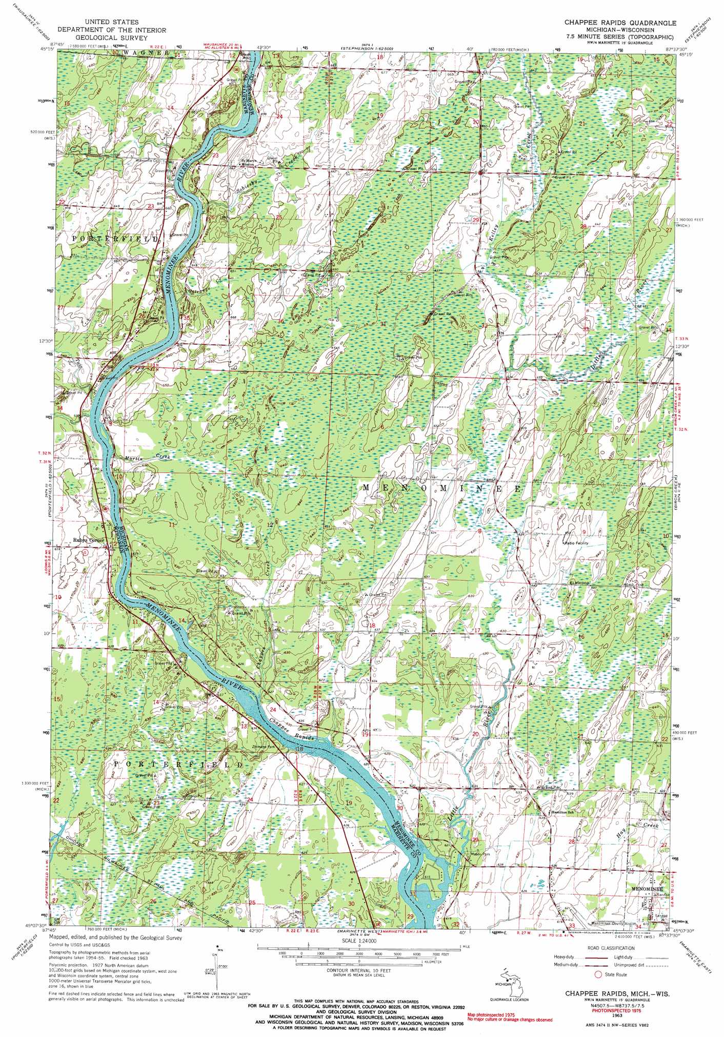
USGS Topo Quad 45087b6 - 1:24,000 scale
| Topo Map Name: | Chappee Rapids |
| USGS Topo Quad ID: | 45087b6 |
| Print Size: | ca. 21 1/4" wide x 27" high |
| Southeast Coordinates: | 45.125° N latitude / 87.625° W longitude |
| Map Center Coordinates: | 45.1875° N latitude / 87.6875° W longitude |
| U.S. States: | MI, WI |
| Filename: | o45087b6.jpg |
| Download Map JPG Image: | Chappee Rapids topo map 1:24,000 scale |
| Map Type: | Topographic |
| Topo Series: | 7.5´ |
| Map Scale: | 1:24,000 |
| Source of Map Images: | United States Geological Survey (USGS) |
| Alternate Map Versions: |
Chappee Rapids MI 1963, updated 1964 Download PDF Buy paper map Chappee Rapids MI 1963, updated 1964 Download PDF Buy paper map Chappee Rapids MI 2011 Download PDF Buy paper map Chappee Rapids MI 2014 Download PDF Buy paper map Chappee Rapids MI 2016 Download PDF Buy paper map |
1:24,000 Topo Quads surrounding Chappee Rapids
Wausaukee North |
Resort Lake |
Swanson |
Stephenson |
North Lake |
Wausaukee South |
Bear Point |
Mcallister |
Wallace |
Arthur Bay |
Loomis |
Porterfield |
Chappee Rapids |
Birch Creek |
Chambers Island Nw |
Porterfiled Sw |
Harmony |
Marinette West |
Marinette East |
Green Island |
Oconto West |
Oconto East |
Peshtigo Harbor |
Idlewild |
> Back to 45087a1 at 1:100,000 scale
> Back to 45086a1 at 1:250,000 scale
> Back to U.S. Topo Maps home
Chappee Rapids topo map: Gazetteer
Chappee Rapids: Airports
Menominee-Marinette Twin County Airport elevation 186m 610′Chappee Rapids: Falls
Twin Island Rapids elevation 188m 616′Chappee Rapids: Parks
Chappee Rapids Historical Marker elevation 193m 633′Mason Park elevation 189m 620′
Ziemann Park elevation 193m 633′
Chappee Rapids: Populated Places
Miles elevation 204m 669′Rubys Corner elevation 194m 636′
Chappee Rapids: Post Offices
Little River Post Office (historical) elevation 195m 639′Chappee Rapids: Rapids
Chappee Rapids elevation 187m 613′Chappee Rapids elevation 187m 613′
Chappee Rapids: Streams
Chappee Creek elevation 187m 613′Kelley Creek elevation 192m 629′
Little River elevation 186m 610′
Martin Creek elevation 187m 613′
Ostrango Creek elevation 188m 616′
Sobiesky Creek elevation 191m 626′
Twin Creek elevation 189m 620′
Chappee Rapids digital topo map on disk
Buy this Chappee Rapids topo map showing relief, roads, GPS coordinates and other geographical features, as a high-resolution digital map file on DVD: