Mcallister Topo Map Wisconsin
To zoom in, hover over the map of Mcallister
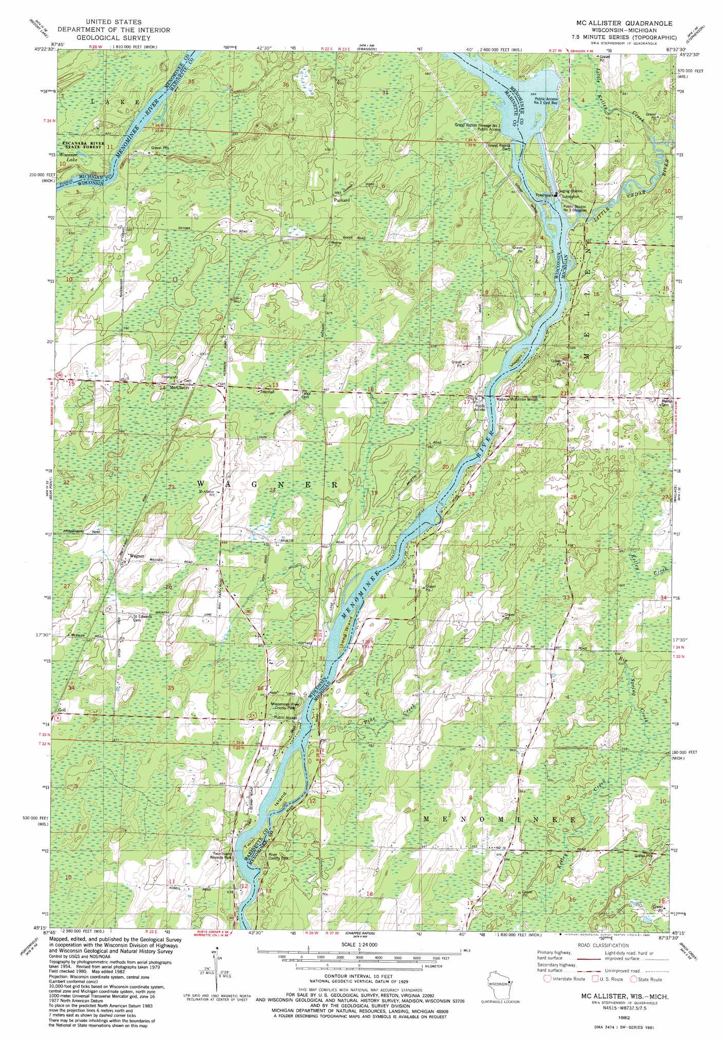
USGS Topo Quad 45087c6 - 1:24,000 scale
| Topo Map Name: | Mcallister |
| USGS Topo Quad ID: | 45087c6 |
| Print Size: | ca. 21 1/4" wide x 27" high |
| Southeast Coordinates: | 45.25° N latitude / 87.625° W longitude |
| Map Center Coordinates: | 45.3125° N latitude / 87.6875° W longitude |
| U.S. States: | WI, MI |
| Filename: | o45087c6.jpg |
| Download Map JPG Image: | Mcallister topo map 1:24,000 scale |
| Map Type: | Topographic |
| Topo Series: | 7.5´ |
| Map Scale: | 1:24,000 |
| Source of Map Images: | United States Geological Survey (USGS) |
| Alternate Map Versions: |
Mc Allister WI 1982, updated 1983 Download PDF Buy paper map McAllister WI 2011 Download PDF Buy paper map McAllister WI 2013 Download PDF Buy paper map McAllister WI 2016 Download PDF Buy paper map |
1:24,000 Topo Quads surrounding Mcallister
Amberg |
Miscauno Island |
Banat |
Nadeau |
Gourley |
Wausaukee North |
Resort Lake |
Swanson |
Stephenson |
North Lake |
Wausaukee South |
Bear Point |
Mcallister |
Wallace |
Arthur Bay |
Loomis |
Porterfield |
Chappee Rapids |
Birch Creek |
Chambers Island Nw |
Porterfiled Sw |
Harmony |
Marinette West |
Marinette East |
Green Island |
> Back to 45087a1 at 1:100,000 scale
> Back to 45086a1 at 1:250,000 scale
> Back to U.S. Topo Maps home
Mcallister topo map: Gazetteer
Mcallister: Areas
Long Reach elevation 202m 662′Mcallister: Bridges
Wallace McAllister Bridge elevation 192m 629′Wallace McAllister Bridge elevation 192m 629′
Mcallister: Dams
Grand Rapids Dam elevation 195m 639′Grand Rapids Dam elevation 195m 639′
Mcallister: Flats
River Park elevation 197m 646′Mcallister: Islands
Long Island elevation 192m 629′Maggies Island elevation 195m 639′
Twin Island elevation 193m 633′
Mcallister: Lakes
Woesner Lake elevation 204m 669′Mcallister: Parks
Grand Rapids Flowage Number 1 Public Access elevation 204m 669′Menominee River County Park elevation 199m 652′
Twin Island Wayside Park elevation 189m 620′
Mcallister: Populated Places
McAllister elevation 211m 692′Packard elevation 211m 692′
Wagner elevation 214m 702′
Mcallister: Streams
Big Spring Creek elevation 198m 649′Little Cedar River elevation 192m 629′
Little Kelley Creek elevation 195m 639′
Pine Creek elevation 193m 633′
Wagner Creek elevation 189m 620′
Mcallister digital topo map on disk
Buy this Mcallister topo map showing relief, roads, GPS coordinates and other geographical features, as a high-resolution digital map file on DVD: