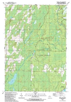
North Lake Topo Map Michigan
To zoom in, hover over the map of North Lake
USGS Topo Quad 45087d4 - 1:24,000 scale
| Topo Map Name: | North Lake |
| USGS Topo Quad ID: | 45087d4 |
| Print Size: | ca. 21 1/4" wide x 27" high |
| Southeast Coordinates: | 45.375° N latitude / 87.375° W longitude |
| Map Center Coordinates: | 45.4375° N latitude / 87.4375° W longitude |
| U.S. State: | MI |
| Filename: | o45087d4.jpg |
| Download Map JPG Image: | North Lake topo map 1:24,000 scale |
| Map Type: | Topographic |
| Topo Series: | 7.5´ |
| Map Scale: | 1:24,000 |
| Source of Map Images: | United States Geological Survey (USGS) |
| Alternate Map Versions: |
North Lake MI 1989, updated 1989 Download PDF Buy paper map North Lake MI 2011 Download PDF Buy paper map North Lake MI 2014 Download PDF Buy paper map North Lake MI 2016 Download PDF Buy paper map |
1:24,000 Topo Quads surrounding North Lake
> Back to 45087a1 at 1:100,000 scale
> Back to 45086a1 at 1:250,000 scale
> Back to U.S. Topo Maps home
North Lake topo map: Gazetteer
North Lake: Bays
Green Bay elevation 176m 577′North Lake: Lakes
Hoglund Lake elevation 218m 715′Kessler Lake elevation 195m 639′
Little Lake elevation 196m 643′
North Lake elevation 196m 643′
Westman Lake elevation 200m 656′
North Lake: Streams
Big Brook elevation 196m 643′Crystal Brook elevation 198m 649′
Dry Creek elevation 208m 682′
Mill Creek elevation 204m 669′
Weary Creek elevation 196m 643′
West Elwood Creek elevation 198m 649′
North Lake: Swamps
Durrow Marsh elevation 203m 666′Horseshoe Marsh elevation 192m 629′
North Lake digital topo map on disk
Buy this North Lake topo map showing relief, roads, GPS coordinates and other geographical features, as a high-resolution digital map file on DVD:


