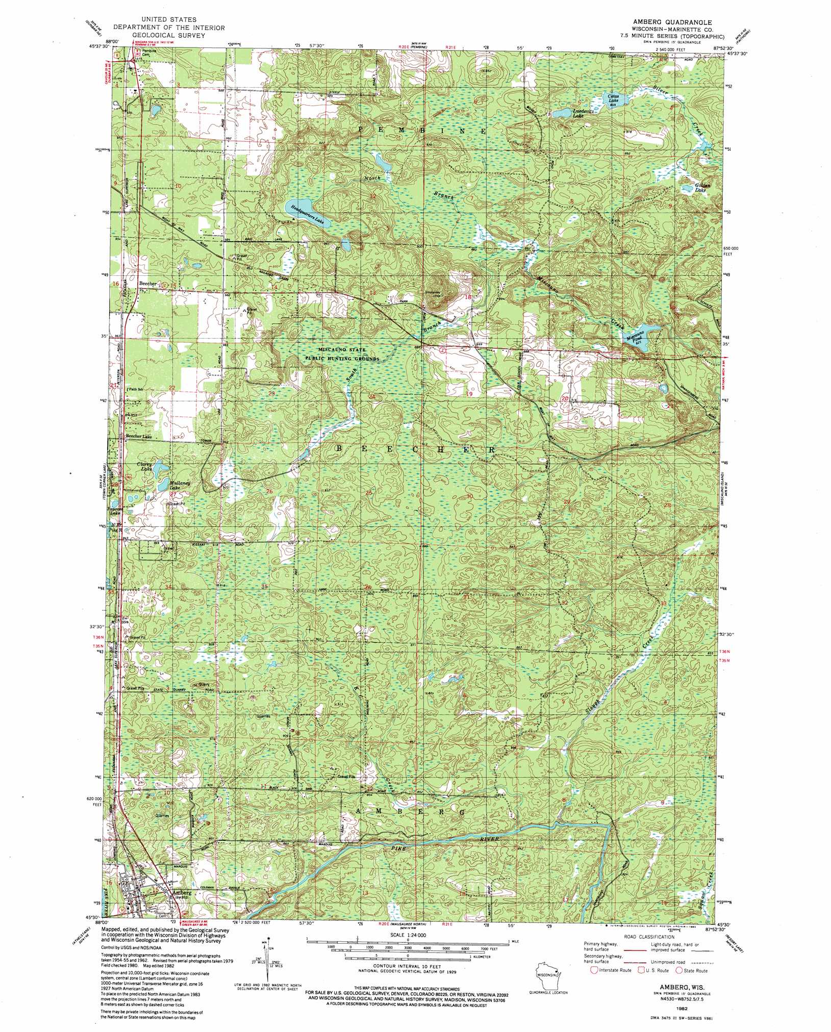
Amberg Topo Map Wisconsin
To zoom in, hover over the map of Amberg
USGS Topo Quad 45087e8 - 1:24,000 scale
| Topo Map Name: | Amberg |
| USGS Topo Quad ID: | 45087e8 |
| Print Size: | ca. 21 1/4" wide x 27" high |
| Southeast Coordinates: | 45.5° N latitude / 87.875° W longitude |
| Map Center Coordinates: | 45.5625° N latitude / 87.9375° W longitude |
| U.S. State: | WI |
| Filename: | o45087e8.jpg |
| Download Map JPG Image: | Amberg topo map 1:24,000 scale |
| Map Type: | Topographic |
| Topo Series: | 7.5´ |
| Map Scale: | 1:24,000 |
| Source of Map Images: | United States Geological Survey (USGS) |
| Alternate Map Versions: |
Amberg WI 1982, updated 1983 Download PDF Buy paper map Amberg WI 2010 Download PDF Buy paper map Amberg WI 2013 Download PDF Buy paper map Amberg WI 2016 Download PDF Buy paper map |
1:24,000 Topo Quads surrounding Amberg
Iron Mountain Sw |
Iron Mountain |
Norway |
Vulcan |
Waucedah |
Dunbar |
Dunbar Ne |
Pembine |
Faithorn |
Cunard |
Twelvefoot Falls |
Town Corner Lake |
Amberg |
Miscauno Island |
Banat |
Lehman Lake |
Athelstane |
Wausaukee North |
Resort Lake |
Swanson |
High Falls Reservoir |
Mount Tom |
Wausaukee South |
Bear Point |
Mcallister |
> Back to 45087e1 at 1:100,000 scale
> Back to 45086a1 at 1:250,000 scale
> Back to U.S. Topo Maps home
Amberg topo map: Gazetteer
Amberg: Dams
Miscauno Pond Dam elevation 252m 826′Amberg: Lakes
Clarey Lake elevation 289m 948′Cotas Lake elevation 262m 859′
Golden Lake elevation 260m 853′
Headquarters Lake elevation 285m 935′
Luedevitz Lake elevation 264m 866′
Mullaney Lake elevation 288m 944′
Papoose Lake elevation 285m 935′
Amberg: Mines
Munot Quarry elevation 275m 902′Reformatory Quarry elevation 283m 928′
Amberg: Parks
Miscauno Cedar Swamp State Natural Area elevation 270m 885′Miscauno State Public Hunting Grounds elevation 270m 885′
Amberg: Populated Places
Amberg elevation 273m 895′Beecher elevation 296m 971′
Beecher Lake elevation 290m 951′
Amberg: Reservoirs
Miscauno Pond elevation 252m 826′Miscauno Pond 23 elevation 258m 846′
Amberg: Streams
Beecher Creek elevation 283m 928′K C Creek elevation 247m 810′
North Branch Miscauno Creek elevation 261m 856′
Slough Creek elevation 244m 800′
South Branch Miscauno Creek elevation 261m 856′
Amberg digital topo map on disk
Buy this Amberg topo map showing relief, roads, GPS coordinates and other geographical features, as a high-resolution digital map file on DVD: