Vega Topo Map Michigan
To zoom in, hover over the map of Vega
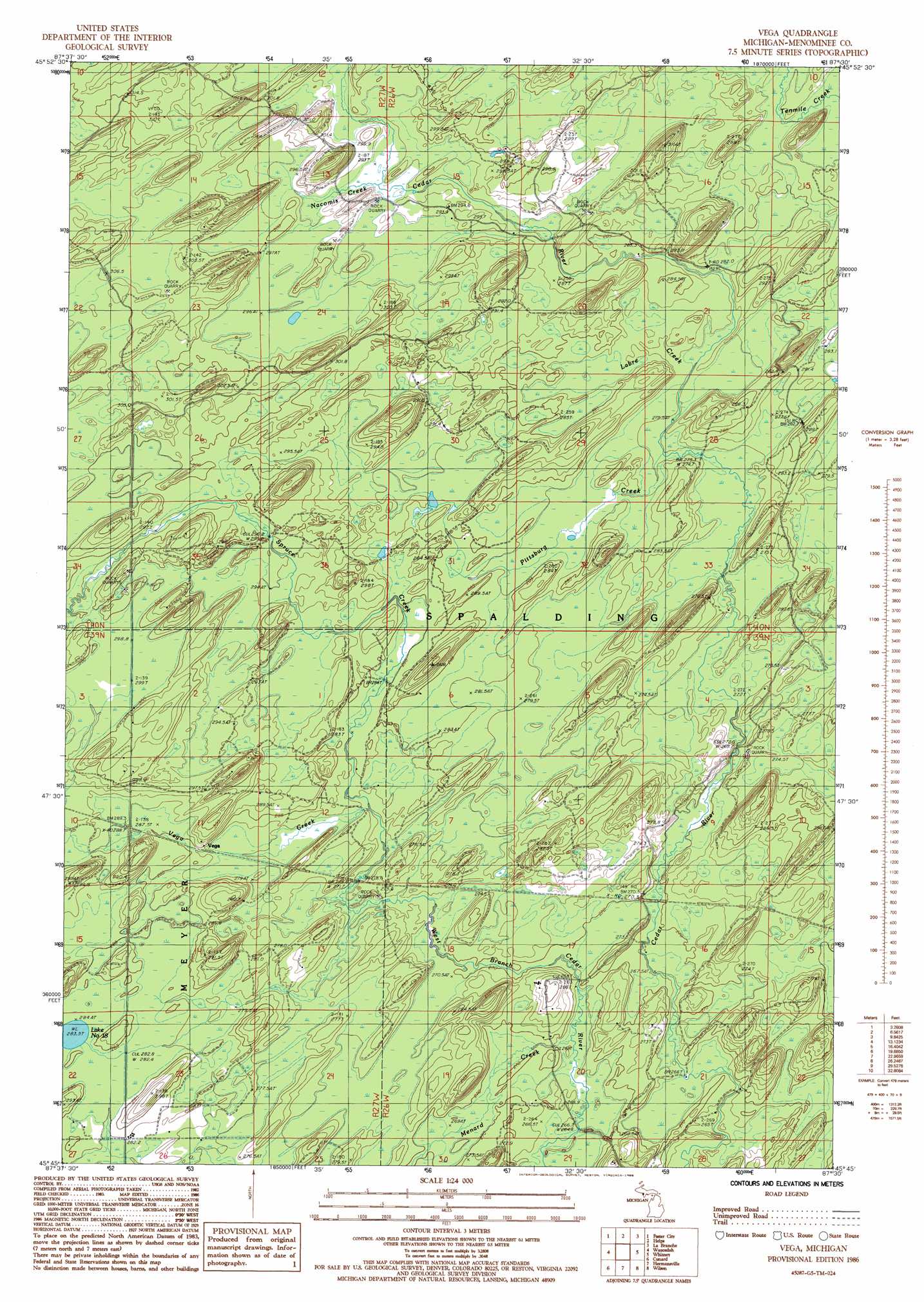
USGS Topo Quad 45087g5 - 1:24,000 scale
| Topo Map Name: | Vega |
| USGS Topo Quad ID: | 45087g5 |
| Print Size: | ca. 21 1/4" wide x 27" high |
| Southeast Coordinates: | 45.75° N latitude / 87.5° W longitude |
| Map Center Coordinates: | 45.8125° N latitude / 87.5625° W longitude |
| U.S. State: | MI |
| Filename: | o45087g5.jpg |
| Download Map JPG Image: | Vega topo map 1:24,000 scale |
| Map Type: | Topographic |
| Topo Series: | 7.5´ |
| Map Scale: | 1:24,000 |
| Source of Map Images: | United States Geological Survey (USGS) |
| Alternate Map Versions: |
Vega MI 1986, updated 1986 Download PDF Buy paper map Vega MI 2011 Download PDF Buy paper map Vega MI 2014 Download PDF Buy paper map Vega MI 2016 Download PDF Buy paper map |
1:24,000 Topo Quads surrounding Vega
Ralph |
Alfred |
Northland |
Arnold |
Swimming Hole Creek |
Felch |
Foster City |
Helps |
La Branche |
Woodlawn |
Vulcan |
Waucedah |
Vega |
Whitney |
Schaffer |
Faithorn |
Cunard |
Hermansville |
Wilson |
Bark River |
Miscauno Island |
Banat |
Nadeau |
Gourley |
Bark River Se |
> Back to 45087e1 at 1:100,000 scale
> Back to 45086a1 at 1:250,000 scale
> Back to U.S. Topo Maps home
Vega topo map: Gazetteer
Vega: Guts
Labre Creek elevation 280m 918′Pittsburg Creek elevation 279m 915′
Vega: Lakes
Lake Number Eighteen elevation 283m 928′Vega: Populated Places
Vega elevation 284m 931′Vega: Streams
Menard Creek elevation 265m 869′Menard Creek elevation 265m 869′
Nacomis Creek elevation 293m 961′
Spruce Creek elevation 282m 925′
Vega Creek elevation 279m 915′
Vega digital topo map on disk
Buy this Vega topo map showing relief, roads, GPS coordinates and other geographical features, as a high-resolution digital map file on DVD: