La Branche Topo Map Michigan
To zoom in, hover over the map of La Branche
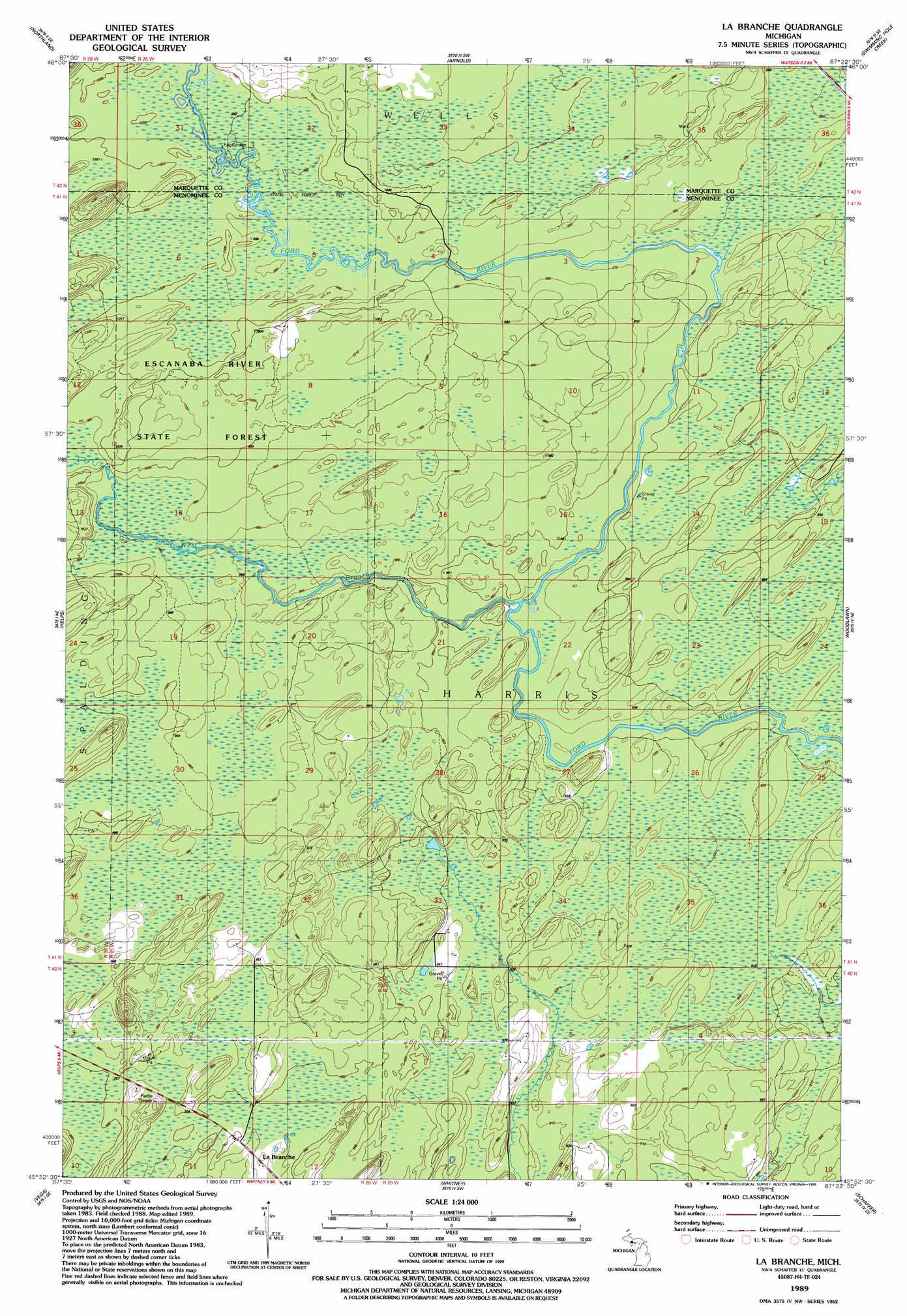
USGS Topo Quad 45087h4 - 1:24,000 scale
| Topo Map Name: | La Branche |
| USGS Topo Quad ID: | 45087h4 |
| Print Size: | ca. 21 1/4" wide x 27" high |
| Southeast Coordinates: | 45.875° N latitude / 87.375° W longitude |
| Map Center Coordinates: | 45.9375° N latitude / 87.4375° W longitude |
| U.S. State: | MI |
| Filename: | o45087h4.jpg |
| Download Map JPG Image: | La Branche topo map 1:24,000 scale |
| Map Type: | Topographic |
| Topo Series: | 7.5´ |
| Map Scale: | 1:24,000 |
| Source of Map Images: | United States Geological Survey (USGS) |
| Alternate Map Versions: |
La Branche MI 1989, updated 1989 Download PDF Buy paper map La Branche MI 2011 Download PDF Buy paper map La Branche MI 2014 Download PDF Buy paper map La Branche MI 2016 Download PDF Buy paper map |
1:24,000 Topo Quads surrounding La Branche
Northland Nw |
Northland Ne |
Anderson Lake |
Helena |
Mcfarland |
Alfred |
Northland |
Arnold |
Swimming Hole Creek |
Rock |
Foster City |
Helps |
La Branche |
Woodlawn |
Cornell |
Waucedah |
Vega |
Whitney |
Schaffer |
Chandler |
Cunard |
Hermansville |
Wilson |
Bark River |
Ford River |
> Back to 45087e1 at 1:100,000 scale
> Back to 45086a1 at 1:250,000 scale
> Back to U.S. Topo Maps home
La Branche topo map: Gazetteer
La Branche: Populated Places
LaBranche elevation 288m 944′La Branche: Post Offices
La Branche Post Office (historical) elevation 288m 944′La Branche: Streams
West Branch Ford River elevation 285m 935′La Branche digital topo map on disk
Buy this La Branche topo map showing relief, roads, GPS coordinates and other geographical features, as a high-resolution digital map file on DVD: